?Final Price Realized includes Buyer’s Premium added to Hammer Price
Estimate: $ 400 - $ 600
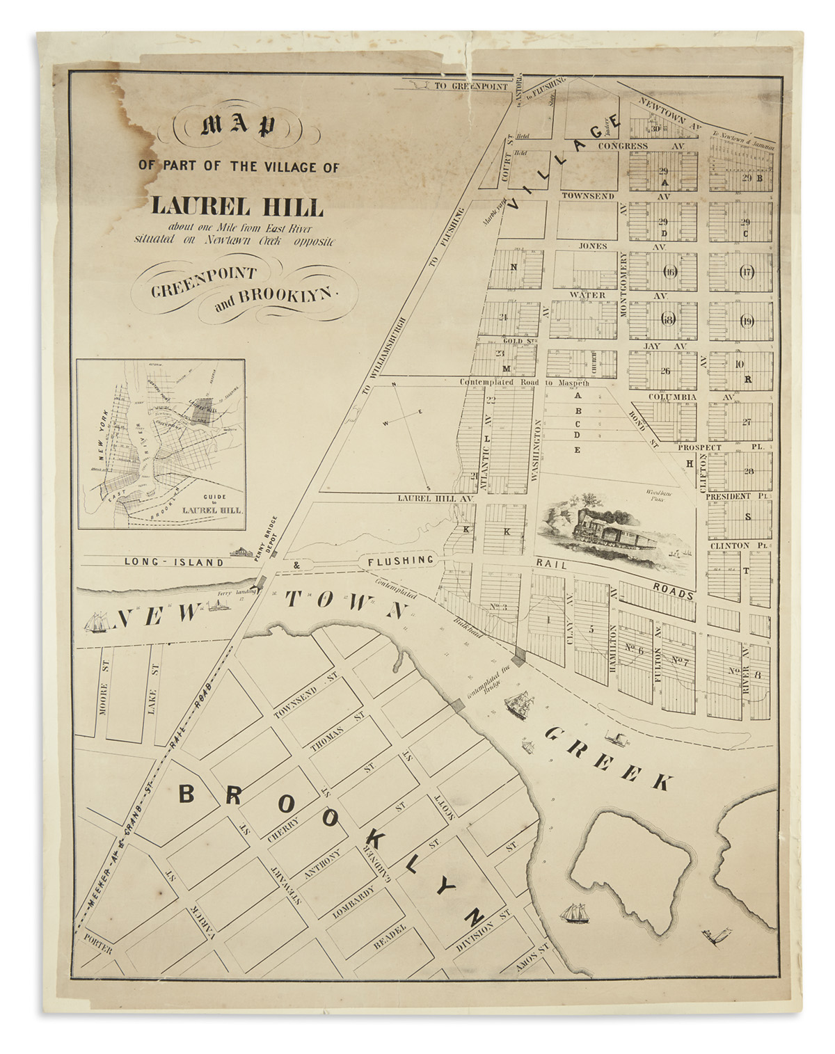
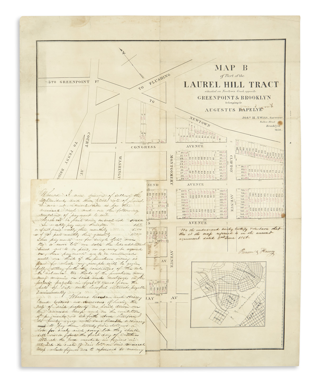
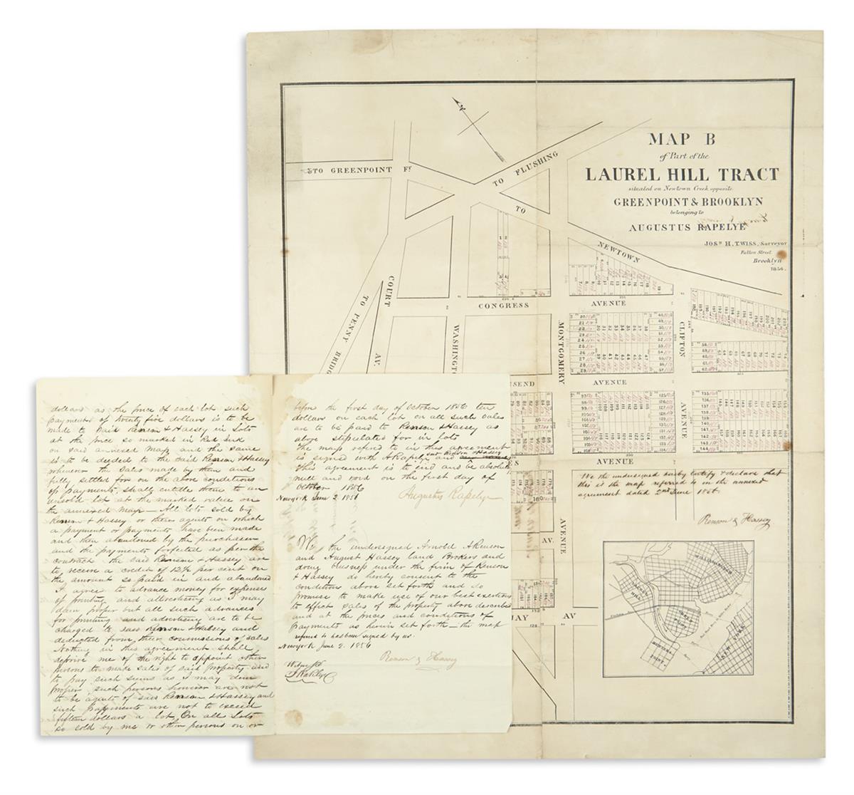
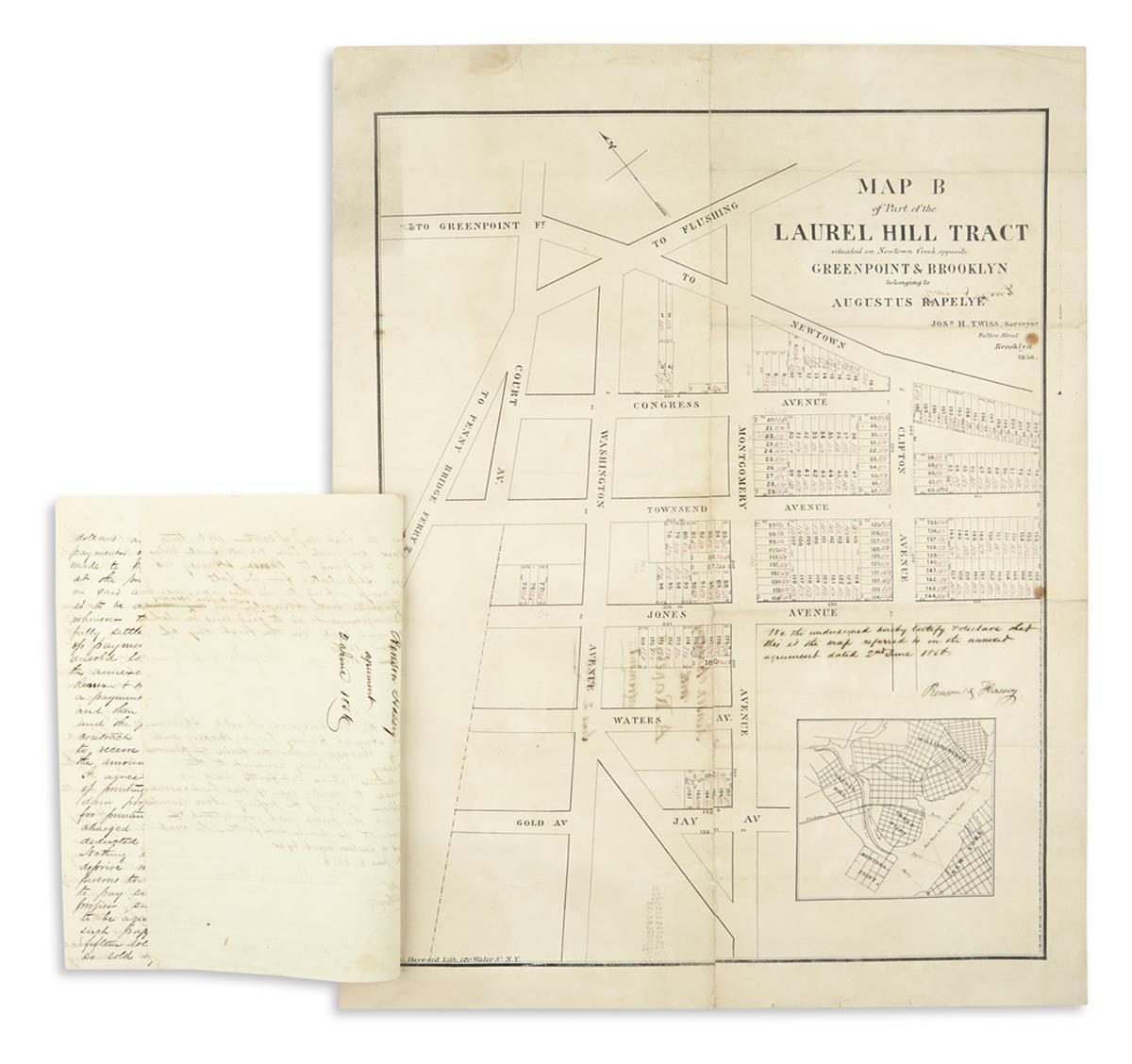
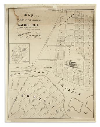
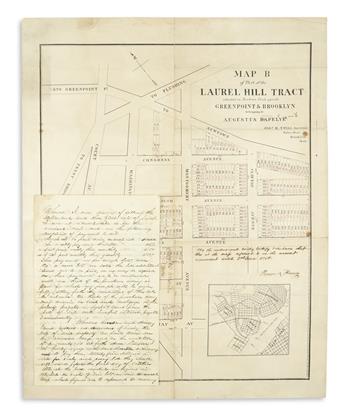
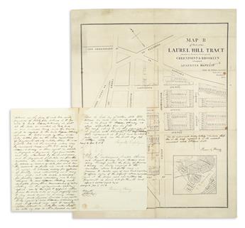
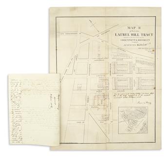
(NEW YORK CITY -- QUEENS.) Map of Part of the Village of Laurel HillAbout One Mile from East River Situated on Newtown Creek Opposite Greenpoint and Brooklyn.and:Map B of Part of the Laurel Hill Tract Situated on Newtown Creek Opposite Greenpoint & Brooklyn Belonging to Augustus Rapelye. Together two lithographed cadastral maps. Approximately 24x19 inches each sheet size; laid on canvas, light staining, soft creases and small losses; the latter annotated and inscribed in ink. [New York], 1856
an original new york city land purchase. Annotated and used to facilitate the sale of plotted property in Laurel Hill, Queens (between Sunnyside and Maspeth) from Augustus Rapelye to New York City land brokers Arnold Renson and August Hassey in 1856. Map [A] shows a larger scope of the general area with a small inset giving context of the property to Manhattan and Brooklyn; Map B is focused to outline the property within a 3 or 4 block radius and is inscribed "We the undersigned hereby certify & declare that this is the map referred to in the annexed agreement dated 2nd June 1856 - Renson & Hassey". Said agreement, a three-page manuscript document bearing the same date and outlining the terms of sale between Rapelye and Renson & Hassey for the described lots is presently affixed to the margin of Map B with blots of red wax.