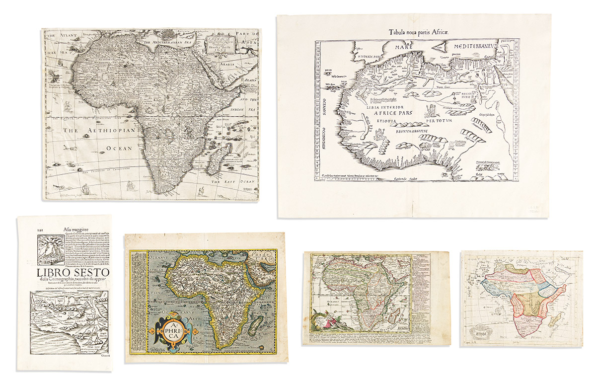
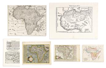
- Laurent Fries.Tabula Nova Partis Africae. Double-page woodcut map of northern Africa. 15 3/4x21 inches sheet size, wide margins; minor edge stain but quite nice. [Strasbourg, circa 1525].
- Peter Heylyn; and Henry Seile. Africae Descriptio Nova Impensis. Double-page engraved map of the continent with attractive carto-ornamentation. 13 1/2x17 1/4 inches sheet size, short margins, but not shaved as common; a few scattered worm holes, crinkling at upper left. London, 1650s.
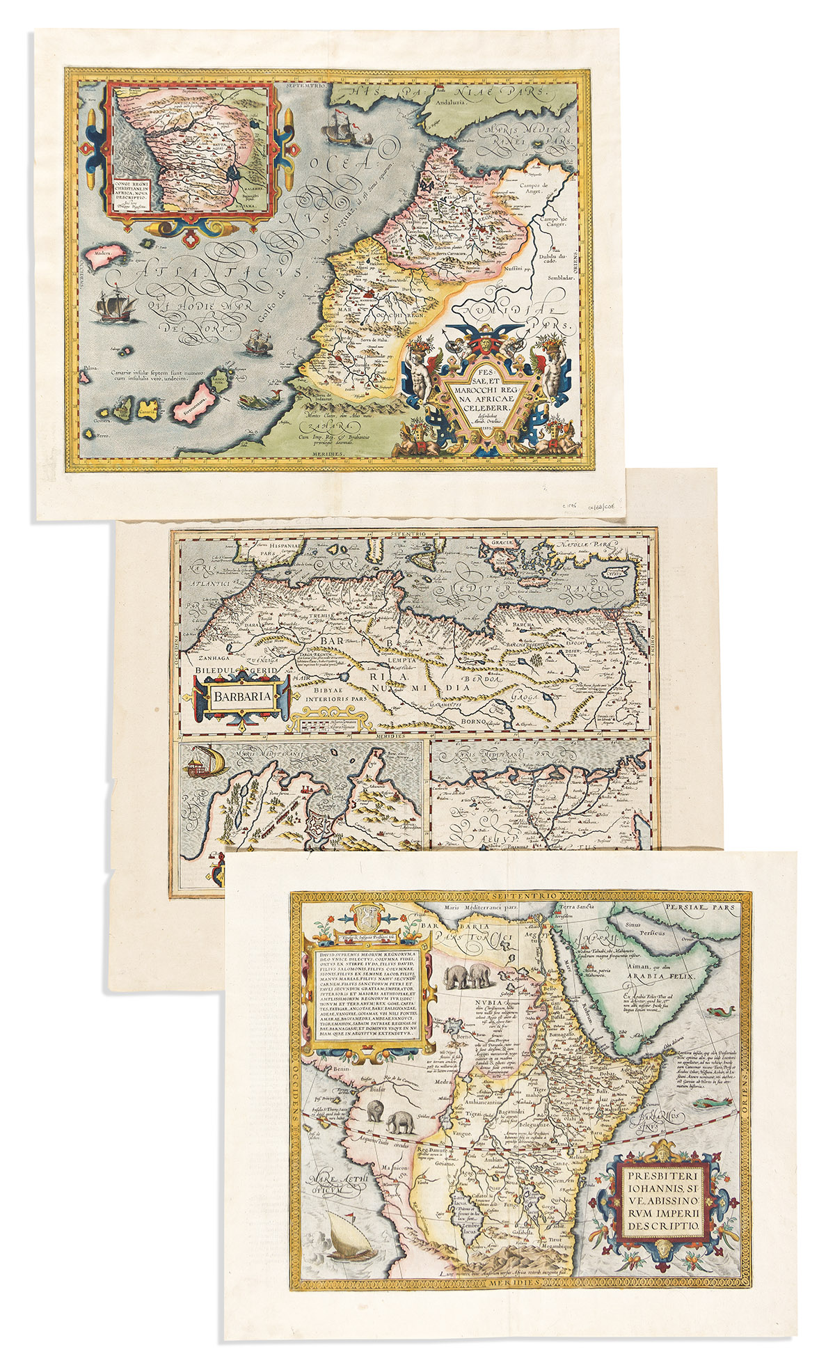
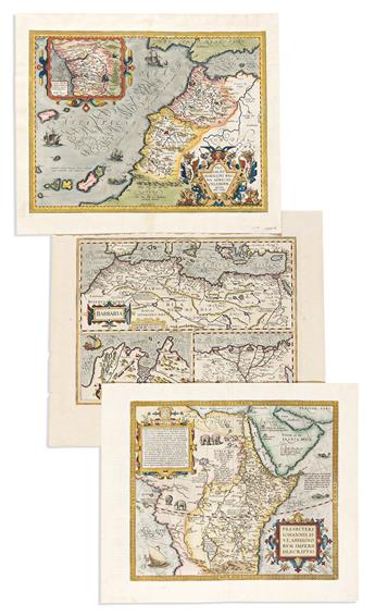
- Abraham Ortelius. Fessae, et Marocchi Regna Africae Celeberr. Hand-colored double-page engraved map of northwestern Africa with an inset of the Congo River region. 18 1/4x22 inches sheet size, wide margins, Latin text on verso; fine. Van den Broecke 177 1595L. Antwerp, 1595.
- Abraham Ortelius. Presbiteri Johannis, Sive, Abissinorum Imperii Descriptio. Hand-colored double-page engraved map of central Africa (i.e., the kingdom of Prester John). 18x21 1/4 inches sheet size, wide margins, Latin text on verso; fine. Van den Broecke 175 1609/1612L126. Antwerp, 1609 or 1612.
- Mercator/Hondius. Barbaria. Hand-colored double-page engraved map of northern Africa. 19 1/4x22 1/2 inches sheet size, wide margins, English text on verso; small marginal losses. Amsterdam, 1638.
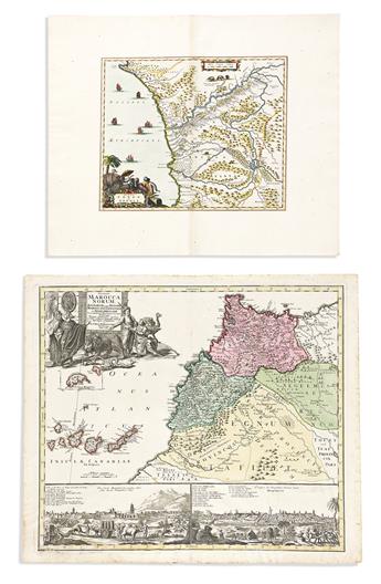
- Arnoldus Montanus or John Ogilby. Regna Congo et Angola. Hand-colored double-page engraved map of the Congo River region with a decorative provincial title cartouche. 17 1/2x21 inches sheet size, extra wide margins; fine. Amsterdam or London, 1671.
- Johann Baptist Homann. Statuum Marocca Norum. Double-page engraved map of northwestern Africa with lower panels of town views. 20 3/4x24 inches sheet size, wide margins; original hand-color; minor foxing at extremities, lower center fold reinforced on verso. Nuremberg, 1728.
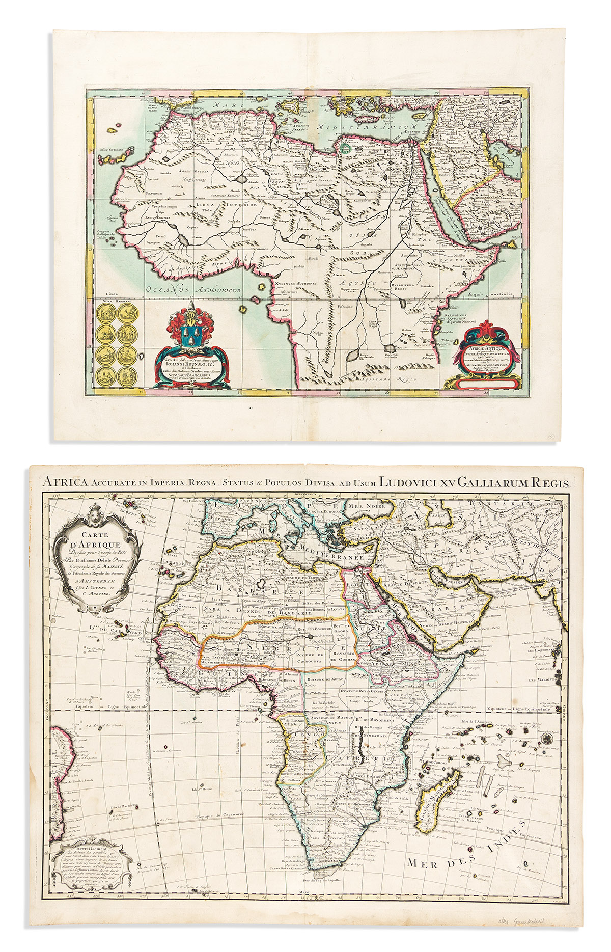
- Jansson/Blanckaert. Africae Antiquae. Hand-colored double-page engraved map of ancient Africa. 19 1/4x23 3/4 inches sheet size, wide margins; small stain at upper center else fine. Amsterdam, circa 1660.
- Covens & Mortier, after De L'Isle. Carte d'Afrique. Double-page engraved map of the continent. 21 1/2x25 3/4 inches sheet size, ample margins; original hand-color in outline; minor edge staining but a nice example. Amsterdam, circa 1740.
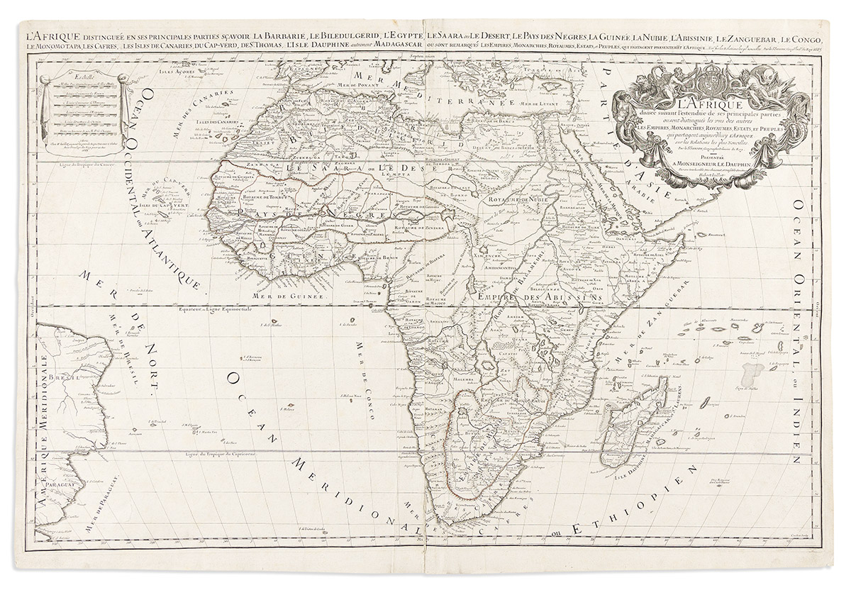
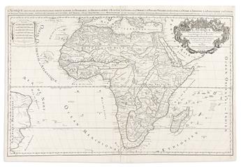
- Alexis-Hubert Jaillot. l'Afrique. Large double-page engraved map of the continent. 2 sheets joined, 24 1/4x36 inches overall, ample margins; minor signs of age. Paris, 1685.
- Bussemacher/Quad. Aphrica. Hand-colored double-page engraved map of the continent. 10x12 3/4 inches sheet size, wide margins; minor edge tears, unobtrusive closed tear into lower center. Cologne, circa 1600.
- Sebastian Münster. [Africa]. Woodcut map of the continent on folio leaf of Latin text. 12 1/4x7 1/2 inches sheet size; fine. Basel, circa 1558.
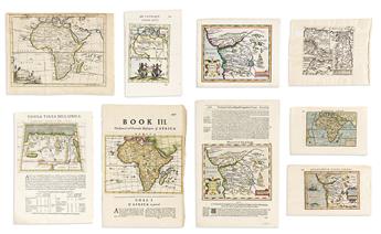
- Johann Michael Probst. Africa. Engraved map of the continent with descriptive text panels. 7 1/4x11 1/4 inches sheet size, ample margins; original hand-color; minor soiling. Augsburg, circa 1790.
- Thomas Jefferys. Africa. Engraved folding map of the continent. 8x10 1/2 inches sheet size, ample margins; minor age toning. London, circa 1750.
- Petrus Bertius. Africa. Miniature hand-colored engraved map of the continent. 4 3/4x7 1/2 inches sheet size, wide margins, Latin header on verso; fine. Amsterdam, circa 1615.
- Petrus Bertius. Congo Regnum Christian in Africa. Miniature hand-colored engraved map of the Congo River region. 5x8 inches sheet size, wide margins, Latin text on verso; fine. Amsterdam, circa 1615.
- Giovanni Magini. Tabula Africae II / Tabula Africae III. Two miniature engraved maps of Northern Africa printed recto/verso on one folio leaf of Italian text. 11x7 3/4 inches sheet size, ample margins; fine. Venice, circa 1598.
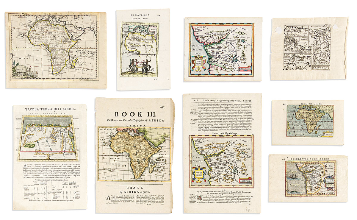
- Herman Moll. Africa. Hand-colored map of the continent on a folio leaf of English text. 12x8 inches sheet size; wear at right edge. London, circa 1700.
- Mercator/Hondius. Congi Regnu. Hand-colored map of the Congo River region on a folio leaf of English text. 12 1/2x8 inches sheet size, wide margins; fine. London, circa 1635.
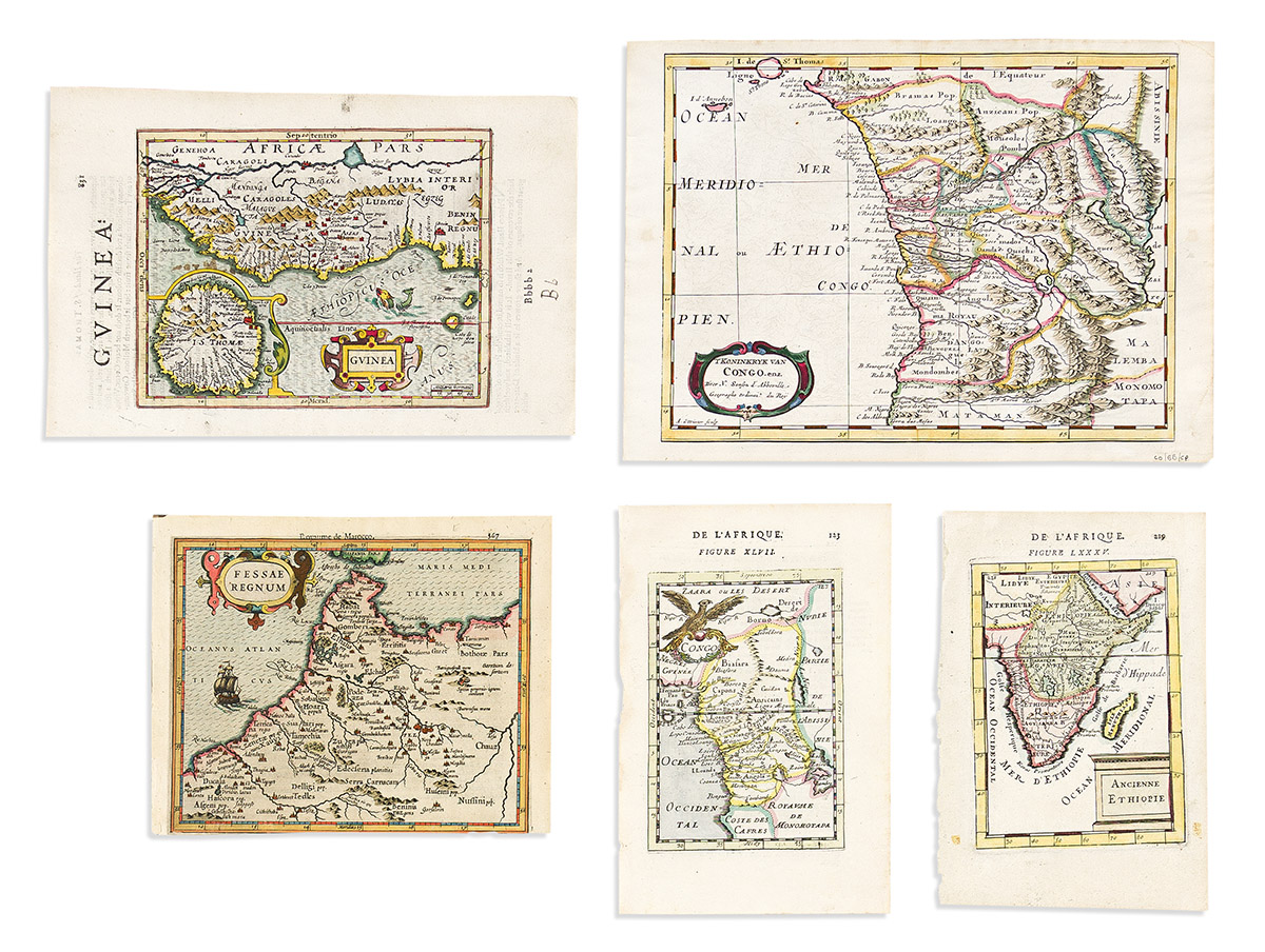
- Francois Halma, after Nicolas Sanson. 'T Koninkryk van Congo, enz. Hand-colored double-page engraved map of the Congo River region. 8 1/2x12 inches sheet size, wide margins; fine. Amsterdam, 1705.
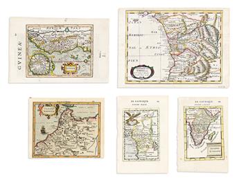
- Mercator/Hondius. Guinea. Hand-colored engraved map of western Africa with an inset of St. Thomas. 10 3/4x7 inches sheet size, wide margins, English text on verso; fine. London, circa 1635.
- Mercator/Hondius. Congi Regnu. Hand-colored engraved miniature map of the Congo River region. 6 1/2x8 inches sheet size, wide margins, blank verso; fine. Amsterdam, circa 1610.
- Mercator/Hondius. Fessae Regnum. Hand-colored engraved miniature map of northwestern Africa. 6 1/2x8 1/4 inches sheet size, French text on verso; lower margin shaved to the platemark. Amsterdam, circa 1610.
- Alain Manesson Mallet. Zaara ou le Desert. Hand-colored map of Africa and the Mediterranean with a twin elephant title cartouche. 8 1/4x5 1/2 inches sheet size, wide margins, French text on verso; fine. Paris, 1683.
- Alain Manesson Mallet. Ancienne Ethiopie. Hand-colored map of southern and eastern Africa. 8x5 1/4 inches sheet size, wide margins, French text on verso; fine. Paris, 1683.
- Alain Manesson Mallet. Congo. Hand-colored map of western central Africa. 8 1/4x5 1/2 inches sheet size, wide margins, French text on verso; fine. Paris, 1683.
- Philipp Cluver. Africa Minor / Mauritania / Aegyptus. Engraved maps of three regions in Africa on one plate. 6 1/2x7 1/2 inches sheet size, wide margins; two spots of mounting residue to the margins, map fine. Amsterdam, circa 1660.
- [Anonymous - L.B.]. Affryka. Small engraved Czech-language folding map of the continent. 7 1/2x9 1/2 inches sheet size, ample margins; minor signs of age. Czechia?, circa 1750.