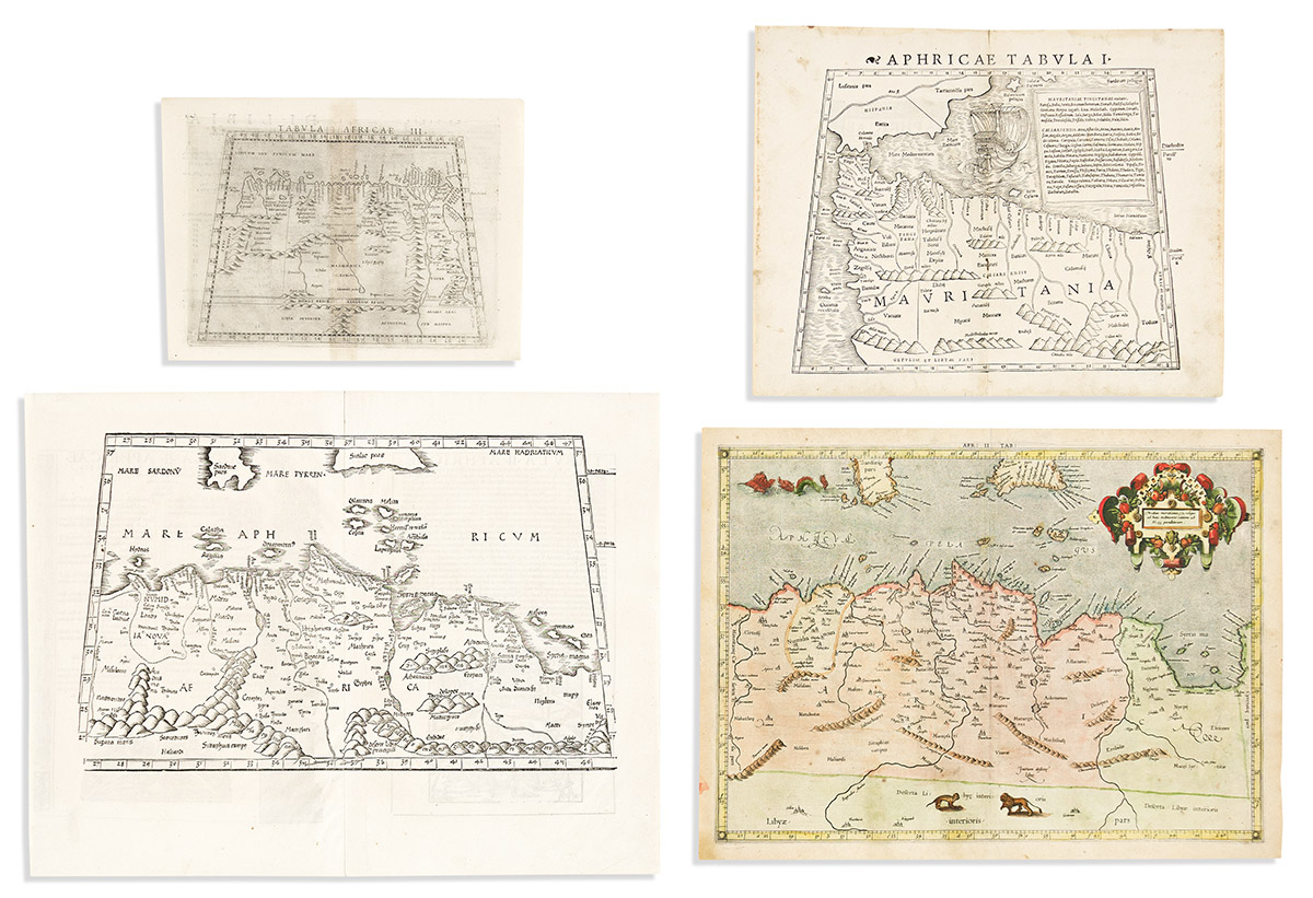
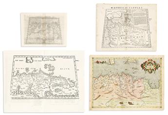
- Laurent Fries. [Tabula II Aphricae]. Double-page woodcut map of north Africa and several Mediterranean islands. 16x21 inches sheet size, wide margins, Latin text and woodcut illustrations on verso; excellent. Strasbourg, 1535.
- Sebastian Munster. Aphricae Tabula I. Double-page woodcut map of northern Africa with a large sailing vessel in the Mediterranean. 12 1/4x15 3/4 inches sheet size, wide margins, Latin header within woodcut border on verso; lightly soiled, small worm track at center. Basel, circa 1540.
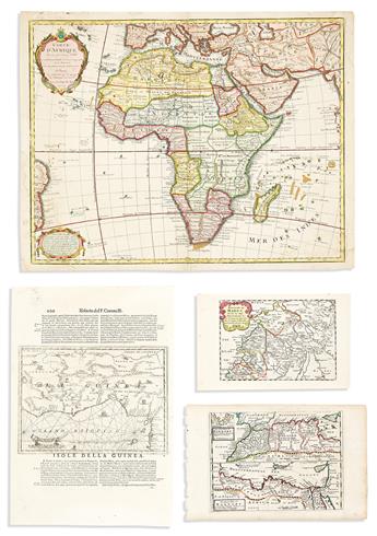
- Girolamo Ruscelli. Tabula Africae III. Double-page engraved map of northern Africa. 8 3/4x12 inches sheet size, wide margins, Italian text on verso; light discoloration at center from binding adhesive. Venice, 1561.
- Gerard Mercator. Africae Tabula II. Double-page engraved map of the eastern Maghreb region of Africa and the central Mediterranean Sea. 14 1/2x19 1/2 inches sheet size, wide margins, Latin text on verso; hand-colored; light age toning and small edge closures. [Cologne, 1578].
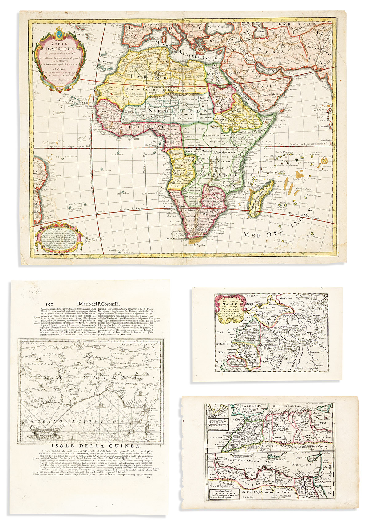
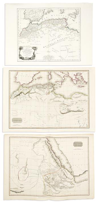
- Nicolas Sanson. Royaume de Maroc Divise en Sept Provinces &c. Small engraved map of northwestern Africa. 7 1/2x12 1/4 inches sheet size, wide margins; original hand-color in outline; fine. Paris, circa 1680.
- Vincenzo Coronelli. Isole della Guinea. Engraved map of western Africa and the Gulf of Guinea on a folio leaf of Italian text. 19 1/4x13 inches sheet size, wide margins, verso with an engraved map of Goree Island off the Senegal coast; minor signs of age. Venice, 1696.
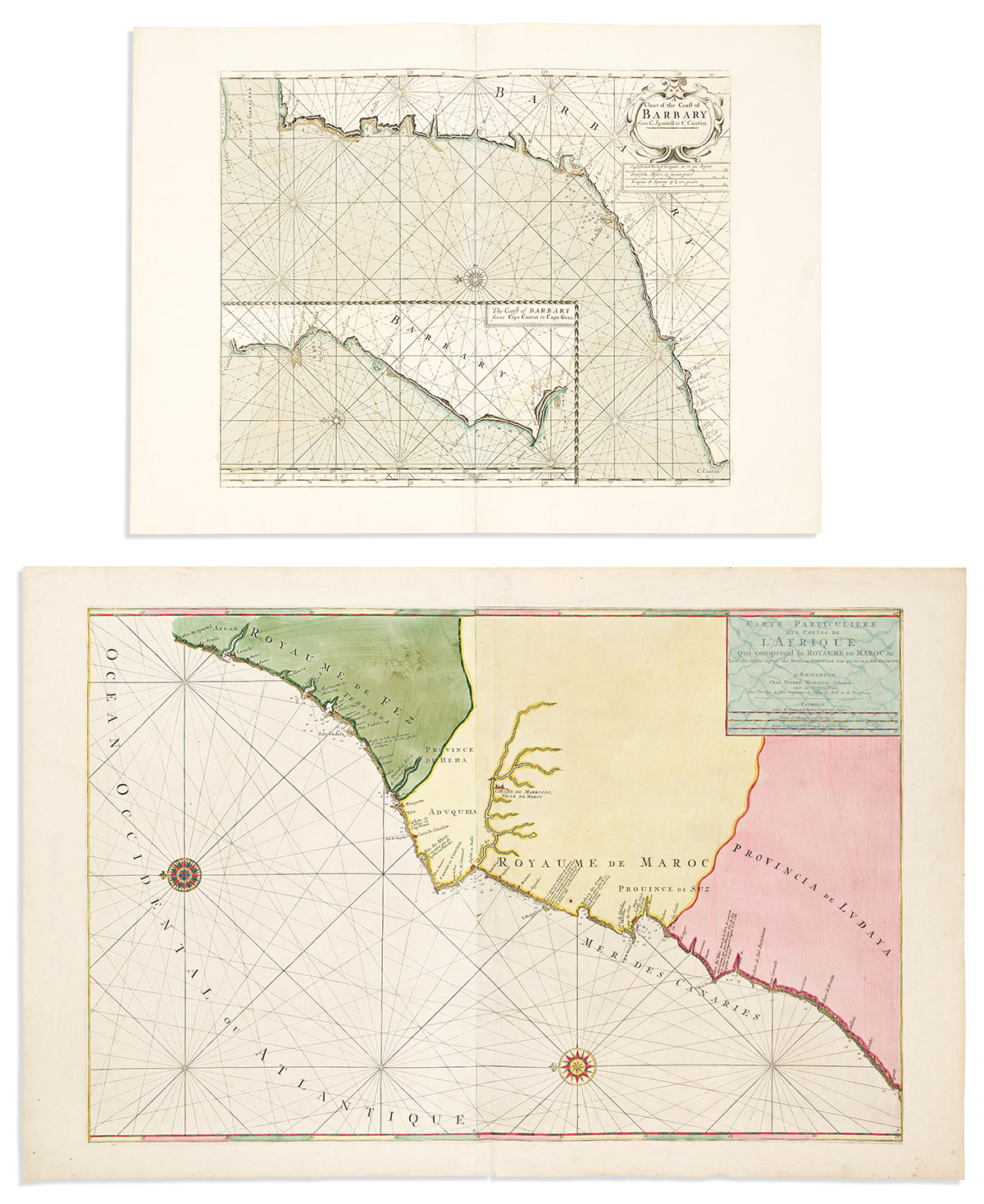
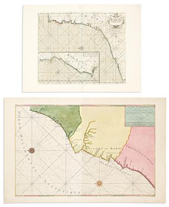
- Pierre Mortier. Carte Particuliere des Costes de l'Afrique qui Comprend le Royaume de Maroc &c. Large double-page engraved sea chart of the Moroccan coast of northwest Africa. Two sheets joined, 25x38 1/2 inches overall, wide margins; strong original hand-color with gilt highlights; minor signs of age. Amsterdam, circa 1700.
- Guillaume de l'Isle. Carte d'Afrique. Hand-colored double-page engraved map of the African continent. 20 1/2x26 3/4 inches sheet size, ample margins; stains and small repairs. Paris 1722.
- Herman Moll. The East Part/The West Part of Barbary. Two-panel engraved map of northern Africa. 9 1/4x14 1/2 inches sheet size, wide margins; original hand-color in outline; minor signs of age. London, 1732.
- Mount & Page. A Chart of the Coast of Barbary from C. Spartell to C. Cantin. Double-page engraved sea chart of the Moroccan coast from the Straits of Gibraltar to Cap Ghir. 20 3/4x28 inches sheet size, wide margins; original hand-color; unobtrusive repair to center fold. London, circa 1760s.
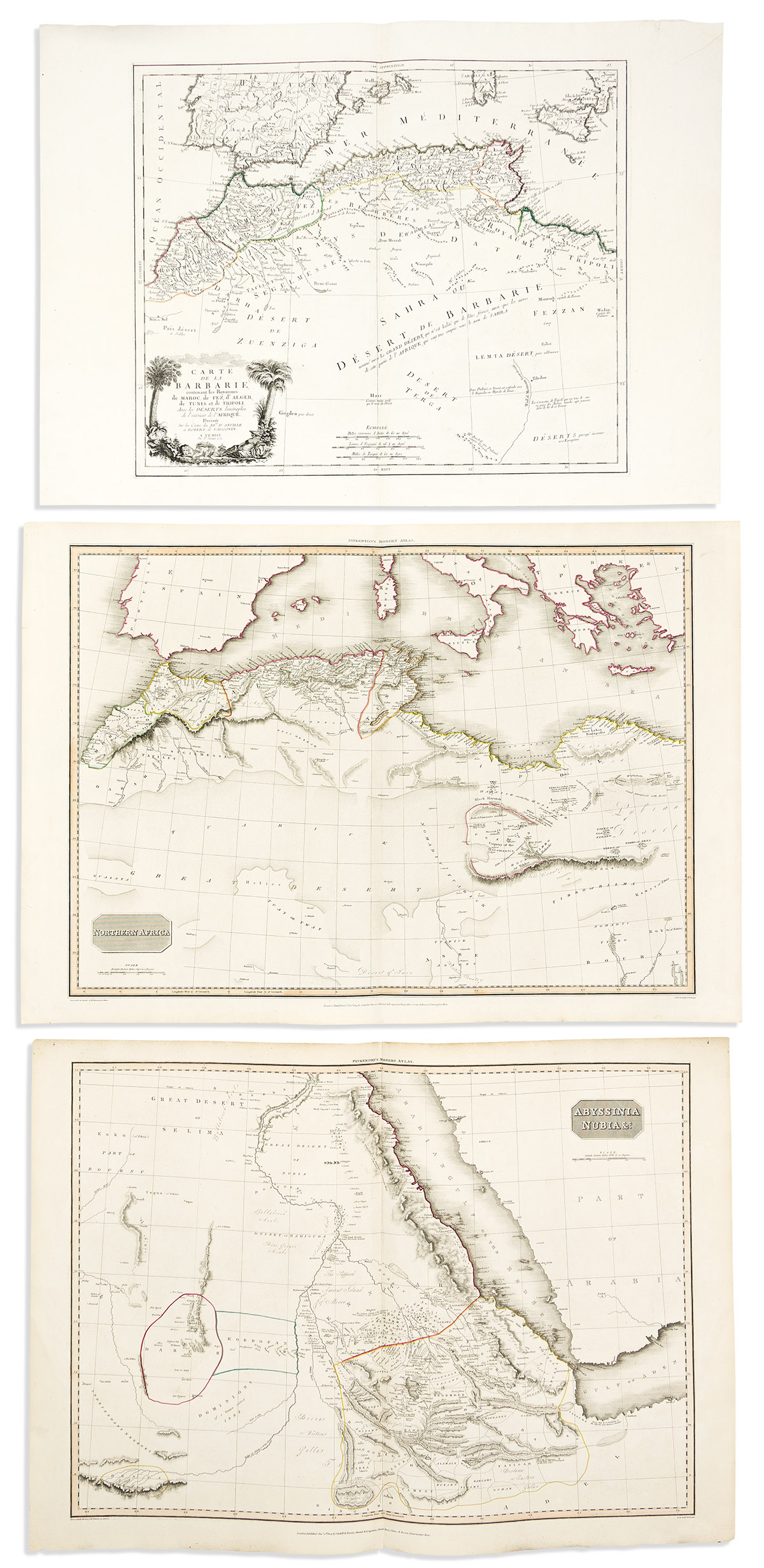
- Paolo Santini; after D'Anville and Vaugondy. Carte de la Barbarie Contenant les Royaumes de Maroc, de Fez, d'Alger, de Tunis et de Tripoli, Avec les Deserts Limitrophes de l'Interieur de l'Afrique. Double-page engraved map of northern Africa. 21x30 inches sheet size, wide margins; original hand-color in outline; fine. Venice, 1775.
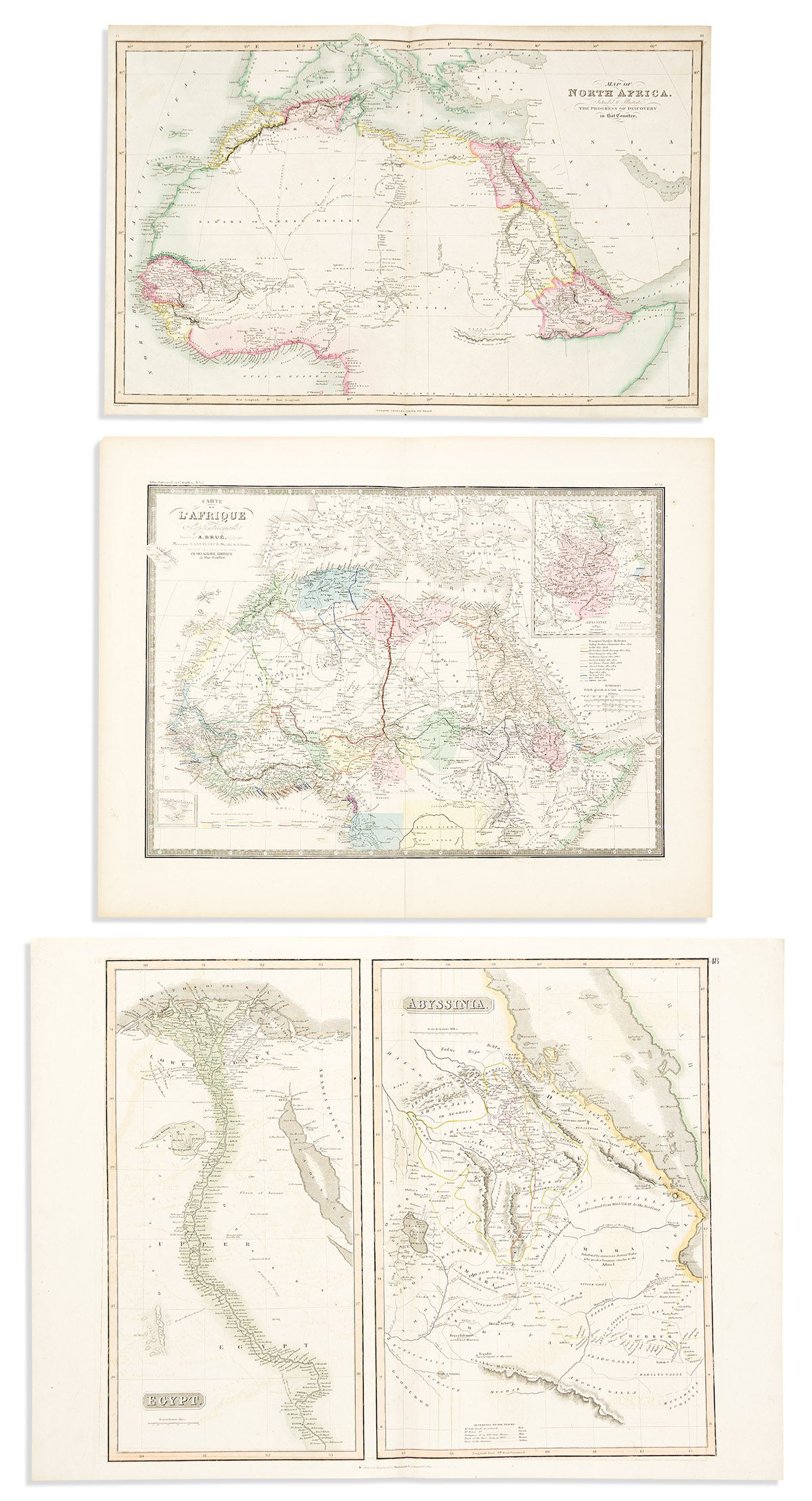
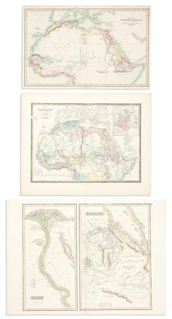
- Charles Smith. Map of North Africa Intended to Illustrate the Progress of Discovery in That Country. Double-page engraved map of north Africa. 15x23 1/2 inches sheet size, ample margins; original hand-color; light offsetting. London, 1808.
- John Pinkerton. Abyssinia, Nubia &c. Double-page engraved map of eastern Africa and the Red Sea. 22x31 inches sheet size, wide margins; original hand-color in outline; fine. London, 1814.
- John Pinkerton. Northern Africa Double-page engraved map of northern Africa. 22x31 3/4 inches sheet size, wide margins; original hand-color in outline; fine. London, 1814.
- John Thomson. Egypt/Abyssinia. Double-page engraved two-panel map the Nile River and Eritrea, Djibouti, and Ethiopia. 21x29 inches sheet size, wide margins; original hand-color in outline; light offsetting. Edinburgh, 1817.
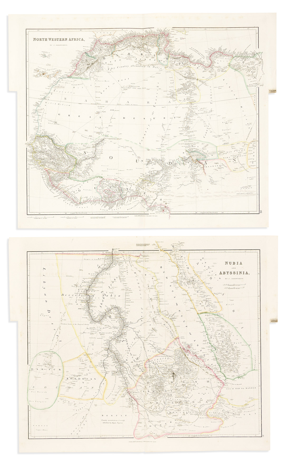
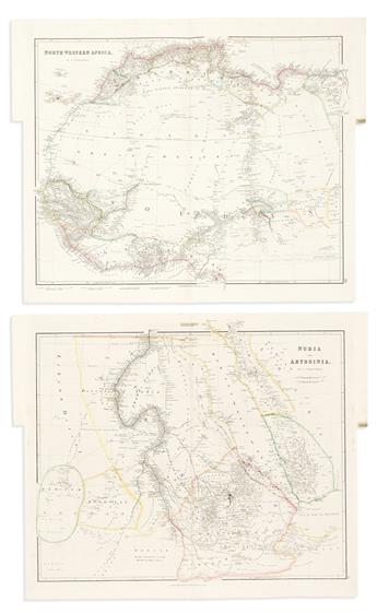
- John Arrowsmith. North Western Africa. Double-page engraved map of northwestern Africa. 21 3/4x25 1/2 inches sheet size, wide margins, printed atlas tab at right; original hand-color in outline; very minor foxing. London, 1840.
- John Arrowsmith. Nubia and Abyssinia. Double-page engraved map of eastern Africa and the Red Sea. 21 3/4x25 1/2 inches sheet size, wide margins, printed atlas tab at right; original hand-color in outline; very minor foxing. London, 1840.
- A.J. Johnson. Africa. Double-page lithographed map of the African continent. 26 1/2x18 inches sheet size, wide margins; original hand-color; archival closures. New York, 1864.
- Adrien Brue. Carte de l'Afrique Septentrionale. Double-page engraved map of northern Africa. 19x24 inches sheet size, wide margins; original hand-color; small edge closures. Paris, circa 1880.