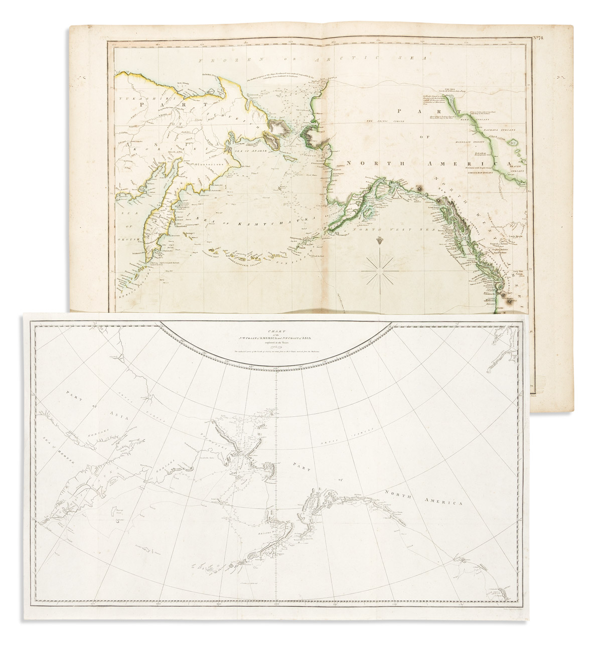
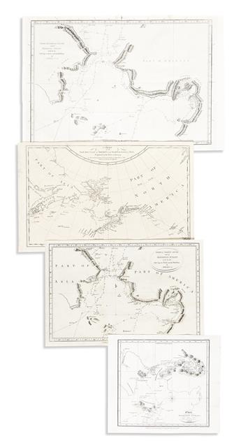
-Captain Cook/Henry Roberts. Chart of the NW Coast of America and NE coast of Asia Explored in the Years 1778 & 1779. 16 1/2x27 1/2 inches sheet size, ample margins (upper right reinstated where trimmed for binding); original folds flattened. London, 1784.
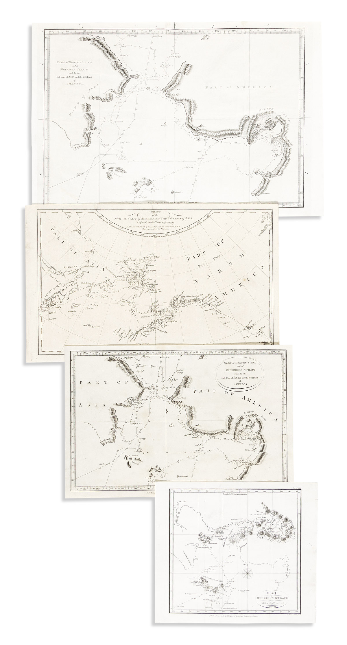
- Captain Cook/Alexander Hogg. Chart of Norton Sound and of Bherings Strait Made by the East Cape of Asia and the West Point of America. 9x13 1/2 inches sheet size, ample margins; minor stain. London, circa 1785.
- Captain Cook/Alexander Hogg. A Chart of the North West Coast of America and North East Coast of Asia, Explored in the Years 1778 & 1779. 9 1/4x15 inches sheet size, ample margins; small edge repairs. London, circa 1785.
- Captain Cook/Henry Roberts. Chart of Norton Sound and of Bherings Strait Made by the East Cape of Asia and the West Point of America. Wove paper, 11 1/2x17 inches sheet size, wide margins; cleaned, original folds flattened. London, 1784 (or after).
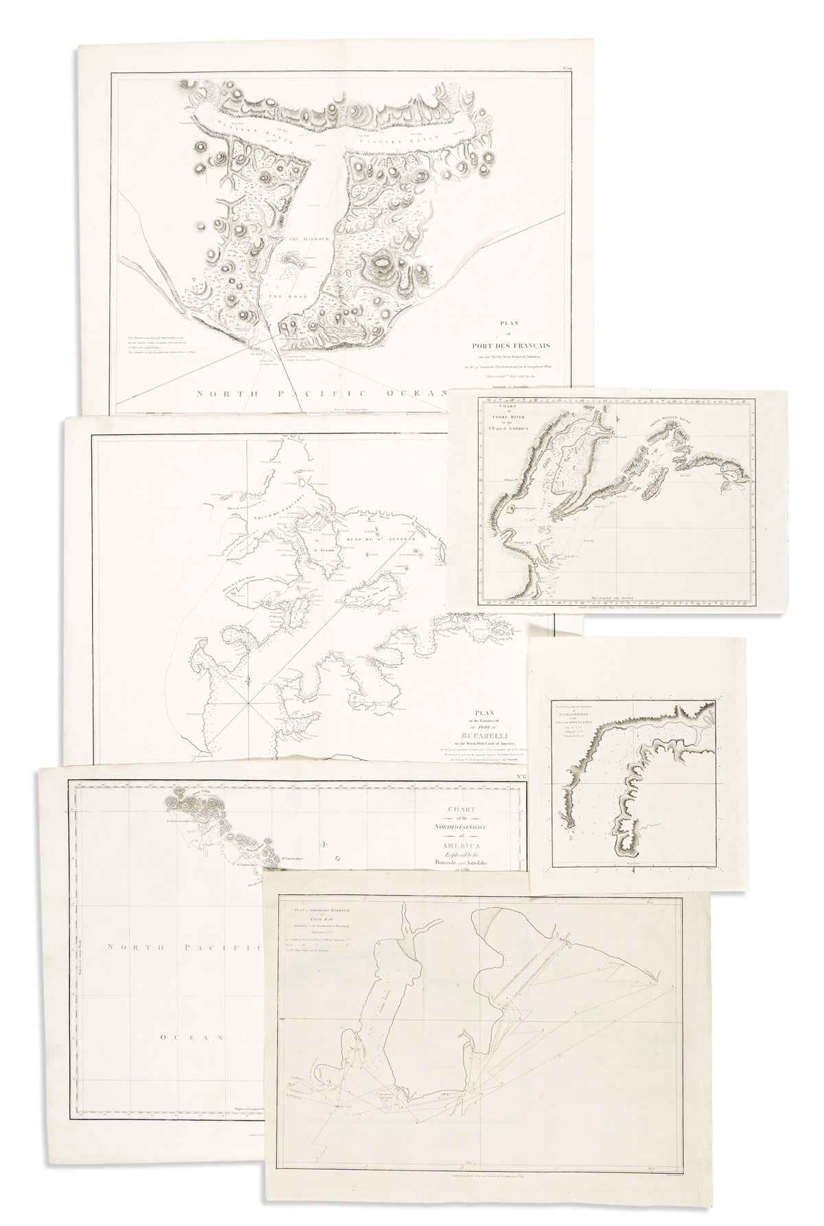
- La Perouse, after. Chart of the Northwest Coast of America. Explored by the Boussole and Astrolabe in 1786. 1st Sheet. 16 1/2x21 inches sheet size, wide margins; center fold flattened. London: G.G. and J. Robinson, 1798.
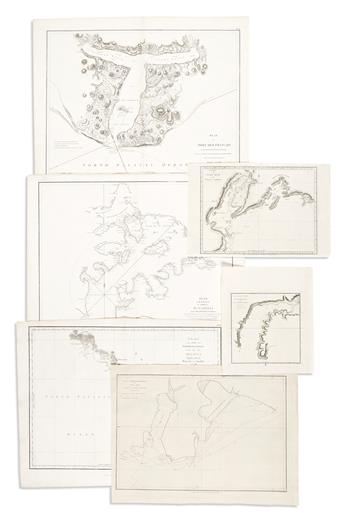
- La Perouse, after. Plan of Port des Francais on the North West Coast of America. (Lituya Bay). 16 1/2x21 1/2 inches sheet size, wide margins; center fold flattened. London: G.G. and J. Robinson, 1798.
- La Perouse, after. Plan of the Entrance of the Port of Bucarelli on the North West Coast of America. 16 1/2x21 1/2 inches sheet size, wide margins; center fold flattened, minor nicks at lower edge. London: G.G. and J. Robinson, 1798.
- Captain Cook/Alexander Hogg. Chart of Cooks River in the N.W. Part of America. (Anchorage). 9 1/4x14 inches sheet size, wide margins; small repair. London, circa 1785.
- Captain Cook/Henry Roberts. Sketch of the Harbour of Samganooda on the Island Oonalaska. Wove paper, 10 1/2x9 inches sheet size, wide margins. London, 1784 (or after).
- Nathaniel Portlock. Plan of Graham's Harbour and Coal Bay. 13 1/2x18 1/2 inches sheet size, wide margins; minor edge crinkle. London: John Stockdale, 1789.
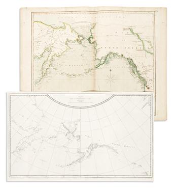
- John Thomson. Chart of the Northern Passage Between Asia & America. 21 1/4x27 1/2 inches sheet size, wide margins; original hand-color in outline; foxing and offsetting. Edinburgh, 1816.
- Otto Von Kotzebue, after. Chart of Behring's Strait, Upon Mercators Projection. 8 1/4x9 1/2 inches sheet size, wide margins; cleaned, original folds flattened. London: R. Phillips, 1821.