Dec 01, 2010 - Sale 2232

Sale 2232 - Lot 1

Unsold
Estimate: $ 600 - $ 900
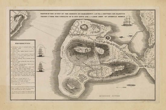
(AMERICAN REVOLUTION.) Bernier, Henry de. Sketch of the Action on the Heights of Charlestown 17 June 1775 betweeen His Majestys Troops under the Command of M Genl. Howe and a Large Body of American Rebels. Engraved map, 525x340 mm sheet size, an India Proof mounted to a larger sheet measuring 560x705 mm; some darkening and soiling at edges of mount, map clean. Philadelphia: Harrison Hall, 10 February 1818

Additional Details

A possible variant of a map appearing in Analectic Magazine on different paper and folded to 8vo format. This map is unfolded and mounted on the original mount. Phillips in American Maps notes a similarly titled map, but punctuated with commas and with an imprint from a month later - appearing in the 4th series of The Port Folio in March 1818 (see page 181).