Sep 15, 2011 - Sale 2253

Sale 2253 - Lot 68

Price Realized: $ 11,400
?Final Price Realized includes Buyer’s Premium added to Hammer Price
Estimate: $ 15,000 - $ 25,000
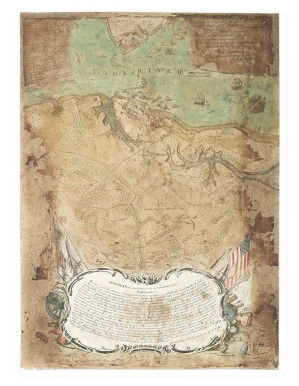
THE FIRST AMERICAN MAP OF THE BATTLE OF YORKTOWN (AMERICAN REVOLUTION--1782.) Bauman, Sebastian. . . . Plan of the Investment of York and Gloucester. Engraved hand-colored map, 25 1/4 x 18 inches; toned and heavily worn with some loss, but expertly laid down on paper and conserved, with a few details added in facsimile. Philadelphia: R. Scot, [February?] 1782

Additional Details

Visually striking and an important historical document, this map gives the first and best American view of the final major battle of the Revolution, printed just months after Cornwallis's surrender effectively ended the war. The map is rich in detail, showing individual buildings within the British fortifications, the British vessels as they lay sunk in the harbor, the number and sizes of guns in each British battery, the topography and the borders of individual farmsteads in the surrounding countryside, and just above the lower cartouche, the headquarters of Washington and Rochambeau. British works are colored in red, the French lines in yellow, and the Americans a faint blue.
The mapmaker Sebastian Bauman was a German-born major in the Second Regiment of New York Artillery, and served at Yorktown during the siege. The British formally surrendered on 19 October, and Bauman began his battlefield survey three days later. On 30 January 1782, an advertisement appeared in the New Jersey Journal, suggesting that the map would appear shortly. It was the first and only only American prototype map of the siege and battle; a British map appeared in London at about the same time. Nebenzahl 189; Schwartz & Ehrenberg, page 201 and plate 125 (''extremely rare"); Verner, Maps of the Yorktown Campaign XXVI; Stauffer 2970.