May 26, 2016 - Sale 2417

Sale 2417 - Lot 2

Price Realized: $ 7,500
?Final Price Realized includes Buyer’s Premium added to Hammer Price
Estimate: $ 6,000 - $ 9,000
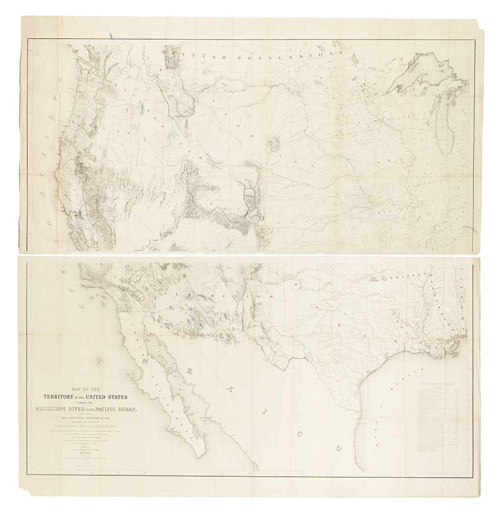
(AMERICAN WEST.) Warren, Gouverneur Kemble. Map of the Territory of the United States from the Mississippi to the Pacific Ocean; Ordered by the Hon. Jeff'n Davis, Secretary of War to accompany the Reports of the Explorations for a Railroad Route ... Compiled from authorized explorations and other reliable data by Lieut. G. K. Warren, Topl. Engrs. ... under the direction of Bvt. Maj. W. H. Emory, Topl. Engrs. in 1854 and of Capt. A. A. Humphreys, Topl. Engrs. 1854-5-6-7-8 ... Drawn by E. Freyhold. Engr. on Stone by J. Bien... Lithographed folding map on two large unjoined sheets. Extensive manuscript annotations identifying mineral deposits and outlining the Dakota Territory. 48x48 inches sheet size, if joined. New York: J. Bien, [1858]

Additional Details

"[The publication of the 1857 edition was] an event comparable in importance to publication of Lewis and Clark's first reports, Warren's map marked the culmination of six decades of effort to comprehend the outlines of western geography… Compared to Warren's map, all previous works of a general nature on the trans-Mississippi West are mere sketches." -- Goetzman, Army Exploration in the American West 1803-1863, pages 313-316.

"This is one of the most important maps of the West in the 1850's and 1860's." -- Rumsey, 693 (1861 edition).

"Warren's masterpiece was a synthesis of the most reliable information available. Integrated into a single map for the first time were the discoveries of the earliest explorers beginning with Lewis and Clark, the information collected in the course of military actions including the Indian wars, the material generated by scientific expeditions, and the newly assembled data compiled during the Pacific Railroad Surveys of 1853-1855" -- Wheat, Mapping the Transmississippi West 936 and IV: pages 84-91 (1857 issue).

The present copy includes a number of interesting circa 1861 manuscript annotations. The dating of the annotations can be discerned by the outline in blue of the boundaries of the original Dakota Territory (i.e. before being divided into smaller territories). Besides the outline of the territory, across much of the map, the same hand has identified mineral deposits, most notably being gold in present day Montana, Colorado, Washington, and California. Also shown are deposits of coal and silver.

Rumsey 2750; Mapping the West, pages 172-175; Phillips, A List of Maps of America, page 904; Schubert/Koepp, pages 57-58.