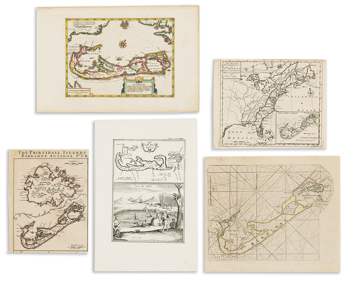
- Johannes Cloppenburg. Mappa Aestivarum Insularum alias Bermudas. Engraved map of Bermuda. 9¾x15 inches sheet size, wide margins; attractively hand-colored; minor signs of age only. Amsterdam, circa 1630.
- Philip Lea. [Antigua and Bermuda] excised from the larger multi-panel Principall Islands in America Belonging to the English Empire. 9½x7¼ inches overall; original hand-color in outline; minor soiling. London, 1696.
- Vincenzo Coronelli. I. Bremude. Small engraved map from Isole Britanniche. 6x11½ inches overall; minor stains. Venice, circa 1707.
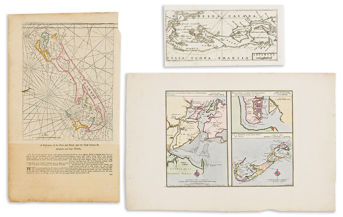
- Phillipe Buache. [Tires de la Carte d l'Amerique de Mr. Popple]. Engraved sheet with maps of New York Bay, Charleston, and Bermuda derived from Popple. 13½x20¼ inches sheet size, wide margins with uncut deckle edges; hand-colored in full; minor signs of age. Paris, 1740.
- Gianfrancesco Pivati. Le Bermude / Caccia dei Castori. Engraved map of Bermuda on a sheet with a beaver hunting scene. 14x9¼ inches overall, wide margins; minor wear only. Venice, circa 1747.
- George Grierson. [Bermuda]. Engraved chart of Bermuda on a leaf of English text (page 52). 18½x11 inches sheet size; hand-colored in outline; age tone at lower descriptive register, small paper loss at upper right corner. Dublin, 1749.
- John Gibson, engraver. The British Governments in Nth. America Laid Down Agreeable to the Proclamation of Octr. 7, 1763. Small engraved folding map of colonial North America with an inset of Bermuda at lower right. 8¼x10¼ inches sheet size, upper margin shaved to the neatline; original fold, minor wear. London: Gentleman's Magazine, 1763.
- Mount & Page. [Bermuda.] Engraved chart of Bermuda from The English Pilot, Fourth Book. 10¾x12½ inches sheet size, edges trimmed affecting English text printed on verso; hand-colored in outline; light age tone. London, circa 1770.