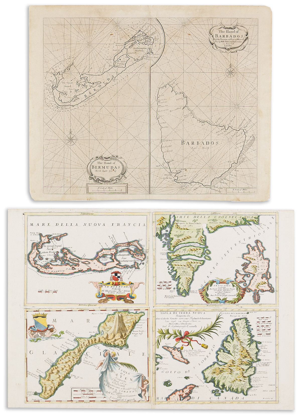
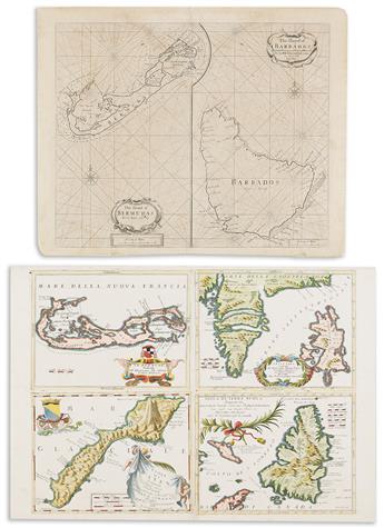
- John Thornton and William Fisher. The Iland of Bermudas / The Iland of Barbados. Double-page engraved two-panel chart of Bermuda and Barbados. 18½x23 inches sheet size, wide margins, blank verso; repair at upper center fold. London, 1689.
- Vincenzo Coronelli. Le Bermude / Frislanda / Isola di Mayen / Isola di Terra Nuova. Double-page engraved four-panel map of Bermuda, the fictional island of Frisland, Jan Mayen Island, and Newfoundland. 19x27 inches sheet size, upper margin narrow, others ample; attractively hand-colored; minor repair of worm track at upper center. Venice, circa 1696.
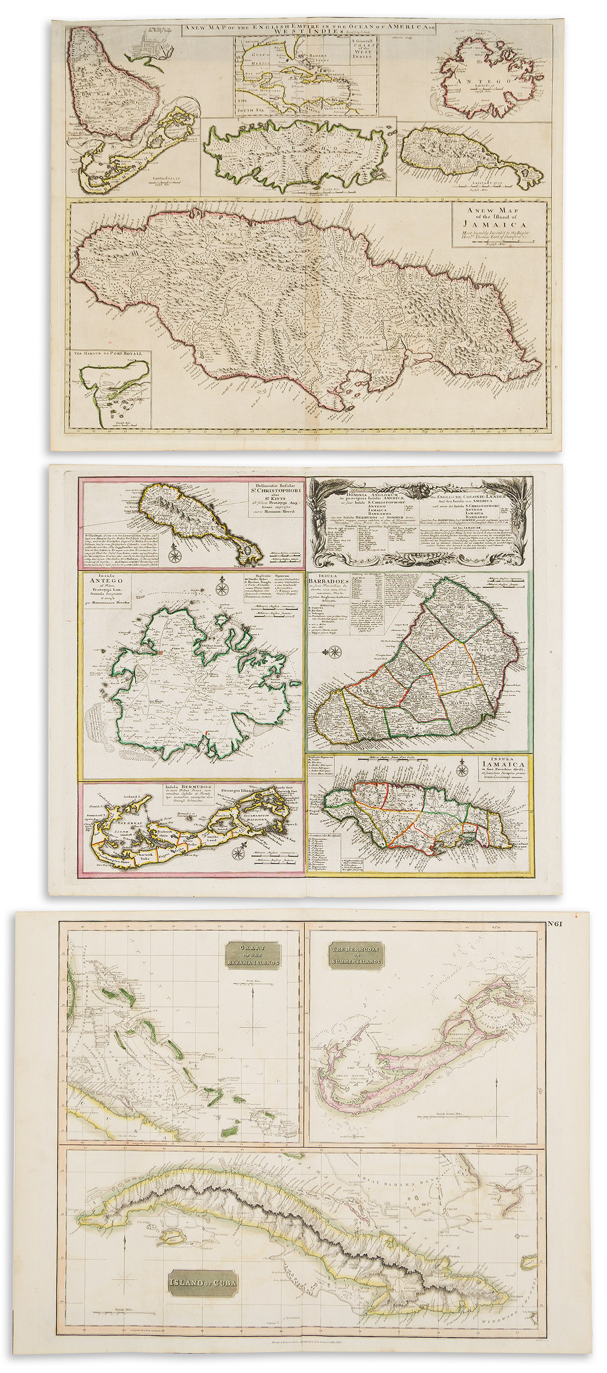
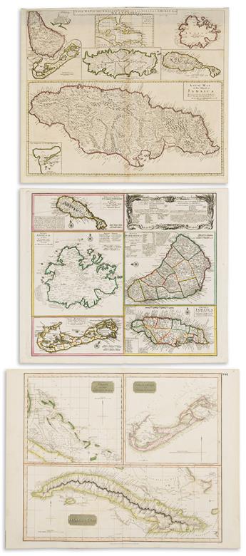
- John Senex. A New Map of the English Empire in the Ocean of America or West Indies. Double-page engraved multi-panel map of Barbados, Bermuda, Tobago, Antigua, St. Christopher's, and Jamaica with a general inset of the West Indies. 21x24½ inches sheet size, upper margin narrow, others ample; original hand-color in outline; minor signs of age only. London, 1721.
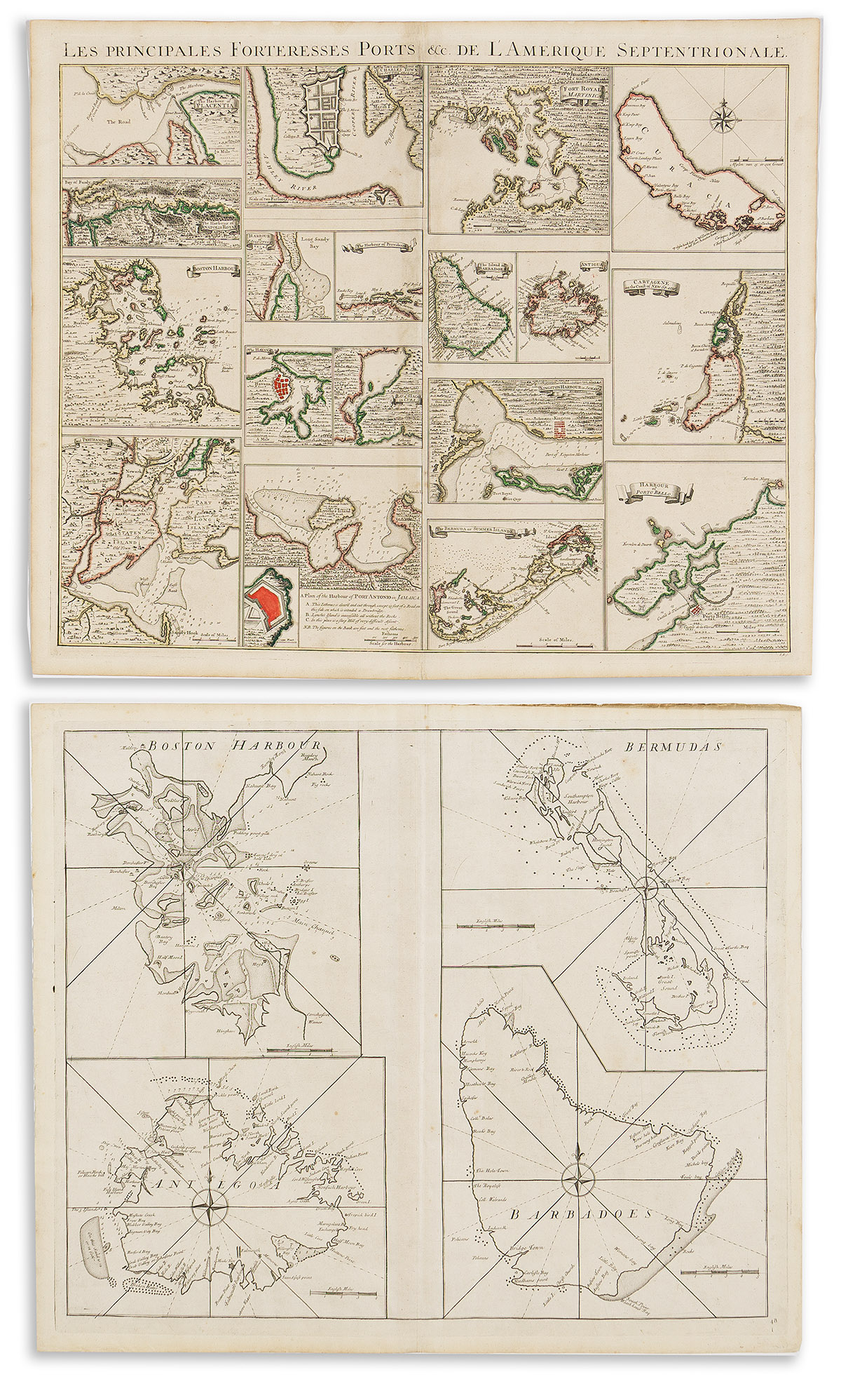
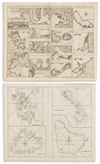
- John Senex, Edmond Halley, Nathaniel Cutler, et al. Boston Harbour / Bermudas / Antegoa / Barbadoes. Double-page engraved four-panel chart of Boston, Bermuda, Antigua, and Barbados. 21x25 inches sheet size, wide margins; minor foxing and edge wear but nice. London, 1728.
- Homann Heirs. Dominia Anglorum in Praecipuis America. Double-page engraved multi-panel map of St. Christopher's, Antigua, Barbados, Bermuda, and Jamaica. 20¾x24½ inches sheet size, ample margins; original hand-color in outline; small closure at lower center fold, otherwise minor signs of age only. Nuremberg, circa 1740.
- Covens & Mortier; after Henry Popple. Les Principales Fortresses Ports &c. de L'Amerique Septentrionale. Double-page engraved assemblage of 18 plans of islands and harbors relative to the Caribbean and Americas. 21¼x26½ inches sheet size, wide margins; original hand-color in outline; minor signs of age but very good. Amsterdam, circa 1745.
- John Thomson. Chart of the Bahama Islands / The Bermudas or Summer Islands / Island of Cuba. Double-page engraved three-panel map. 21x27½ inches sheet size, wide margins; original hand-color; light offsetting. Edinburgh, 1816.