?Final Price Realized includes Buyer’s Premium added to Hammer Price
Estimate: $ 400 - $ 600
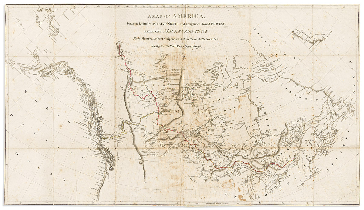
(CANADA.) Alexander Mackenzie. A Map of America, Between Latitudes 40 and 70 North and Longitudes 45 and 180 West,Exhibiting Mackenzie's Track from Montreal to Fort Chipewyan & from Thence to the North Sea in 1789 & to the West Pacific Ocean in 1793. Large engraved folding map of lower Canada tracing Mackenzie's epic transcontinental path from Montreal to the west coast, the first officially recorded overland passage of the territory. 17¼x30½ inches sheet size, narrow margins; original hand-color in outline; soiling and several folds mended on the verso, sold as is but would conserve nicely. London, 1801