?Final Price Realized includes Buyer’s Premium added to Hammer Price
Estimate: $ 1,800 - $ 2,200
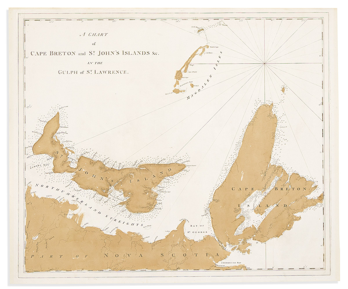
(CANADA.) Joseph Frederick Wallet Des Barres. A Chart of Cape Breton and St. John's Islands &c. in the Gulph of St. Lawrence. Large engraved chart of northern Nova Scotia, Prince Edward Island, Cape Breton Island, and the Magdalen Island archipelago. "J Bates" watermarked laid paper, 24¾x29¾ inches sheet size, wide margins; original wash color; a few very minor edge tears but overall excellent. Without imprint, scale of miles, fleur-de-lis on the north-running compass rhumb line, topographical stippling, and virtually all place names on Cape Breton - this lack of printed information suggests a preceding proof to what is identified as the first state in Kershaw's Printed Maps of Canada, Vol. II, 601 (plate 434). London, [1777]