May 29 at 12:00 PM - Sale 2706 -

Sale 2706 - Lot 63

Estimate: $ 800 - $ 1,200
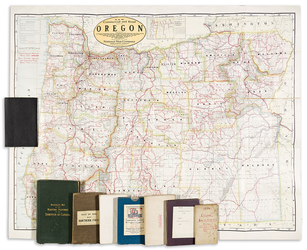
(CASE MAPS.) Group of 8 miscellaneous nineteenth-and-twentieth-century folding maps. Individual photos on request. Vp, vd

Additional Details

- James Wyld. The Crimea. Third Edition. Hand-colored lithographed map of the Crimean Peninsula with insets of the Black Sea and Sevastopol. 19½x27 inches overall, mounted on original linen backing and folding into printed publisher's advertisement self-wrapper; light signs of age. London, 1854.

- Eugene Andriveau-Goujon. Carte Strategique de l'Italie Septentrionale. Hand-colored lithographed military strategy map of northern Italy. 24¼x33¼ inches overall, segmented, mounted on original linen backing, and folding into publisher's 8vo format cloth case; moderate wear and toning. Paris, 1859.

- Eugene Andriveau-Goujon. Navigation a Vapeur dans le Bassin de la Mediterranee et Chemins de Fer de l'Europe Centrale. Large hand-colored lithographed map detailing the maritime and railroad routes of Europe. 27x40½ inches overall, segmented, mounted on original linen backing, and folding into plain card self-wrappers; light age tone, linen separation along several folds. Paris, 1863.

- George Philip & Son. Mackinlay's Map of the Maritime Provinces of the Dominion of Canada. Monumental color-printed lithographed map of New Brunswick, Nova Scotia, and Prince Edward Island. 2 sections, approximately 51x33 inches each, segmented, mounted on original linen backing, and folding into publisher's 8vo format gilt cloth case; some staining. London, circa 1880.

- National Map Company. New Commercial and Road Map of Oregon. Large color-printed map of Oregon. 40x49½ inches overall; mounted on original linen backing and folding into publisher's 8vo format cloth case; minor wear only. Indianapolis, 1917.

- Edward Stanford. The Seat of War in Turkey. Stanford's War Maps No. 9. Large hand-colored lithographed map of the region around Türkiye between Greece and the Persian Gulf. 29x42 inches overall, segmented, mounted on original linen backing, and folding into publisher's 8vo format cloth case; minor wear only. London, 1918.

- C.E. Sherman; and W.D. Turnbull. Map of Ohio Showing Original Land Subdivisions to Accompany Volume III, Final Report Ohio Cooperative Topographic Survey. Large lithographed map of Ohio overprinted in red, green, and blue. 45x41 inches overall, segmented, mounted on original linen backing, and folding; light tanning else good. Np, 1922.

- George Philip & Son. Philips' Mercantile Map of Europe. Large color-printed map detailing the railroads and commercial maritime routes of Europe. 37½x47¾ inches overall, segmented, mounted on original linen backing, and folding into publisher's 8vo format cloth slipcase with printed pictorial label; virtually as new. London, 1945.