?Final Price Realized includes Buyer’s Premium added to Hammer Price
Estimate: $ 400 - $ 600
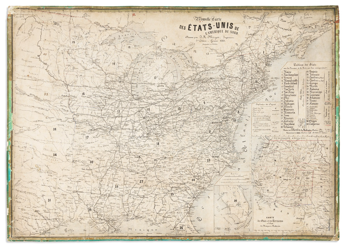
(CIVIL WAR.) Jean-Rodolphe Mayer. Nouvelle Carte des Etats-Unis de l'Amerique du Nord… 2de Edition. Large hand-colored lithographed map of the United States with a keyed reference table numbering 42 states and territories grouped into free and slave-holding categories with population figures of each; those two factions delineated in pale red and blue outline. 23 3/4x33 1/2 inches sheet size; mounted to contemporary French blue-backed green paper card, stains, chips, and soiling mostly keeping to the edges. Not in Stephenson; OCLC locates one example of this second edition (Bibliotheque Geneve) and only two examples of the first edition; no copies traced in market records. Geneva, 1861