?Final Price Realized includes Buyer’s Premium added to Hammer Price
Estimate: $ 1,500 - $ 2,000
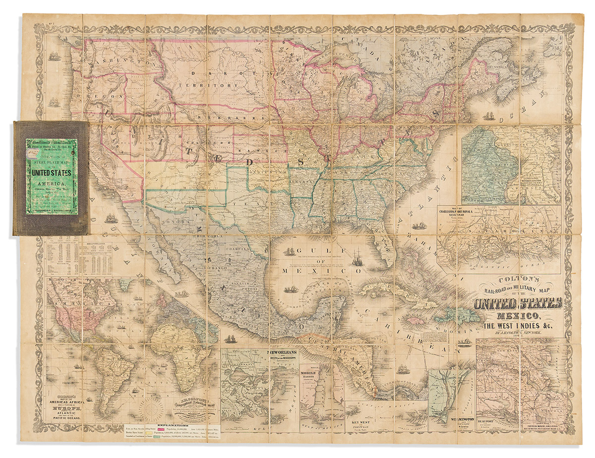
(CIVIL WAR.) Joseph Hutchins Colton. Colton's Rail-Road and Military Map of the United States, Mexico, The West Indies &c. Large lithographed case map of the United States hand-colored to delineate the free or non-slaveholding states in red, border slave states in yellow, and seceded or confederate states in green, with a printed slip explaining the populations of those factions pasted at the lower edge; insets detail 8 ports and regions of major importance during the war. 34½x44 inches overall, segmented, mounted on original linen backing, and folding into publisher's 8vo format cloth case with printed shop label of London mapseller G.W. Bacon pasted to upper cover; browned overall with age but no other significant damages. New York, 1863