Jun 13, 2024 - Sale 2672

Sale 2672 - Lot 47

Price Realized: $ 1,188
?Final Price Realized includes Buyer’s Premium added to Hammer Price
Estimate: $ 700 - $ 1,000
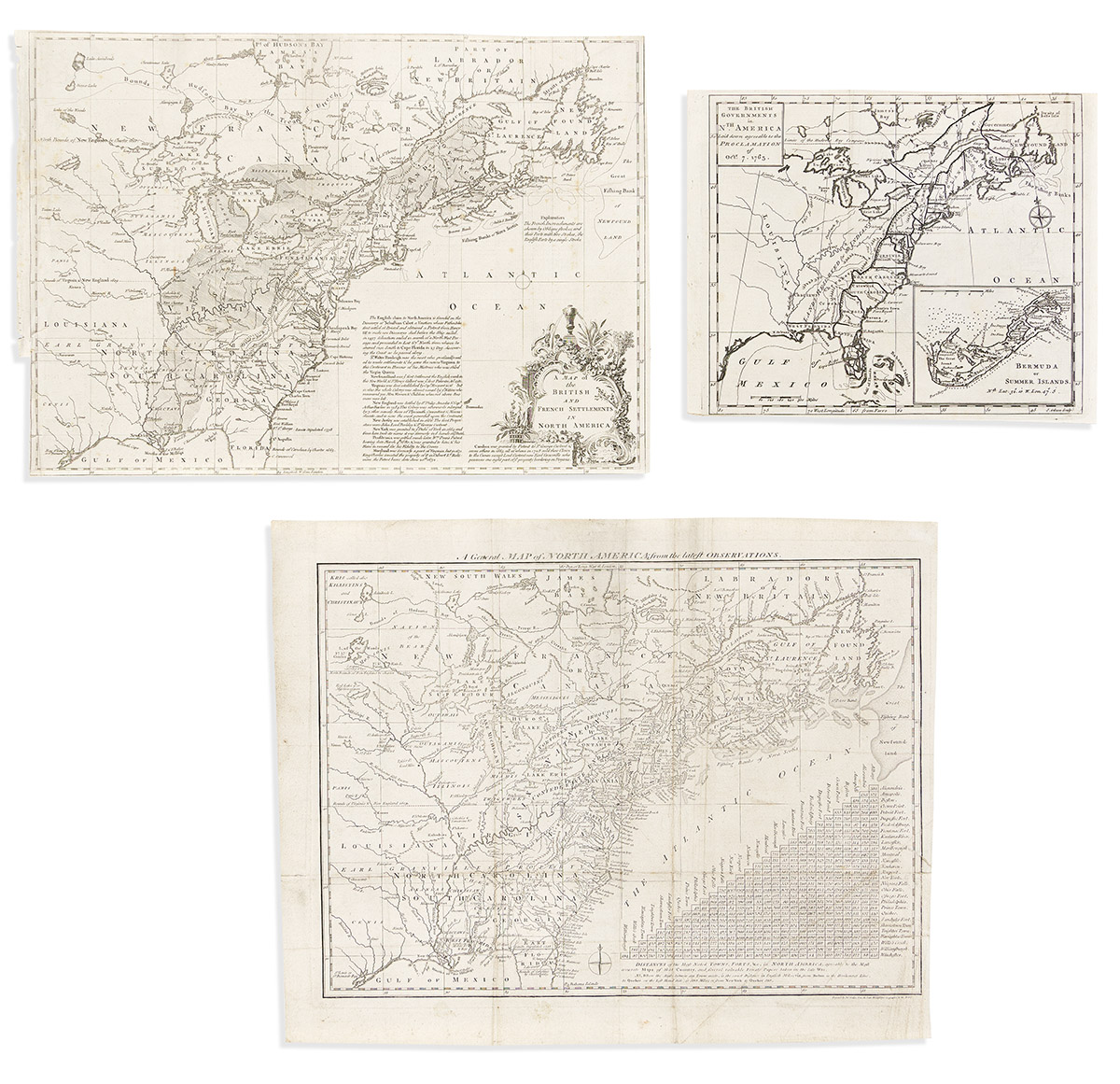
(COLONIAL NORTH AMERICA.) Group of 3 engraved maps from eighteenth-century British publications. London, vd

Additional Details

- John Lodge, engraver. A Map of the British and French Settlements in North America. Engraved folding map of political claims in North America at the outset of the French and Indian War. 11x15½ inches sheet size, margins trimmed close, binding stub at left; minor foxing, neatly closed tear. London: Gentleman's Magazine, 1755. Jolly GENT-91.

- John Gibson, engraver. The British Governments in Nth. America Laid Down Agreeable to the Proclamation of Octr. 7, 1763. Engraved folding map of North America at the close of the French and Indian War with a large tract of "Land Reserved for the Indians" defined between the Appalachian Mountains and the Mississippi River; a detailed inset of Bermuda appears lower right. 8¼x10¼ inches sheet size, ample margins; generally fine. London: Gentleman's Magazine, 1763. Jolly GENT-170.

- John Lodge, engraver. A General Map of North America; from the Latest Observations. Engraved folding map of political claims in North America at the outset of the American Revolution with a large chart of city distances. 13x16¼ inches sheet size, wide margins; archivally lined on verso stabilizing old folds. London, circa 1776.