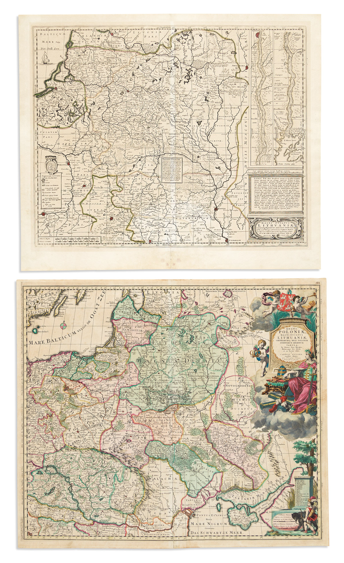
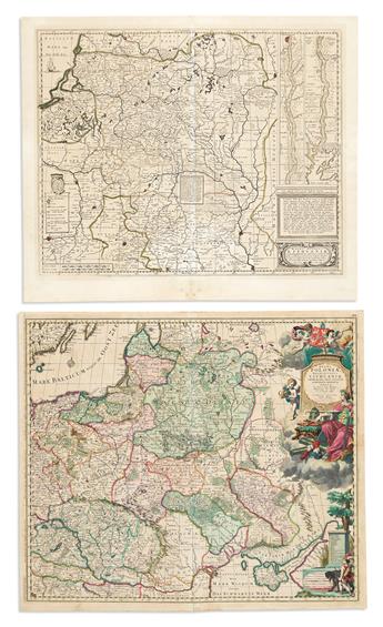
- Carel Allard. Regni Poloniae, Magni Ducatus Lithuaniae Coeterumque Regi Poloniae Subditarum Regionum Tabula. Double-page engraved map of Poland, Slovakia, Hungary, Romania, Kaliningrad, Lithuania, Latvia, Belarus, and Ukraine with a decorative allegorical title cartouche. 20 1/2x24 inches sheet size, ample margins; fine original hand-color in full; minor age tone else rather nice. Amsterdam, circa 1690.
- Schenk & Valk; after Hondius. Magni Ducatus Lithuaniae Caetrarumq Regionum illi Adiacentium. Double-page engraved map of Kaliningrad, Lithuania, Belarus, and parts of Poland and Ukraine with an inset plan of the lower Dnieper River. 19 3/4x23 1/4 inches sheet size, wide margins; original hand-color in outline; mat line and age tone. Amsterdam, circa 1690.
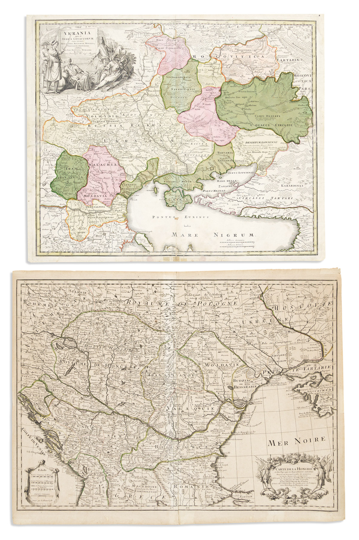
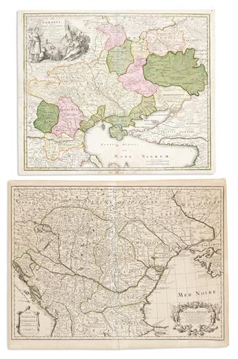
- Johann Baptist Homann. Ukrainia Quae et Terra Cosaccorum cum Vicinis Walachiae, Moldaviae, Minorisque Tartarie Provinciis. Double-page engraved map of the Black Sea, Ukraine, Moldova, Romania, and Bulgaria. 19 1/2x23 3/4 inches sheet size, ample margins; original hand-color; small repairs and edge stains. Nuremberg, circa 1720.
- Guillaume de L'Isle. Carte de la Hongrie et des Pays Qui en Dependoient Autrefois. Double-page engraved map of Hungary, Slovakia, Romania, Moldova, Bulgaria, North Macedonia, Albania, Kosovo, Serbia, Montenegro, Bosnia/Herzegovina, Croatia, and parts of Slovenia, Austria, Czechia, Poland, and Ukraine, 20 1/4x26 1/2 inches sheet size, ample margins; original hand-color in outline; light toning, small edge repairs. Paris, 1703.