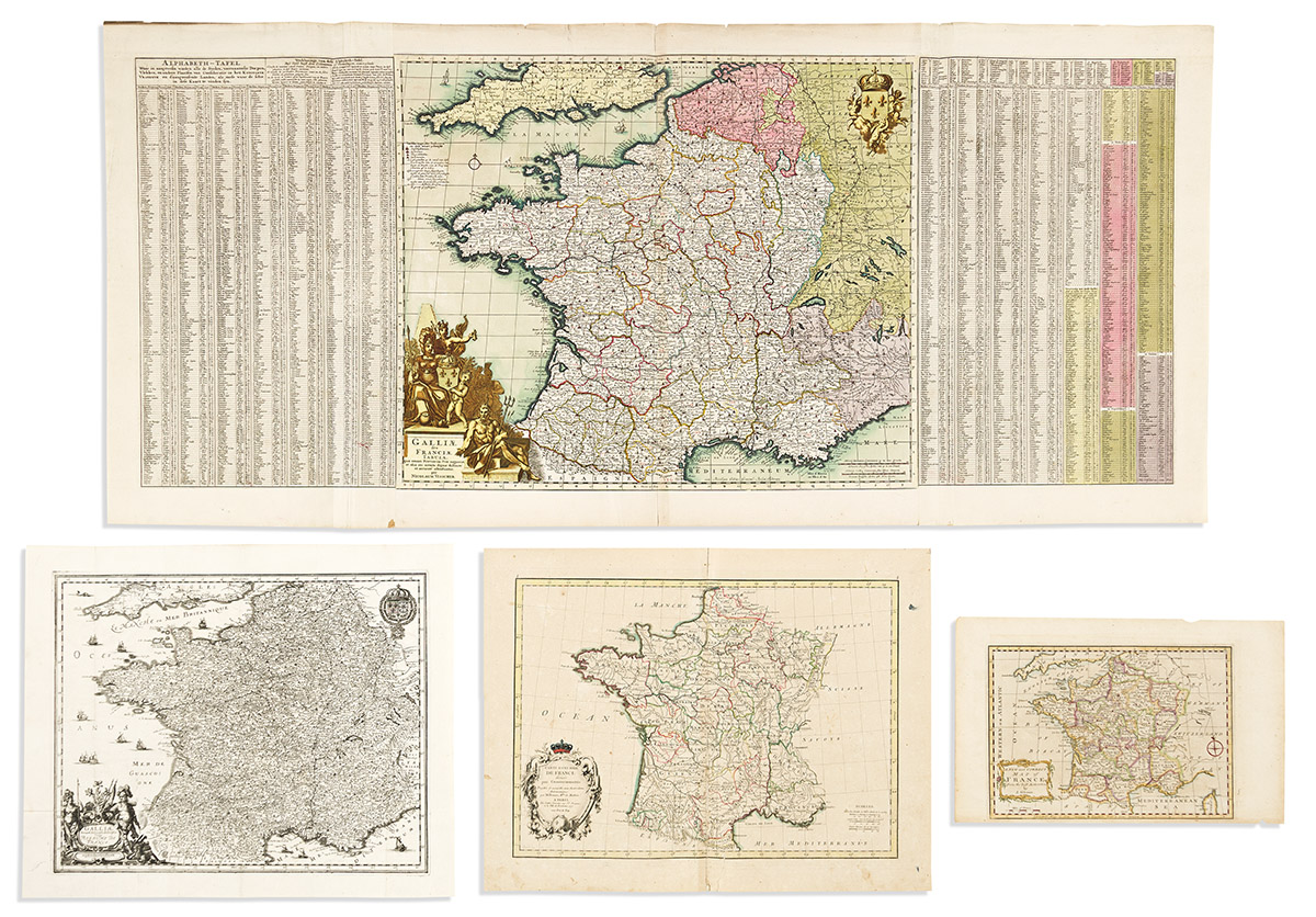
- Matthaus Merian. Galliae Nova et Accurata Descriptio Vulgo Royaume de France. Engraved folding map of France. 15x18 1/4 inches sheet size, wide margins; crisp and clean. Frankfurt, circa 1650.
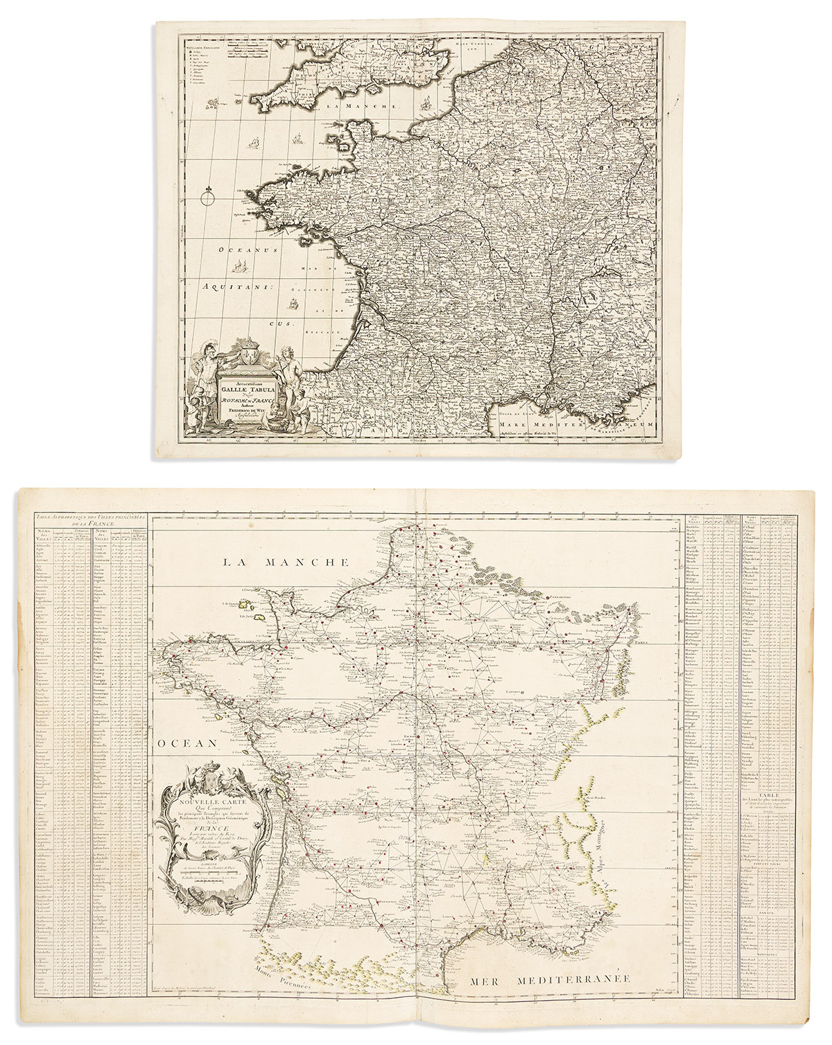
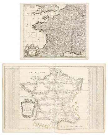
- Frederick de Wit. Accuratissima Galliae Tabula Vulgo Royaume de France. Double-page engraved map of France. 20 1/2x24 1/2 inches sheet size, wide margins; small edge closures, else nice. Amsterdam, circa 1690.
- Nicolas Visscher. Galliae seu Franciae Tabula. Double-page engraved map of France with engraved wing tables referencing the placement of alphabetically arranged cities and towns. 3 sheets joined, 21 1/2x47 inches overall, wide margins; fine original hand-color in full; minor edge wear. Amsterdam, circa 1690.
- Cesar-Francois Cassini de Thury; and Giovanni Domenico Maraldi. Nouvelle Carte qui Comprend les Principaux Triangles qui Servent de Fondement a la Description Geometrique de la France. Large double-page engraved triangulation map of France bordered by distance tables. 25x37 inches sheet size, ample margins; touches of hand-color; light toning and small stains. Paris, circa 1744.
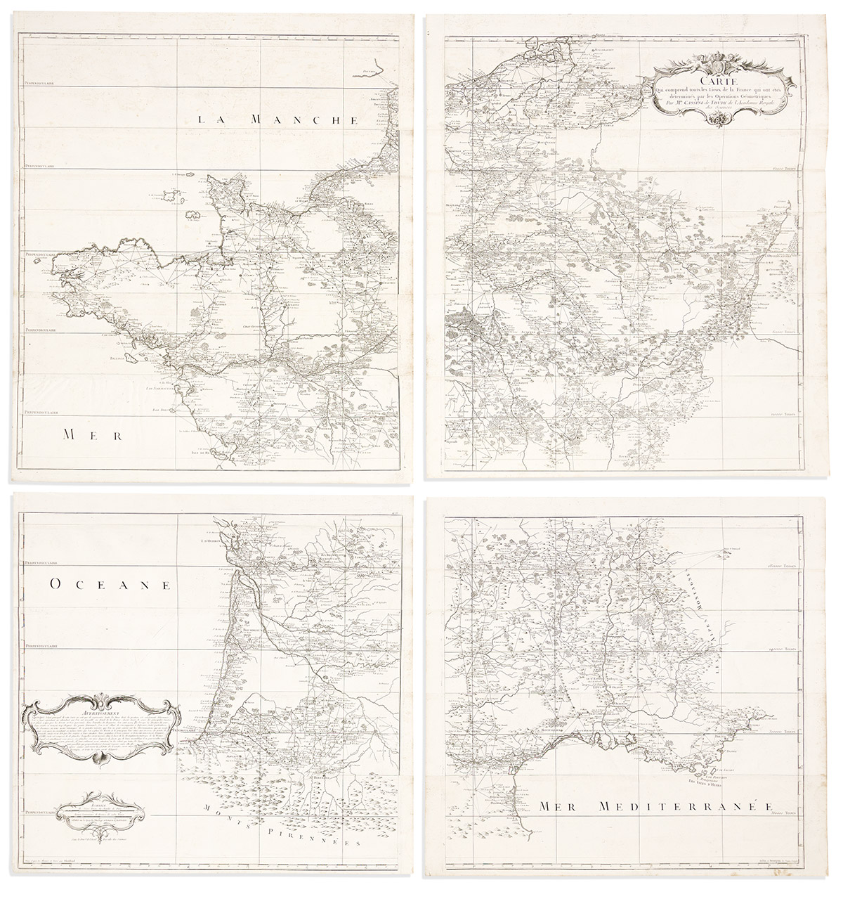
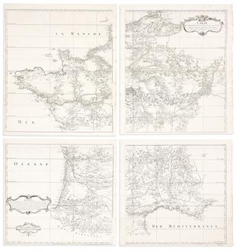
- Cesar-Francois Cassini de Thury; and Guillaume Dheulland (engraver). Carte qui Comprend Touts les Lieux de la France qui ont Etes Determines par les Operations Geometriques. Large multi-sheet triangulation map of France joined as 4. Approximately 29 1/2x25 1/4 and 24x25 1/4 inches each section, wide margins; minor signs of age mostly at sheet edges. Paris: de l'Isle, circa 1744.
- John Gibson. A New and Correct Map of France. Engraved map of France. 8 3/4x14 inches sheet size, wide margins; hand-colored in outline; minor edge nicks. London, circa 1775.
- Rigobert Bonne. Carte Generale de France Divisee par Gouvernements. Double-page engraved map of France. 14 1/2x19 inches sheet size, wide margins; hand-colored in outline; repair at lower center, small stains. Paris, 1791.
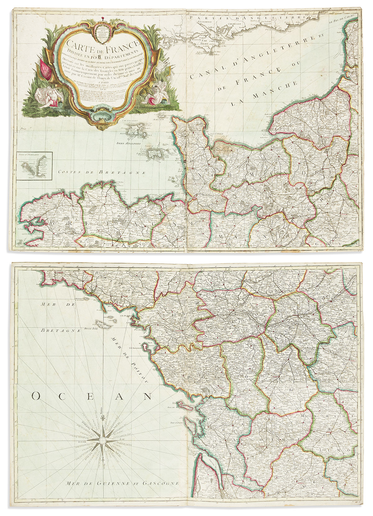
- Cesar-Francois Cassini de Thury; and Louis-Charles Desnos. Carte de France Divisee en 108 Departements. 24-sheet engraved wall map of France joined as 12. 20 3/4x15 inches each part; original (?) hand-color in outline; scattered staining, leaves joined with adhesive and requiring conservation if desired to composite. Paris, [1792].