Dec 04, 2014 - Sale 2369

Sale 2369 - Lot 50

Price Realized: $ 2,750
?Final Price Realized includes Buyer’s Premium added to Hammer Price
Estimate: $ 1,200 - $ 1,800
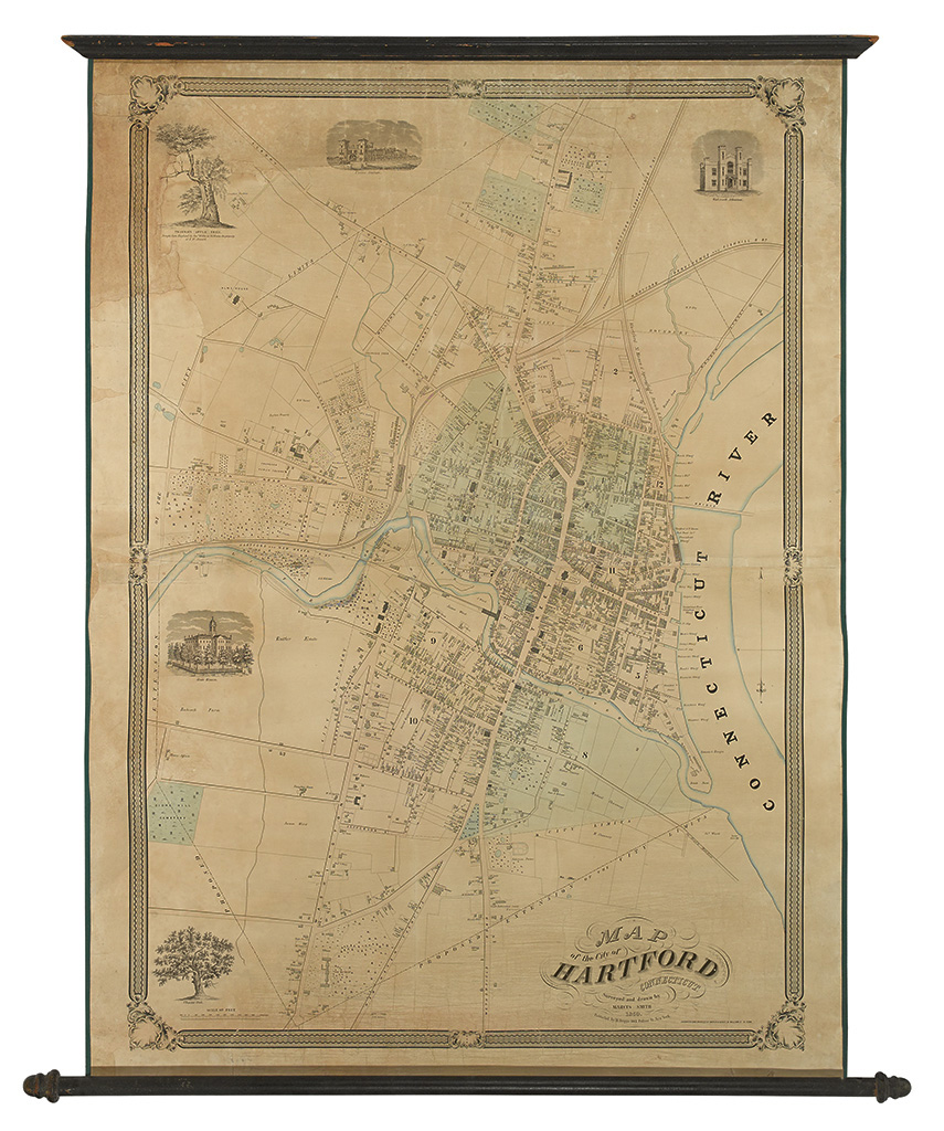
(HARTFORD, CT.) Smith, Marcus. Map of the City of Hartford Connecticut. Survey and drawn by Marcus Smith 1850. Large lithographed roll map, mounted on linen with wood dowels. 1130x787 mm; hand-colored; conserved, with varnish removed and linen replaced, typical cracking repaired, areas of paper reinstated including border and part of pictorial vignette in facsimile. New York: M[atthew] Dripps, 1850

Additional Details

A rare and information-rich image of mid-19th century Hartford. Only the second large-scale plan of that city, following the first issued in 1824.

Marcus Smith portrays this intensely developed urban area in immense detail. Not only does the map depict Hartford's topographical features, street plan, and rail lines, but the large scale of 1:3600 makes it possible to accommodate property lines as well as the footprints of individual buildings (with different shading apparently used to indicate construction materials). To get a sense of the detail, one need only examine the many fine estates in and around the city, where one can make out not only the layout of the homes but also the gardens and walking paths. The decorative impact of the image is enhanced by a lovely geometric and foliate border and pictorial vignettes of Hartford landmarks such as the State House, Union Station and even the Charter Oak.

Thompson, Maps of Connecticut, 125, giving only examples as Connecticut Historical Society and Boston Public Library.