Jun 13, 2024 - Sale 2672

Sale 2672 - Lot 61

Unsold
Estimate: $ 1,800 - $ 2,200
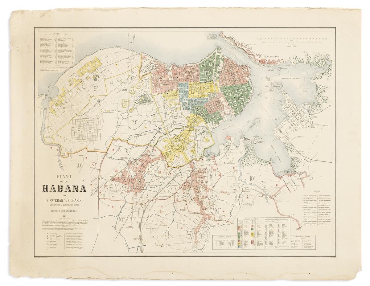
(HAVANA.) Esteban Pichardo y Tapia. Plano de la Habana. Oversized and well-detailed color-printed map of Havana with explanatory reference tables. 34x43¾ inches sheet size, very wide margins; several large closed tears at left, minor dampstain at lower edge. Paris: A. Simon for Imprimerie Becquet, 1881

Additional Details

This grand format separately issued work is the finest and most important map of Havana and its environs made in the twilight years of the Spanish colonial era. It was created by Esteban Pichardo, the 'Father of Cuban Geography', who mapped the country to top-grade modern systematic standards. It captures the Cuban capital as it appeared in the 1870s, when it had a population of around 180,000, and was one of the most beautiful, cultured, and well-appointed cities in the Americas.

The map embraces the entire harbor of Havana and its environs and depicts the city proper, plus all its fast-growing suburbs and exurbs. Every street is pictured and labeled, with the street numbers given per block, while the city's numerous parks, squares, public institutions, and facilities (ex. forts, barracks, hospitals, schools/colleges, religious places, and large business campuses) are noted. Indicative of metro Havana's rapid growth, the streets of the several projected areas of development are shown by intermittent lines. The map was created by Esteban Pichardo while the esteemed polymath-cartographer was in his 70s. He bases the map upon his own surveys, as well as the best mapping done for the army and Havana's Public Works Department, creating an unrivaled graphic record of the city.

This is the second edition of the map, first published in 1874, and quite uncommon with only 4 institutional copies traced. Pichardo's map served as a model for many American government-issued versions published in the late 19th and early 20th centuries.

Cueto 209.