Jun 23, 2022 - Sale 2610

Sale 2610 - Lot 79

Price Realized: $ 2,000
?Final Price Realized includes Buyer’s Premium added to Hammer Price
Estimate: $ 2,000 - $ 3,000
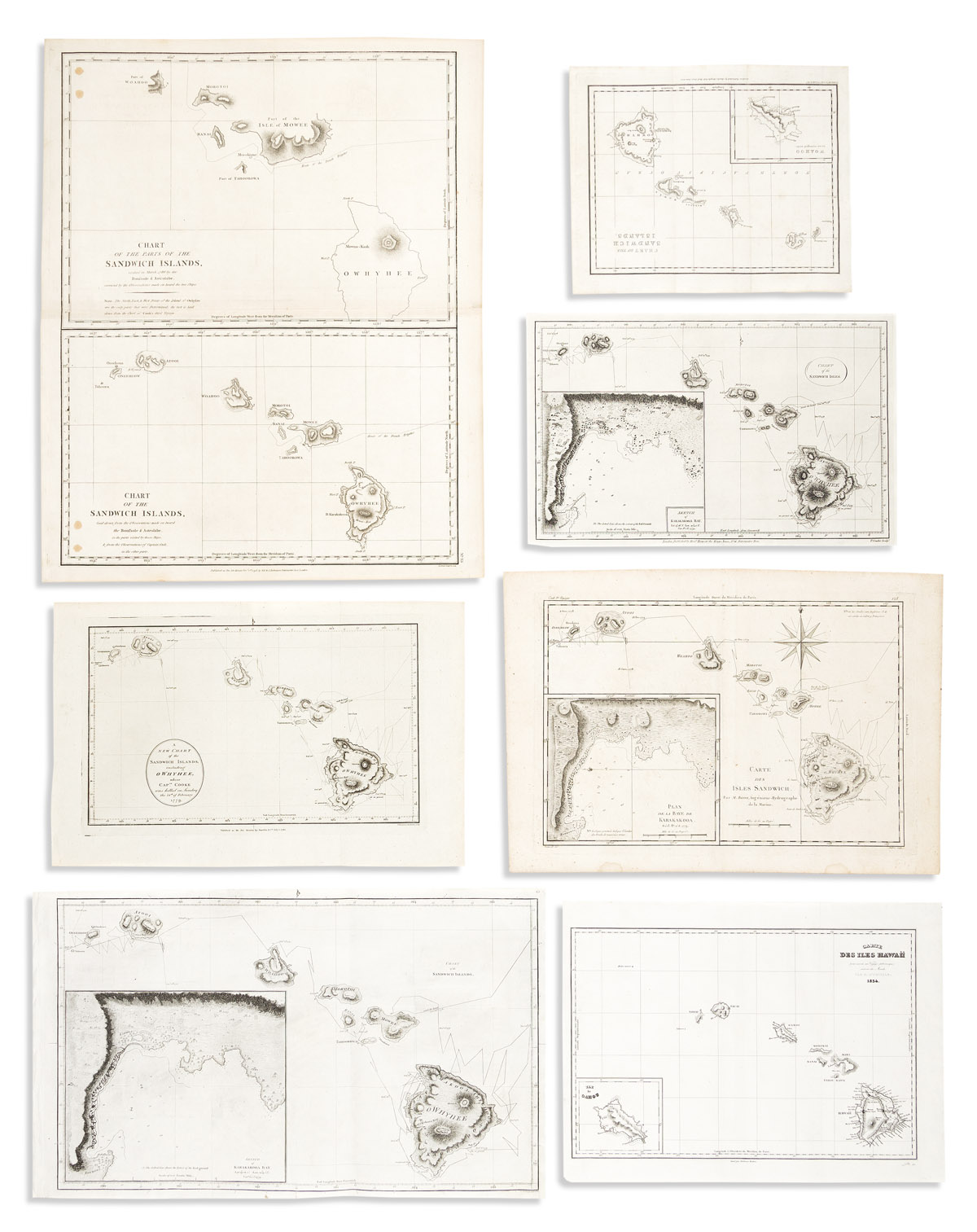
(HAWAII.) Group of 7 eighteenth and nineteenth century engraved maps. Vp, vd

Additional Details

- La Perouse, after. Chart of the Parts of the Sandwich Islands. / Chart of the Sandwich Islands. 20 3/4x16 3/4 inches sheet size, wide margins; small stains. London: G.G. & J. Robinson, 1798.

- Captain Cook/Rigobert Bonne. Carte des Isles Sandwich. 11 1/2x16 1/4 inches sheet size, wide margins; small stains. Paris, 1780s.

- William Harrison & Co. A New Chart of the Sandwich Islands; Including Owhyhee, Where Captn. Cooke Was Killed on Sunday the 14th of February 1779. 10x15 1/2 inches sheet size, wide margins; old fold gently flattened on verso. London, 1784.

- Captain Cook/Henry Roberts. Chart of the Sandwich Islands. Wove paper, 11 1/2x19 1/4 inches sheet size, ample margins; cleaned, minor edge crinkle. London, 1784 (or after).

- Captain Cook/Alexander Hogg. Chart of the Sandwich Isles. 9x14 inches sheet size, ample margins; no flaws. London, circa 1790.

- George Cruchley/Gilbert Mathison. Chart of the Sandwich Islands. 8 3/4x10 3/4 inches sheet size, ample margins; minor foxing. London, 1825.

- Dumont d'Urville/Ambrose Tardieu. Carte des Iles Hawaii. 10 1/2x14 1/4 inches sheet size, wide margins; cleaned. Paris, 1834.