Dec 05, 2013 - Sale 2334

Sale 2334 - Lot 72

Price Realized: $ 7,500
?Final Price Realized includes Buyer’s Premium added to Hammer Price
Estimate: $ 7,000 - $ 10,000
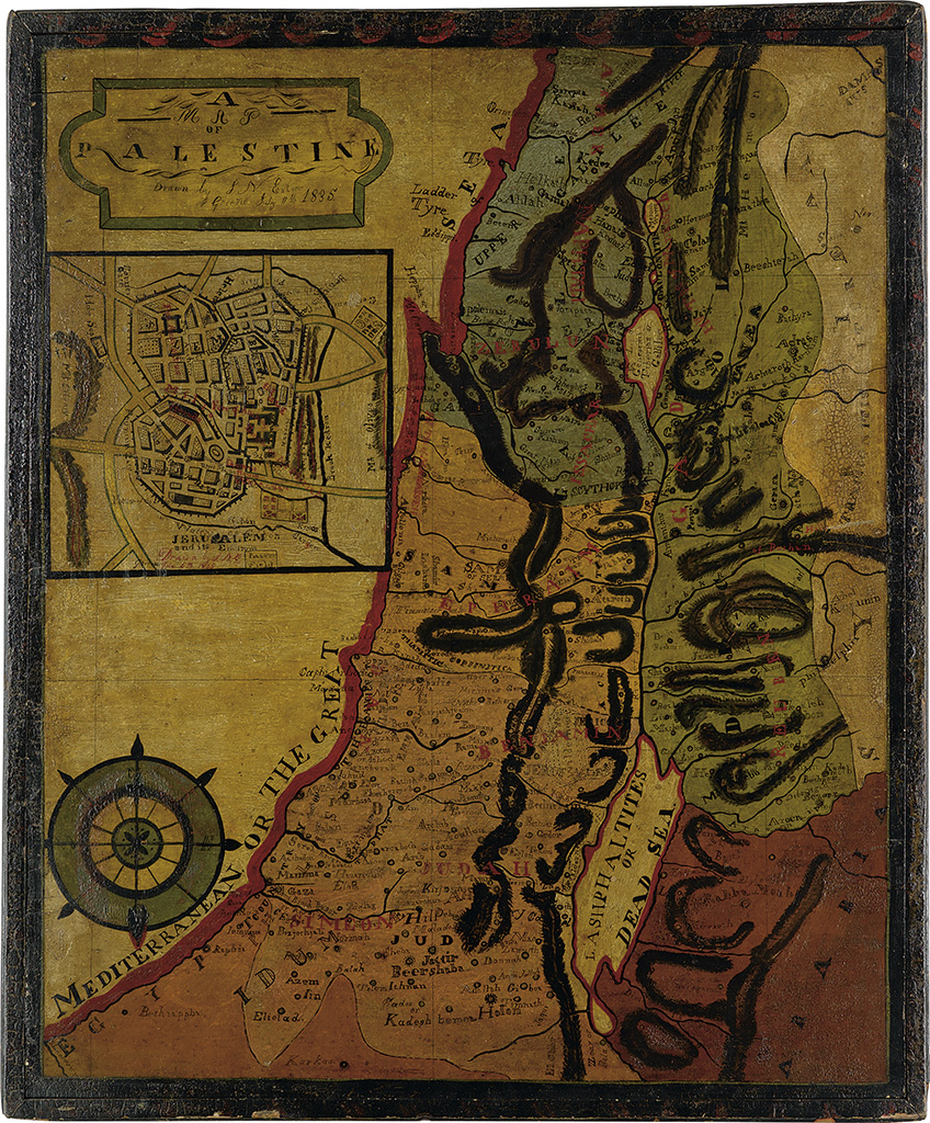
FOLK ART PAINTED MAP OF THE HOLY LAND (HOLY LAND.) Eaton, J. N. American folk art painting of a map of Palestine with an inset of Jerusalem. Oil on pine board, 28 1/2x23 1/2 inches overall including frame which is an integral part of the work, Signed and dated in the cartouche and initialled in the inset; slight reticulation of the original shellac. Greene County, New York, 11 July 1835

Additional Details

An important and impressive piece of primitive American folk art from the first half of the 19th century. Little is known about the artist J. N. Eaton. The Abby Aldrich Rockefeller Folk Art Center in Williamsburg, VA, acquired an Eaton painting titled "Conversation Piece" from collectors J. Stuart Halladay and Herrel George Thomas. Halladay and Thomas acquired the piece prior to 1942. The painting has been identified as a primitive copy of an illustration appearing in a children's book of the period.
The painted map of Palestine can be traced to the collection of Ludwig Rosenberger, an ardent Zionist born in Germany in 1904. Rosenberger emigrated to the United States in 1929 and began forming a massive library of Judaica-Hebraica which was later gifted to the Regenstein Library at the University of Chicago. He married Irmgard Hess in 1970 and she reported that the painting of the map belonged to her husband before their marriage. Rosenberger died in 1987 without leaving evidence of where he may have acquired the map.
The cartouche reads, " A Map of Palestine. Drawn by J. N. Eaton. Greene. July 11th 1835." The inset is Signed, "Drawn by J.N.E. Greene. July 4th 1835." It is difficult to identify the source for Eaton's map, if in fact he copied directly from a published map. While it bears similarities to many maps of the Holy Land of the period, it perhaps most clearly mirrors Arrowsmith's map "Terra Sancta" from his atlas "Orbis Terrarum. A Comparative Atlas of Ancient and Modern Geography," published in London in 1828. Eaton has added a large compass rose and moved the inset of Jerusalem, but otherwise the maps are quite similar.