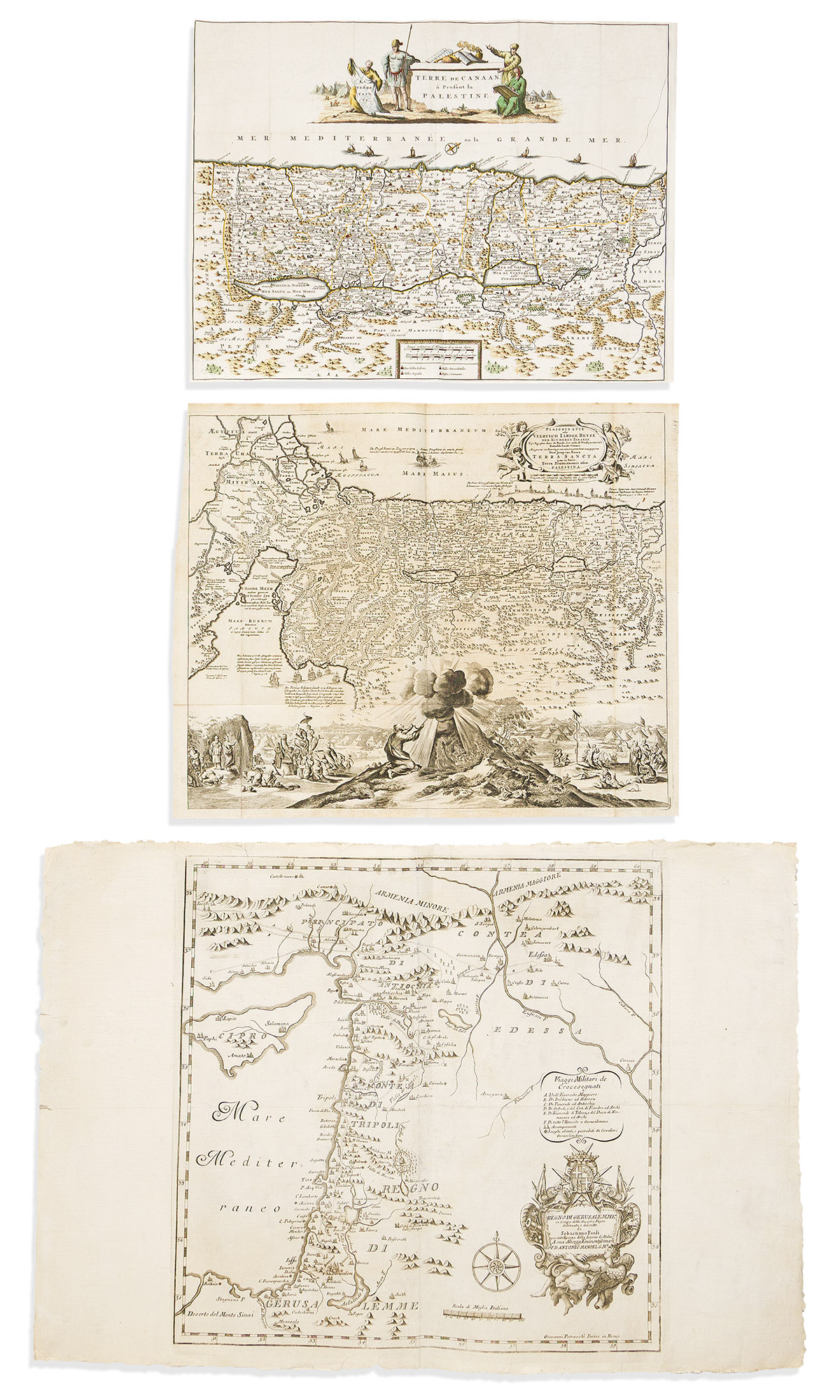
- Sebastiano Paoli; and Giovanni Petroschi, engraver. Regno di Gerusalemme in Tempo delle Guerre Sagre. Double-page engraved map of the Holy Land with a keyed legend referencing military activity during the Crusades. 20x29 inches sheet size, wide margins with untrimmed deckle edges; split and repair along center fold. Rome, 1733. Not in Laor.
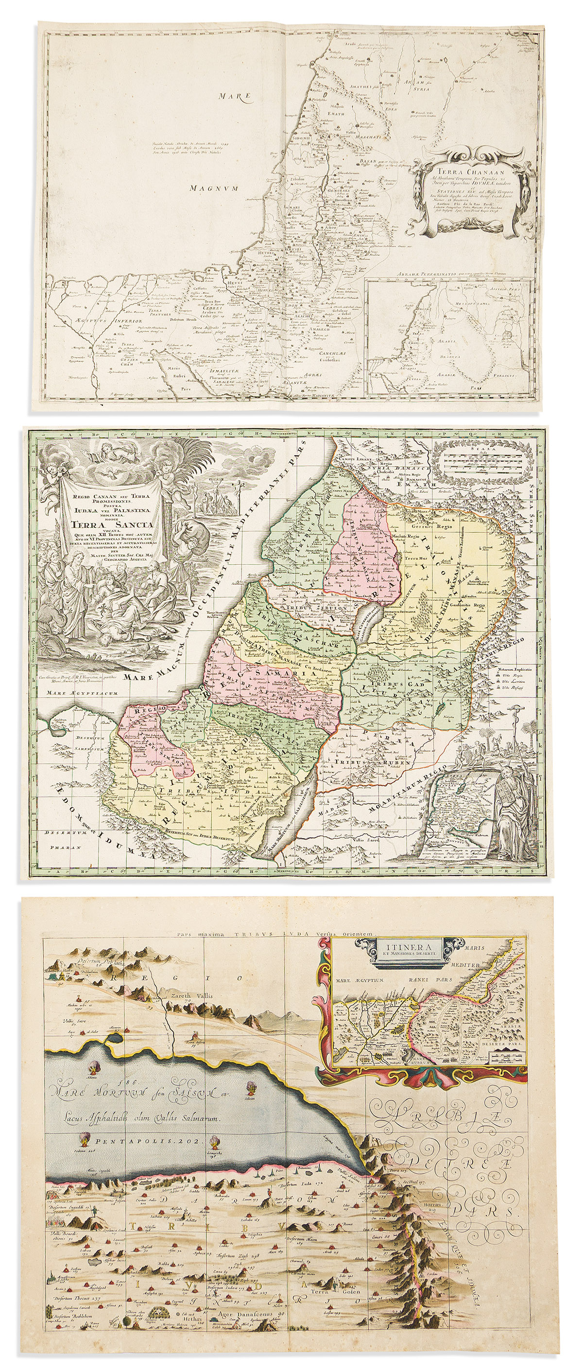
- Johannes Janssonius; and Georg Horn. [Regions of the 12 Tribes of Israel]. 1 sheet only (of six); double-page engraved map of the Dead Sea with an inset showing the Exodus. 19½x23½ inches sheet size, wide margins, Latin text on verso; original hand-color highlighted with gold; age tone, foxing, creases. Amsterdam, 1658. Laor 348.
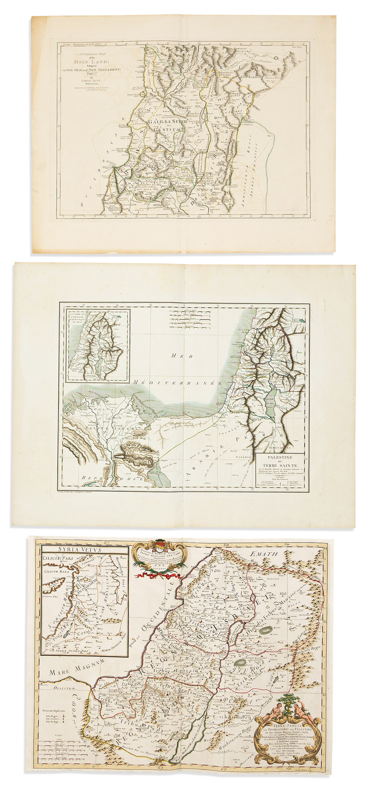
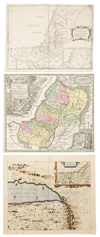
- Giacomo Giovanni Rossi; after Guillaume Sanson. Terra Sancta Sive Promissionis, Olim Palestina, in Duo Divisa Regna, Israel, et Iuda, et in Sex Subdvisa Provincias. Hand-colored double-page engraved map. 17¼x22½ inches sheet size, narrow margins; scattered repairs. Rome, 1679. Laor 682.
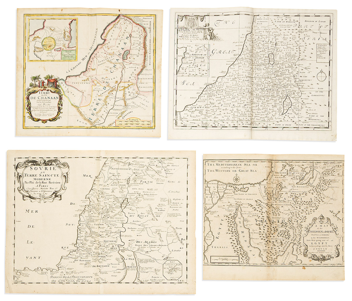
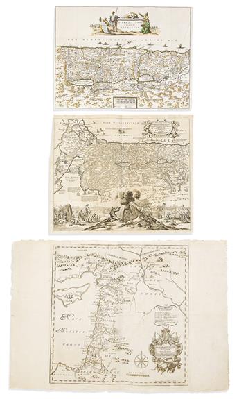
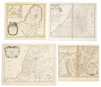
- Philippe De La Rue; and Pierre Mariette. Sovrie ou Terre Saincte Moderne. Double-page engraved map showing political divisions under Turkish rule with a small inset plan of Jerusalem at lower right. 17¼x23 inches sheet size, wide margins; minor signs of age. Paris, 1651. Laor 420.
- Anonymous; after Visscher. La Terre Sainte / Terre de Canaan, a Present la Palestine. Hand-colored engraved folding Bible map with a decorative title cartouche. 14¼x18¾ inches sheet size, narrow margins; old folds, unobtrusive small repairs. Np, early-to-mid-eighteenth century.
- Olfert Dapper; and Jacob Meurs. Perigrinatie ofte Veertich-Iarige Reyse der Kinderen Israëls. Engraved folding map of the Holy Land illustrated with scenes of Moses and the Israelites from the book of Exodus. 16x19½ inches sheet size, ample margins; original folds, minor age tone. Amsterdam, 1677 [or after]. Laor 232.
- Pierre Moullart-Sanson. Terre des Fils de Chanaan Dont Ils s'Emparerent sur les Descendans de Sem. Hand-colored double-page engraved map with an inset of the Garden of Eden at upper left. 15½x17½ inches sheet size, wide margins; small stains and other signs of age. Paris, 1717. Laor 509.
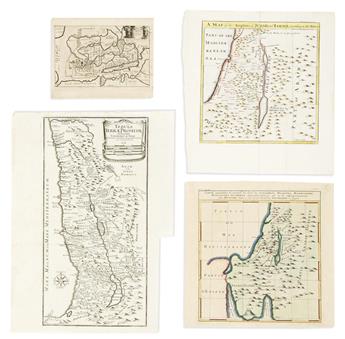
- Edward Wells. A New Map of the Land of Canaan and Parts Adjoining Shewing the Division Thereof Among the Twelve Tribes of Israel. Double-page engraved map. 16x20¼ inches sheet size, wide margins; minor signs of age. [Oxford, 1700]. Laor 835.
- Philippe de la Rue. Terra Chanaan Ad Abrahami Tempora. Double-page engraved map. 17¼x22½ inches sheet size, narrow margins; spots of filled worm track, areas of loss to the scale border reinstated in ink facsimile. Paris, 1651. Laor 415.
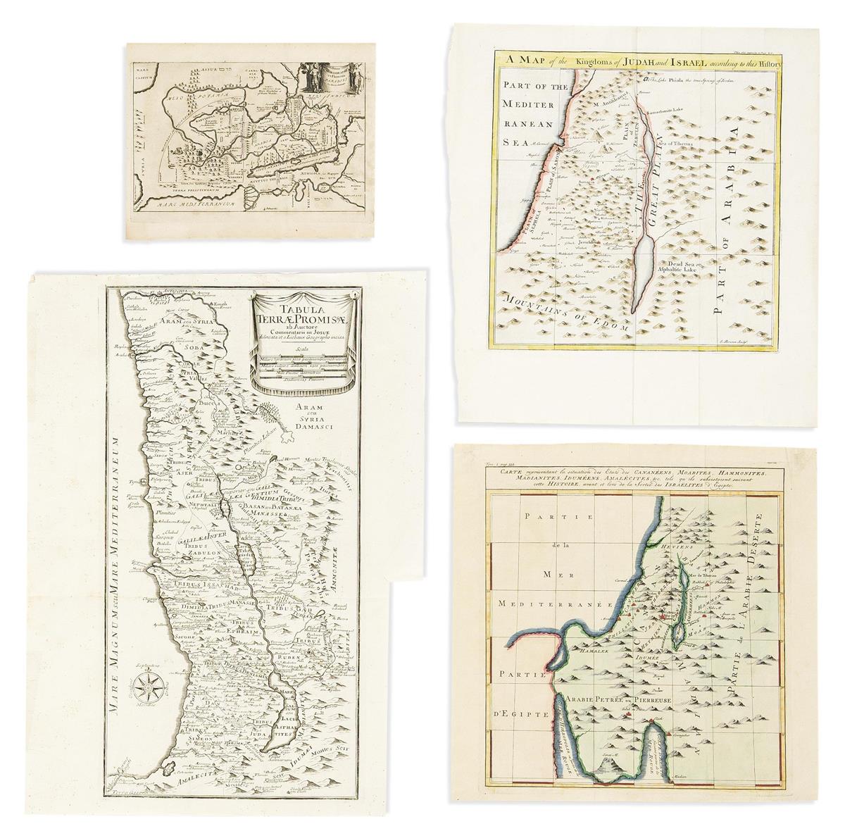
- Augustin Antoine Calmet. Tabula Terrae Promissae ab Auctore Commentarii in Josue Delineata et a Liebaux Geographo Incisa. Engraved folding map. 19¼x14 inches sheet size, wide margins, trimmed at lower right for binding; original folds, minor foxing. Venice, 1757. Laor 154.
- Samuel Dunn. A Complete map of the Holy Land; Adapted to the Old and New Testament: Part I. Top sheet only, of two. Double-page engraved map. 18x22½ inches sheet size, wide margins; original hand-color in outline; minor toning and offset. London, 1774. Laor 257.
- Pierre François Tardieu, engraver; for Edme Mentelle and Pierre Gregoire Chanlaire. Palestine ou Terre Sainte. Double-page engraved map. 19½x25½ inches sheet size, wide margins; original hand-color in outline; light foxing and edge wear. Paris, 1807. Laor 490.
- J. Mynde, engraver; for Augustin Antoine Calmet. A Map of the Children of Israel's Travels and Marches in the Wilderness from their Going Out of Egypt to Their Passage Over the River Jordan. Double-page engraved map. 15x17 inches sheet size, left and right margins shaved to the neatline, others wide; stains. London, 1732. Laor 167.
- Philipp Cluver. Situs Chorographia et Flumina Paradisi in Terra Canaan. Decorative miniature engraved map. 7x9 inches sheet size, wide margins; original fold, minor signs of age. London, 1711.
- Emanuel Bowen. A Map of the Kingdoms of Judah and Israel. Hand-colored engraved folding map. 14¼x13 inches sheet size, wide margins; old folds. London, circa 1744.
- Anonymous. Carte Representant la situation des Etats des Cananeens, Moabites, Hammonites, Madianites, Idumeens, Amalecites, &c. Hand-colored engraved folding map. 12¾x13 inches sheet size, wide margins; old folds. Paris?, circa 1750.
- Matthaeus Seutter. Regio Canaan seu Terra Promissionis Postea Iudaea vel Palestina Nominata Hodie Terra Sancta Vocata. Double-page engraved map with an elaborately ornamented title cartouche and inset. 20x23¼ inches sheet size, narrow margins; original hand-color; very nice. Augsburg, circa 1725. Laor 720.