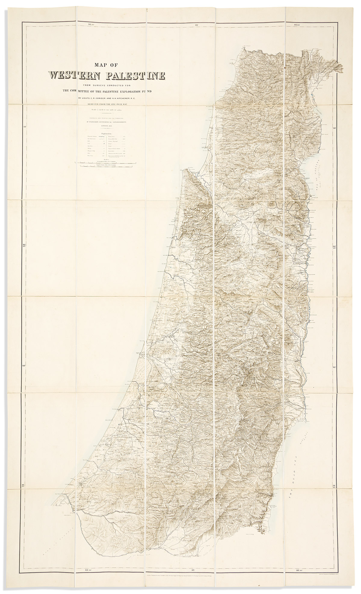
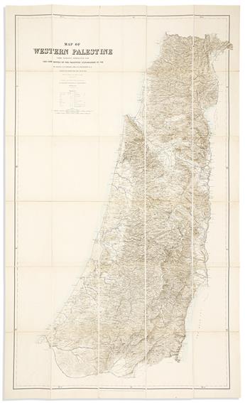
-C.R. Conder, and H.H. Kitchener. Map of Western Palestine from Surveys Conducted for the Committee of the Palestine Exploration Fund. Hand-colored lithographed map of present-day Israel, West Bank, and Gaza. 62 1/2x37 1/2 inches overall, segmented and mounted to original linen backing with marbled paper self-wrappers; folding into original cloth slipcase; minor tanning at fold lines, case with wear and publisher's label partially torn. London: Edward Stanford, 1881.
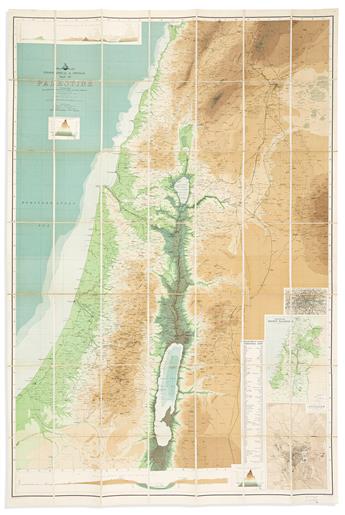
-John George Bartholomew; revised by George Adam Smith. Topographical & Physical Map of Palestine Compiled from The Palestine Exploration Fund Surveys and Other Authorities. Large chromolithographed map of present-day Israel, West Bank, and parts of Jordan, Syria, and Lebanon with inset elevation charts and plans. 57x38 inches overall, segmented and mounted to original linen backing with marbled paper self-wrappers; folding into worn and broken cloth case; map with minor signs of aging, contemporary mapseller's ink stamp at lower right margin. Edinburgh, circa 1900.