Jun 22, 2023 - Sale 2642

Sale 2642 - Lot 61

Price Realized: $ 2,000
?Final Price Realized includes Buyer’s Premium added to Hammer Price
Estimate: $ 2,000 - $ 3,000
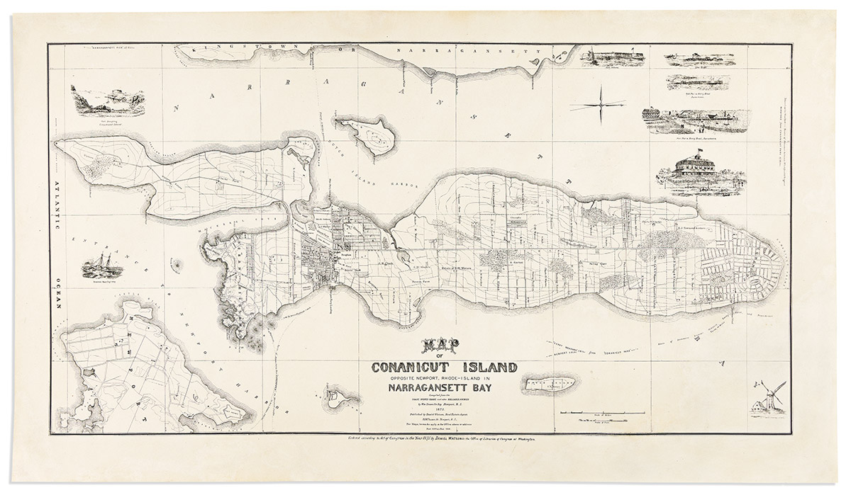
(JAMESTOWN, R.I.) William Dame. Map of Conanicut Island Opposite Newport, Rhode Island in Narragansett Bay. Large lithographed map of Conanicut Island and part of Newport. 23 1/2x41 inches sheet size, wide margins; skilled restoration to the sheet edges and lower right corner including expert reinstatement of the windmill vignette and neatline in ink facsimile. Newport, R.I.: Daniel Watson, 1875

Additional Details

Outstanding map of Conanicut Island detailing the municipal arrangement of Jamestown and its surrounding farmlands, family estate properties across the island, and ferry lines to Newport and Narragansett. Two additional layouts appear for proposed development which never materialized: Ocean Highlands, a scant platted grid at the bottom of the island and Conanicut Park, a much more planned-out community at its northern tip. Several small vignette illustrations playfully surround the map.

The map is quite scarce, with a single example appearing in market resources and just two institutional copies located. A comparison to the example at the New York Public Library shows several variations which seem to indicate ours would be a second state: a changed Newport address for real estate agent and publisher Daniel Watson; the pictorial vignettes seen here are absent; and a good number of property owner's names not seen there are presently added or updated. Phillips Maps, page 245.