Sale 2555 - Lot 114
Price Realized: $ 2,200
Price Realized: $ 2,750
?Final Price Realized includes Buyer’s Premium added to Hammer Price
Estimate: $ 4,000 - $ 6,000
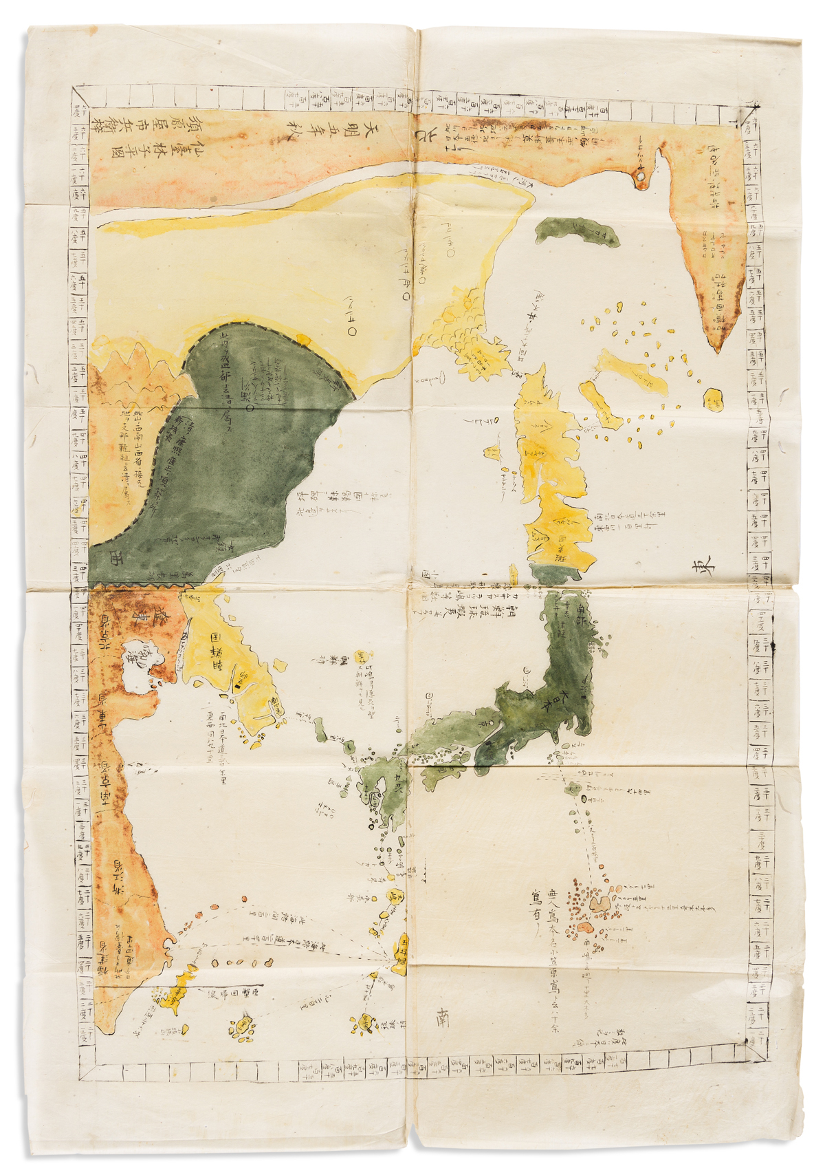
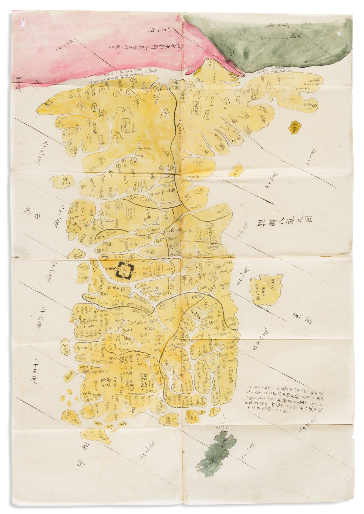
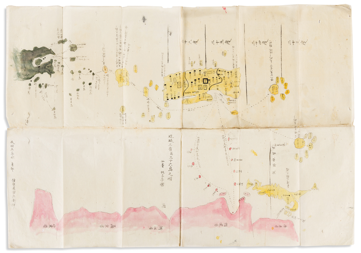
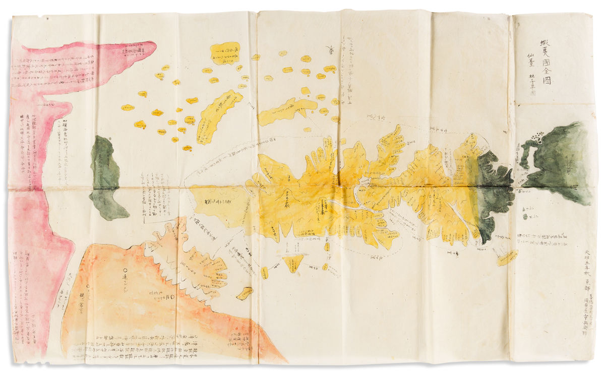
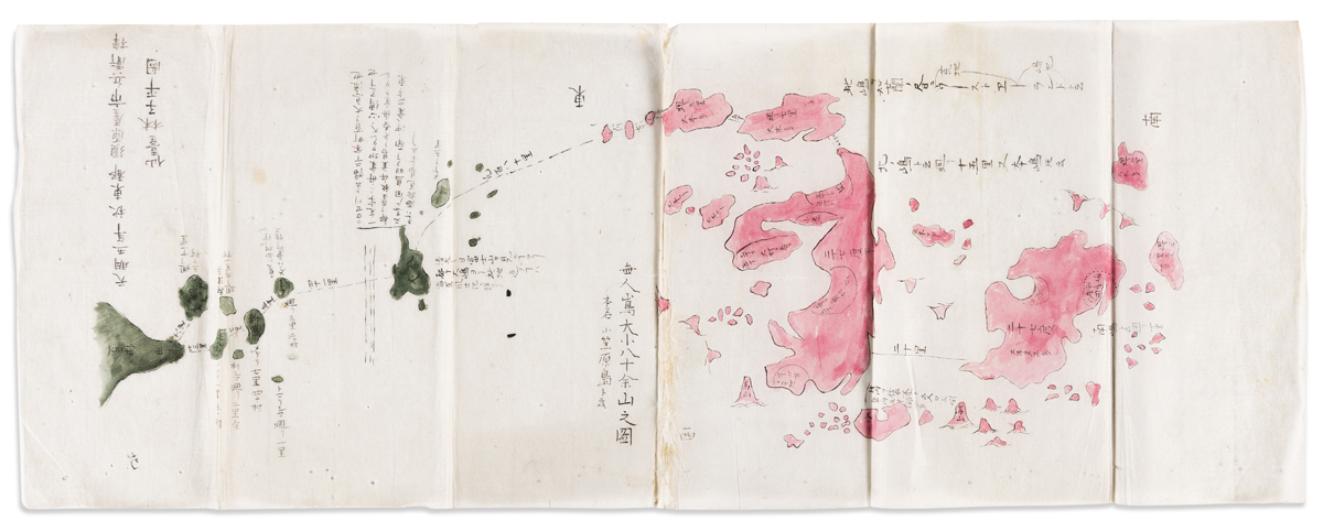
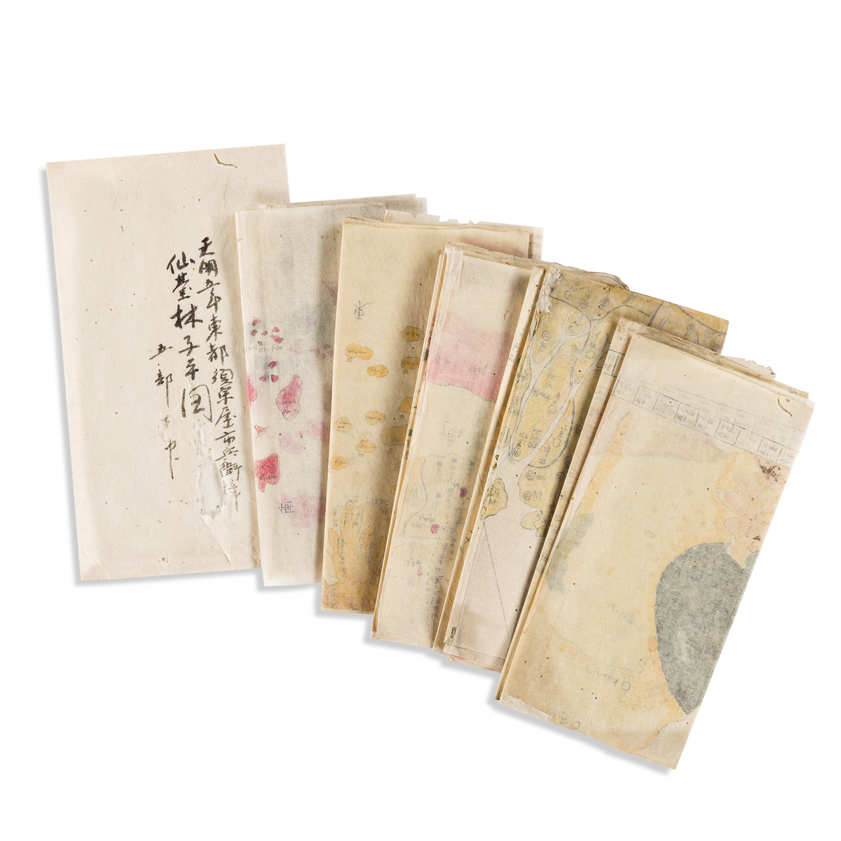
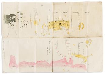
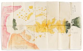
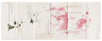
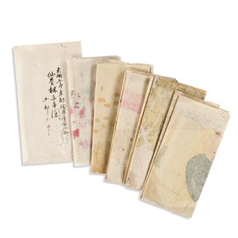
(JAPAN.) Shihei, Hayashi (after). Set of 5 manuscript maps of Japan's surrounding regions. Ink and watercolor on thin mulberry, sheet sizes noted; original folds, scattered worming and the occasional small repair but in overall fine condition; complete with original outer envelope. Japan, Tenmei 5 (1785)
Additional Details
Hayashi Shihei, a Japanese scholar with military interests, put forth one of the earliest attempts to define the boundaries of Japan with a concern for security and national defense in his work Sangoku Tsuran Zusetsu (Illustrated General Survey of the Three Countries). Shihei's book was banned by the government in 1792 and practically all copies were destroyed. The maps within the book were preserved and perpetuated in manuscript copies, such as the present, and are scarcely found together in a complete set.
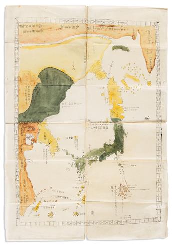
Sangoku Tsuran Yochi Rotei Zenzu. 4 sheets joined, 32x22 inches. General route map between Japan, Ezo (Hokkaido), Korea, and the Kingdom of Ryukyu (Okinawa). Includes the disputed Dokdo Islands, Northern Territories, Taiwan, and parts of China.
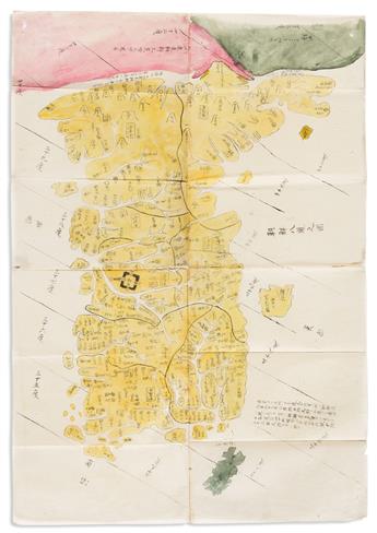
Chosen Koku Zenzu. 4 sheets joined, 32x22 inches. Kingdom of Korea delineating all provinces, major towns and rivers. The royal palace is prominently shown in Seoul.
Ryukyu Zenzu. 4 sheets joined, 22x32 inches. Kingdom of Ryukyu (Okinawa). Shows Taiwan, parts of China, southern Japan and disputed islands. Routes and distances for regional trade vessels are included.
Ezo Koku Zenzu. 6 sheets joined, 22x37 inches. Map of Ezo (Hokkaido). Ezo, Sakhalin, disputed Northern Territories, Karafuto, part of Mongolia, and the tip of Northern Honshu (Japan).
Mujinto No Zu. 2 sheets joined, 10 3/4x29 inches. Uninhabited Islands, depicting a shipping route from Japan to Ogasawara (Bonin) Islands.
Exhibition Hours
Exhibition Hours
Aliquam vulputate ornare congue. Vestibulum maximus, libero in placerat faucibus, risus nisl molestie massa, ut maximus metus lectus vel lorem.


