?Final Price Realized includes Buyer’s Premium added to Hammer Price
Estimate: $ 100,000 - $ 150,000
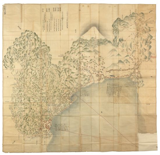
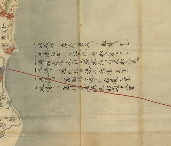
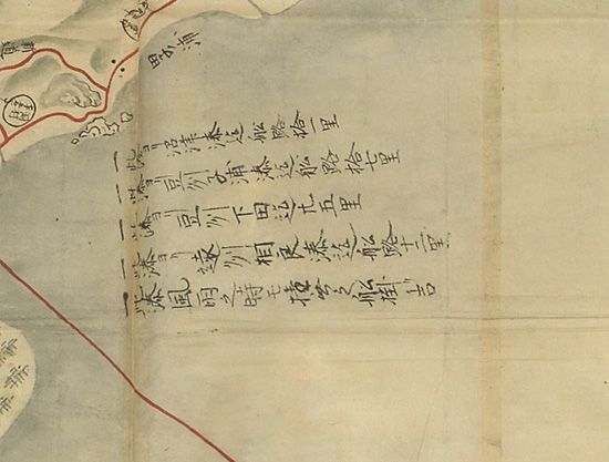
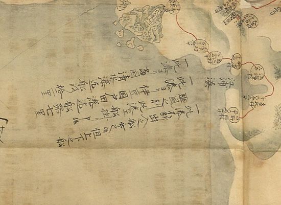
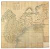
(JAPAN.) Suruga Province. Magnificent pen-and-ink and watercolor map of Suruga Province, 1700 mm square (5'7"), with enormous detail of villages and other landmarks, calligraphic notations dealing with the local economy, and an inspiring Mt. Fuji in the background; in very fine condition except for very minor loss at several folds. Suruga Province, Japan, circa 1716-35
Map of Suruga province which now comprises Shizuoka and parts of Yamanashi and Kanagawa prefectures. Map is given over largely to the foothills and surrounding areas of Mt. Fuji. To achieve its large size, the map is made up of joined smaller handmade sheets. The 7 prefectures of Suruga are shown (Shida, Mashizu, Abe, Udo, Ihara, Fuji, Sunto). This type of map served as an economic report from various Japanese lords (daimyo) under the Sankin Kotai system and were submitted to the Shogun in Edo (Tokyo). They represent a part of a system of "alternate attendance" whereby daimyo were required to spend at least 6 months in Edo. This practice lasted for more than 200 years during the Tokugawa era. It has strong similarities to visitations of the noble families of France to Versailles where they were kept in style by a monarch who wished to keep a sharp eye on them. Daimyo brought with them maps such as the example being offered. The maps served as economic reports showing all the details of agricultural and natural resource production, locations of all villages and towns, all trails, roads, and sea routes, and the distance between various destinations. Based on these maps the Shogun would gather the facts upon which he would base his taxation of the daimyo. The map shows one of the most prosperous areas of the Shogunate, an area on the Tokaido road including Hara, Numazu, and Mishima. In addition to agricultural production, the area received income by virtue of the fact that it was on the Eastern Mountain route between Kamakura (near Kyoto) and Edo. Processions of daimyo and their retinues passed through the area and availed themselves of the inns, restaurants, and other forms of hospitality in the area. The area is still a center of commerce and agriculture in Japan. Suruga province was dissolved in 1868 under the Meiji restoration.