Dec 06, 2012 - Sale 2297

Sale 2297 - Lot 214

Price Realized: $ 16,800
?Final Price Realized includes Buyer’s Premium added to Hammer Price
Estimate: $ 18,000 - $ 22,000
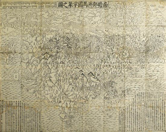
(JAPAN.) Zuda, Rôkashi (aka Sôshun or Hôtan or Naniwashi). Outline map of all the countries of the universe based on Buddhist beliefs (Nansen bushû bankoku shôka no zu). Multi-sheet woodblock map of the world, 1170x1440 mm; slight separations at several intersecting folds, else very fine; modern Japanese-style cloth case. [Kyoto]: Bundaiken Uhei, Year of the Tiger [1710]

Additional Details

First printed Japanese world map representing Buddhist cosmology with real world geography. It is therefore the prototype for later Buddhist world maps. India, the birthplace of Buddha, is shown as the heart of the world, but the map shows both the European and American continents. The American continent is depicted as being reached by a land bridge.
The map is a fusion of earlier Sino-centric maps along with European influences derived the the famous world map of Matteo Ricci. Europe is portrayed upper left as a group of islands, identified as England, Italy, Scandinavia, etc. The Iberian peninsula is not named as it was viewed as the seat of the Christian faith which was infecting Japan.
The map celebrates the pilgrimage route of the Chinese Buddhist monk Xuan Zang. The monk travelled to India in the 7th century to collect sanskrit texts on Buddhism which he translated into Chinese. This helped establish Buddhism in China and it eventually spread to Japan.
There is a considerable amount of detail in the mapping of India. The "Iron Gate," believed to be the only entry point to India from the North is shown as a square. The route that Xuan Zang followed after leaving Samarkand is also shown. The upper left corner of the map lists 102 reference works of geographical and theological writings, helping to add credibility to the mapping itself. Cortazzi, page 120.