Sep 30, 2010 - Sale 2223

Sale 2223 - Lot 120

Price Realized: $ 4,320
?Final Price Realized includes Buyer’s Premium added to Hammer Price
Estimate: $ 4,000 - $ 6,000
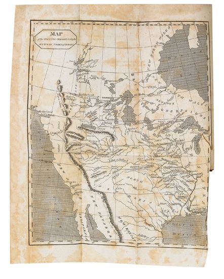
FIRST EDITION OF THE "APOCRYPHA" (LEWIS & CLARK.) The Travels of Capts. Lewis & Clarke. Folding map with closed tear, 5 plates. 12mo, contemporary calf, worn at extremities, front board coming loose; foxing; early owner's inscription and later bookplate on front endpapers. Philadelphia, 1809

Additional Details

The first published book on the expedition other than Gass. An unauthorized compilation which includes the first map to show Fort Clatsop, as well as the Jefferson, Madison and Gallatin Rivers in Montana, all named by the expedition. "Here were the earliest published cartographic reflections of Lewis and Clark's great effort"--Wheat, Transmississippi West, II:14, item 294.
The book features extracts from the few available accounts of the expedition, but also plates described by Beckham as "wholly fanciful and absurd," a note which misleadingly implies the endorsement of President Jefferson, and other material which was comically irrelevant. The publisher "Hubbard Lester" appears to have worked under a pseudonym, and never wrote or published anything else under this name. Despite the shady nature of this undertaking, it was frequently republished through the 1840s, long after the official journals became available. This is a nice unsophisticated copy.
The inscription reads "J.C. Smith, bought of an itinerant bookseller at the price of one dollar. A sad imposition." The list price was an exorbitant $1.62 1/2, so Mr. Smith actually got a bargain. Beckham, Erickson et al., Literature of the Lewis and Clark Expedition 4a.1 and pages 121-122; Howes L321 ("aa"); Streeter sale V:3122; Wagner-Camp 8:1.