May 29 at 12:00 PM - Sale 2706 -

Sale 2706 - Lot 131

Estimate: $ 1,000 - $ 1,500
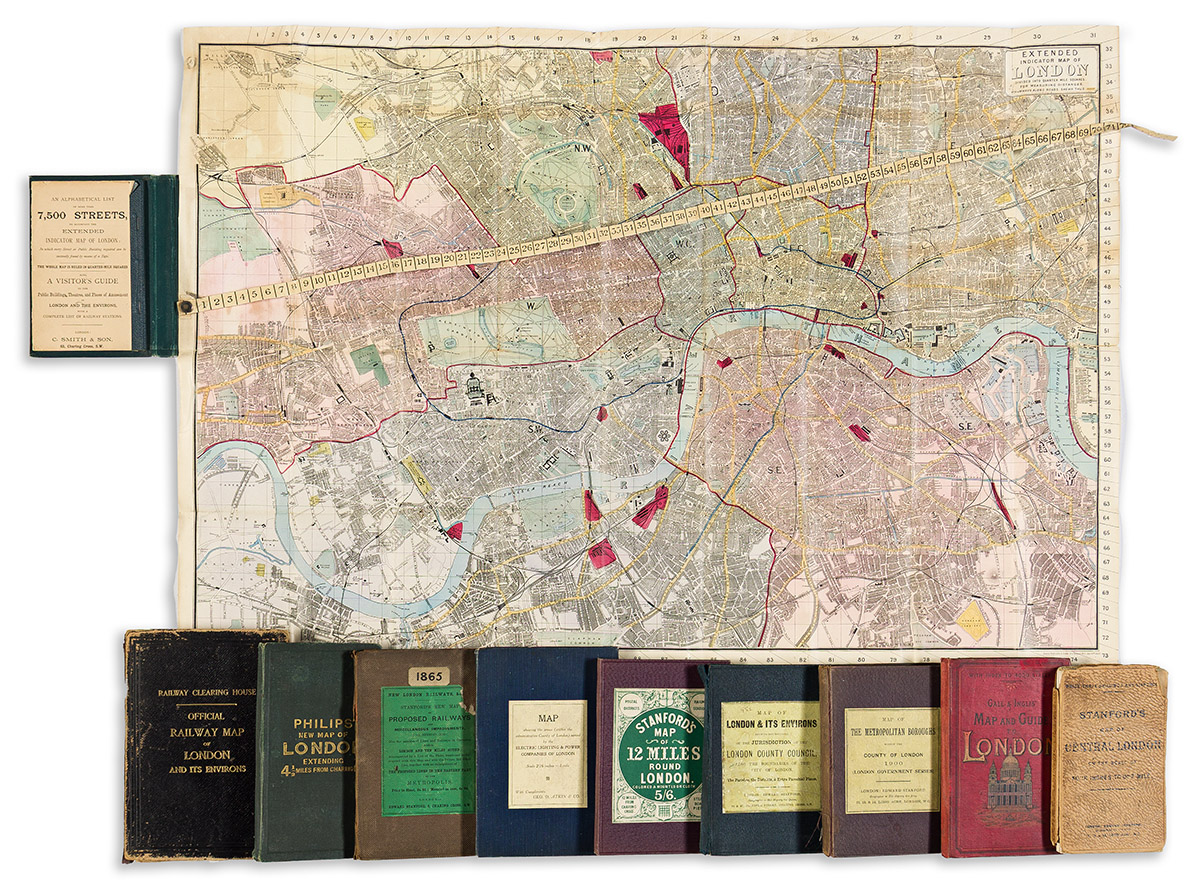
(LONDON.) Group of 10 nineteenth-and-twentieth-century folding maps. Individual photographs on request. London, vd

Additional Details

- C. Smith & Son. Extended Indicator Map of London. Hand-colored lithographed map of London affixed with a printed cloth measuring tape. 24¾x35 inches overall, mounted on original linen backing and folding into publisher's 8vo format cloth covers with a 64-page index booklet tipped in; minor staining but generally good. London, 1889.

- Edward Stanford. Stanford's Map of Central London. Color-printed lithograph. 27x39½ inches overall, segmented, backed on original linen, and folding into publisher's worn printed card covers; map with moderate age tone. London, 1903.

- George Philip & Son. Philips' New Map of London Extending Four and a Half Miles Round Charing Cross. Hand-colored lithograph. 30½x40 inches overall, segmented, backed on original linen, and folding into publisher's 8vo format cloth covers; moderate wear and age tone. London, circa 1890s.

- Gall & Inglis. Gall & Inglis' Reduced Ordnance Map of London. Color-printed lithograph. 34½x40½ inches overall, backed on original linen and folding into publisher's 8vo format pictorial cloth case with an illustrated index booklet bound in; light wear. London, circa 1890s.

- Edward Stanford. A Map of the Metropolitan Boroughs Within the County of London. Hand-colored lithograph with red overprinting. 26½x40¾ inches overall, segmented, backed on original linen and folding into publisher's 8vo format cloth case; moderate age tone. London, 1900.

- Edward Stanford. A Map of the County of London Shewing the Boundary of the Jurisdiction of the London County Council, Also the boundaries of the Sanitary Districts. Hand-colored lithograph with red overprinting. 27x40½ inches overall, segmented, backed on original linen and folding into publisher's 8vo format cloth case; moderate age tone. London, 1898.

- Edward Stanford. Stanford's Map of 12 Miles Round London. Hand-colored lithograph. 28x27¼ inches overall, segmented, backed on original linen, and folding into publisher's 8vo format cloth case with printed title label pasted on; very nice. London, 1900.

- George D. Atkin & Co. Map Showing the Areas (Within the Administrative County of London) Served by the Electric Lighting and Power Companies of London. Color-printed lithograph. 30x39½ inches overall, segmented, backed on original linen, and folding into publisher's 8vo format cloth case with printed title label pasted on; very nice. London, circa 1920.

- Edward Stanford. A New Map of the Proposed Railways & Miscellaneous Improvements for Session 1865, Also the Sanctioned Lines and Railways in Operation Within London & Ten Miles Around. Engraving overprinted in red. 29x35 inches overall, segmented, backed on original linen, and folding into publisher's 8vo format cloth case; light wear. London, 1865.

- J. & W. Emslie; for the Railway Clearing House. Official Railway Map of London and Its Environs. Color-printed lithograph. 41x52 inches overall, segmented, backed on original linen, and folding into publisher's 8vo format roan case; front cover detached, linen deteriorated and separated at several folds. London, 1907.