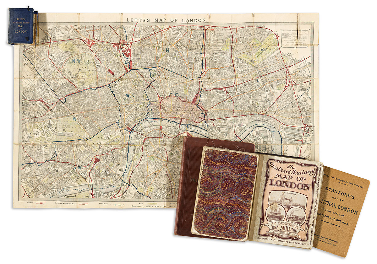
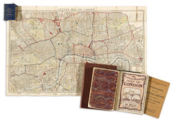
- Letts & Son. Letts's Map of London. 17x26 3/4 inches overall, segmented, mounted on original linen backing and folding into 16mo format gilt roan case; moderate wear. London, circa 1881.
- George Gill & Sons. [William Collins & Sons]. Ordnance Survey of the Country Thirty Miles Round London. 44x55 1/2 inches overall, segmented, mounted on original linen backing and folding into marbled paper self-wrappers; moderate wear. London, circa 1880.
- Edward Stanford; and The Ordnance Survey of England. Environs of London. 2 sections, each 38 1/2x56 inches overall, segmented, mounted on original linen backing with marbled paper self-wrappers and folding into original gilt-blocked cloth case; moderate wear. London, 1908.
- G.W. Bacon & Co. Bacon's Library Map of the Environs of London. 39x58 1/2 inches overall, segmented, mounted on original linen backing with marbled paper self-wrappers and folding into original gilt-blocked cloth case; moderate wear. London, circa 1930.
- George Philip & Son. Philips' New Library Map of London and Its Environs. 23x58 3/4 inches overall, segmented, mounted on original linen backing (2 sections recto/verso) and folding into original red cloth covers with an extensive separately-printed index; minor wear. London, circa 1890.
- Davies's New Map of the British Metropolis. 27x38 1/2 inches overall, segmented, mounted to original linen backing and folding into publisher's 8vo format cloth case (front cover detached; minor wear. London: Edward Stanford, 1870.
- George Philip & Son. Philips' New Large Print Map of the County of London. 40x55 1/2 inches overall, segmented, mounted to original linen backing and folding into publisher's 8vo format cloth case; minor wear. London, circa 1880.
- Edward Stanford. Stanford's Map of Central London. 27x40 inches overall, segmented, mounted to original linen backing and folding into publisher's 8vo format printed card wrappers; foxing. London, 1901.
- Edward Stanford. A Map of the Parliamentary Boroughs Within the County of London. 27x41 inches overall, segmented, mounted to original linen backing and folding into publisher's 8vo format cloth case (front cover lacking); minor wear. London, 1900.
- J. Cross. Cross's New Plan of London. 26x39 1/2 inches overall, segmented, mounted to original linen backing and folding into marbled paper self-wrappers; fold splits. London, 1829.
- Sampson Low, Marston & Company. The "District Railway" Map of London - Seventh Edition. 27x42 inches overall, segmented, mounted to original linen backing and folding into publisher's 8vo format pictorially printed case; occasional staining. London, circa 1910.
- G.W. Bacon & Co. Bacon's Library Map of the Environs of London. 39x58 inches overall, segmented, mounted to original linen backing and folding into marbled paper self-wrappers with cloth slipcase; minor wear. London, circa 1900.