?Final Price Realized includes Buyer’s Premium added to Hammer Price
Estimate: $ 800 - $ 1,200
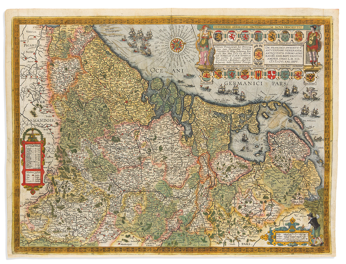
(LOW COUNTRIES.) Abraham Ortelius; and J.B. Vrients. Inferioris Germaniae Provinciarum Nova Descriptio. Double-page engraved map of the Netherlands, Belgium, Luxembourg, and western Germany with decorative carto-ornamentation including vessels, sea monsters, and emblematic arms of the XVII Provinces. 17x22½ inches sheet size, ample margins, Spanish text on verso; original hand-color retouched; scattered repairs. Van Den Broecke 59.2 1612S39; H.A.M. van der Heijden, The Oldest Maps of the Netherlands 32(d), cover illustration. Antwerp, 1612