?Final Price Realized includes Buyer’s Premium added to Hammer Price
Estimate: $ 2,000 - $ 3,000
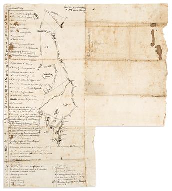
(MANUSCRIPT MAPS.) Eighteenth-century survey of property tracts in Virginia's Northern Neck Proprietary. Pen and ink on two sheets of "Gior Magnani" watermarked laid paper, joined. Approximately 19x17 inches overall, survey approximately 14x5 inches; folds, various staining, small losses. Np, mid-to-later 18th century
Fine eighteenth-century manuscript surveying approximately 1,500 acres in the Northern Neck Proprietary, Prince William County, but present-day Fauquier County, Virginia.
The outer cover of the folded map is described "Plot of Meadowville Tract of Land" and delineates recently-divided properties to the east of land belonging to the family of Lord Fairfax. Tract 1 is an area of 643 acres originally deeded to John Toward by William Russell on November 17th, 1725; Tract 2 comprises 699 acres owned by Nathaniel Chapman, deeded June 1st, 1749; Tract 3 is 105 acres purchased by George Chapman from Jacob Cornwell; Tract 4, 60 acres of George Chapman at Pignut Ridge; and Tract 5 an un-surveyed plot previously owned by Moses Johnson.
A detailed key at left dictates boundary markers with trees and stones, paying particular attention to those points demarcating the coterminous property of Colonel Fairfax and other notes which offer context of the defined tracts.
Several large icons appear indicating the homes of Moses Johnson, Jacob Cornwell, William Brown, Benjamin O'Bannon, a large plantation house called "Meadowville", and a building at the branch of Carter's Run labeled O'Bannon's Tavern. The most notable topographic features are the stream called Broad Run at the center of the survey and a mountainous representation of Pignut Ridge at the lower edge. "The Shannondoah Road" is also mentioned in the notes.
The survey is very accomplished, a skill not averagely possessed in the mid-eighteenth century, and one bearing significance as the responsibility to accurately record the legal boundaries of property exchanged in colonial America was essential. Indeed, a teenaged George Washington was apprenticed to a group which was organized by Lord Fairfax to survey his possessions in the Northern Neck of Virginia during the time period which the exchanges on this manuscript took place, though no connection of its authorship has been drawn.
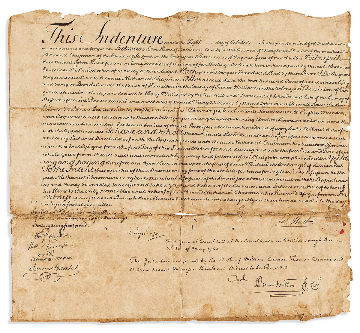
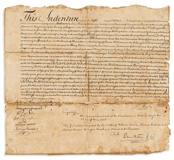
Included with the survey is an associated manuscript land indenture dated October 5th, 1747, selling 200 acres of land "on Broad Run in the Parish of Hamilton in the County of Prince William in the Colony and Dominion of Virginia" for 5 shillings sterling by John Hunt of Baltimore County to the aforementioned Nathaniel Chapman. Laid paper mounted on early linen backing, 12x13 inches, old folds and damages; judiciously signed and sealed by Benjamin Waller, Williamsburg courthouse, May 2nd, 1749.