Sep 27, 2018 - Sale 2486

Sale 2486 - Lot 491

Price Realized: $ 8,750
?Final Price Realized includes Buyer’s Premium added to Hammer Price
Estimate: $ 3,000 - $ 4,000
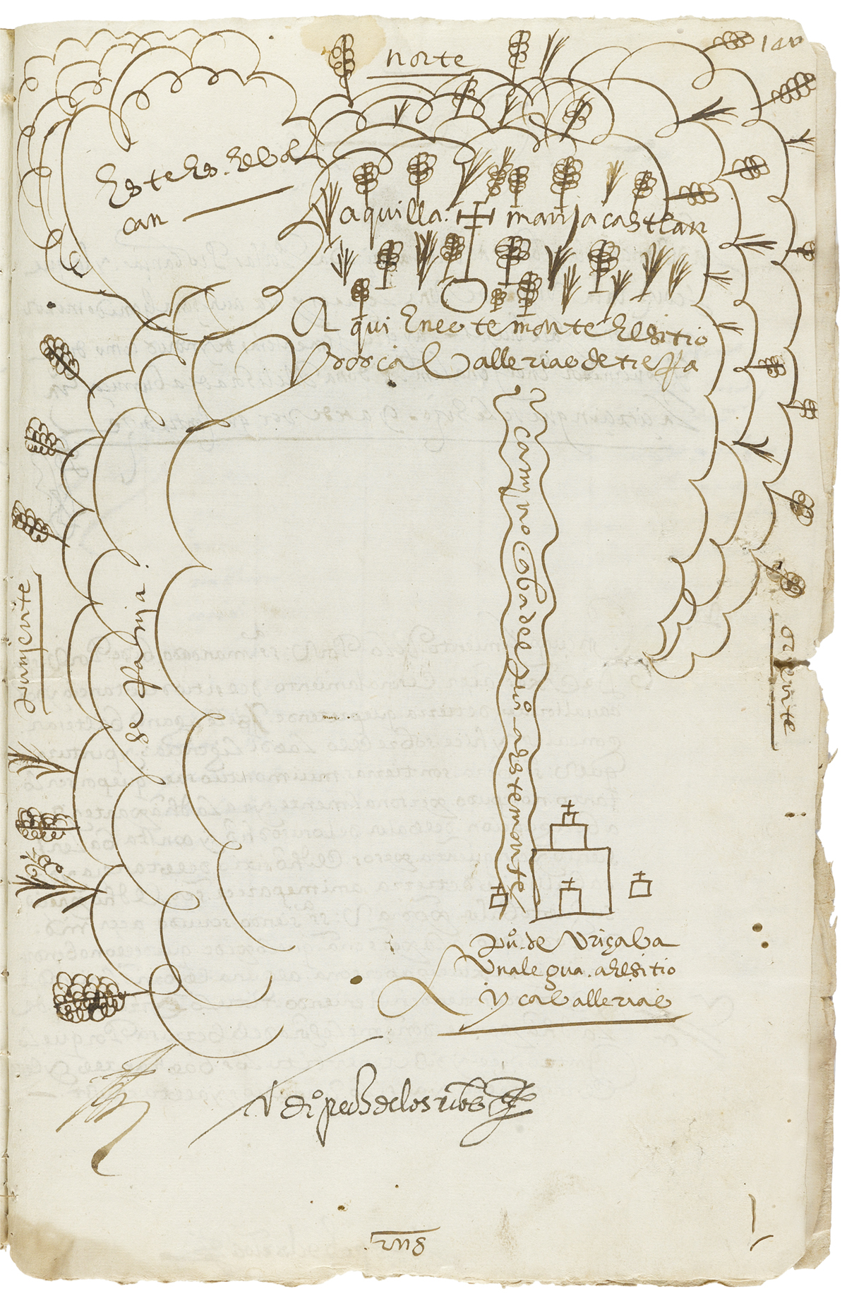
(MEXICAN MANUSCRIPTS.) Case involving land near Orizaba, featuring a map compiled with evidence from Indians. Manuscript document, signed twice by the Viceroy of New Spain, Gaspar de Zúñiga Acevedo y Velasco, Count of Monterrey, as "El Conde de M'rey", and by others. 17 pages, 12 1/4 x 8 1/2 inches, stitched; minor worming, minor edge wear. Mexico, 1599-1600

Additional Details

A bound packet of documents and a map relating to the concession of land in Orizaba, Veracruz, by Viceroy Gaspar de Zúñiga, the Count of Monterrey, utilizing the substantial testimony of indigenous people. A Spaniard named Baltazar González desired a plot of ranching land in Orizaba, and the viceroy wished to be certain that the land was completely uninhabited and unclaimed before making the grant. He appointed the corregidor of Orizaba, Diego Pérez de los Ríos, to investigate and interview locals, and assess a competing claim by a rival landowner.
This case is made particularly interesting by the significant role of several indigenous people who were summoned to testify, including the governor of the town, Juan Blanco Medina, a bilingual Indian who also served as an interpreter. The Indians were certainly Nahua (Aztec) as one of the documents records a speech given in the "Mexican language," a term for Nahuatl. The indigenous witnesses were able to supply extensive information (nearly all of it favoring González), and even added a warning about the unsuitability of some of the surrounding terrain for horses. The formal assignation of the land was carried out not in Spanish, but in Nahuatl.
Most strikingly, the investigation produced a map of a disputed part of territory. Although drawn by a scribe, it seems very likely to be a copy of a map produced by Indians. The flat, austere, stylized aesthetic strongly resembles that of Mesoamerican maps, and the scribe, by his own admission, was not able to personally survey the rugged terrain depicted in the map. While it is well known that Spaniards made use of indigenous testimony, knowledge, and maps in issues involving Indians, this case is an interesting example of Spaniards seeking out indigenous lore to settle their own land dispute.