Sep 26, 2019 - Sale 2517

Sale 2517 - Lot 301

Price Realized: $ 10,625
?Final Price Realized includes Buyer’s Premium added to Hammer Price
Estimate: $ 6,000 - $ 9,000
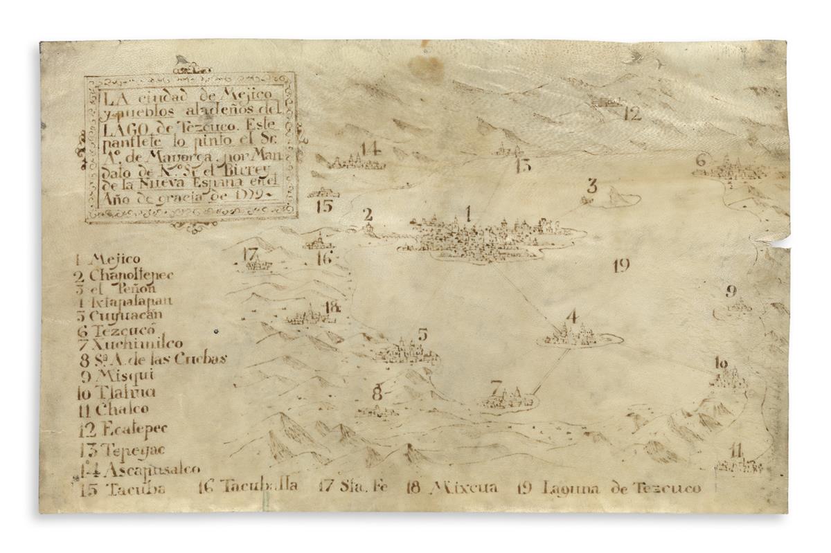
(MEXICAN MANUSCRIPTS.) Mayorga, Antonio de. Late colonial map of Mexico City and the surrounding towns and landscape. Manuscript map, 9 1/4 x 15 inches, on vellum; generally well preserved, two holes in upper margin (from mounting?), 1-inch flaw in vellum on right edge, paste spots on verso. Mexico, 1779

Additional Details

Detailed perspective map of the upper Valley of Mexico centered on Mexico City and Lake Texcoco which encompassed it, along with several other settlements and geographical features which are listed in a numbered legend. The map covers much of what is today known as the greater Mexico City metropolitan area. The title reads "La ciudad de Mejico y pueblos aladeños del lago de Tezcuco" ("The city of Mexico and the towns surrounding Lake Texcoco"). Mayorga made the map at the behest of the viceroy, quite possibly Martín de Mayorga Ferrer who took office that August and shared a name with the cartographer.
The map shows the evident failure of the massive desagüe project carried out in the 17th century to control flooding by draining Lake Texcoco. The great lake, while diminished, nonetheless clearly envelops the city and several other satellite towns, as it would until the 19th century when the draining was finally complete. A Roman-style aqueduct emanating from Chapultepec Hill on the map shows that the colonial administration had managed to rebuild the Aztec aqueduct which had been destroyed during the Conquest. Mexico City itself looks heavily developed and populous, evoking the grandeur and magnificence of the Aztec capital it was built upon. This map is a superb example of a wave of late colonial urban map-making initiated by colonial authorities to showcase all that they had achieved in their attempts to organize and administer the Spanish Empire.