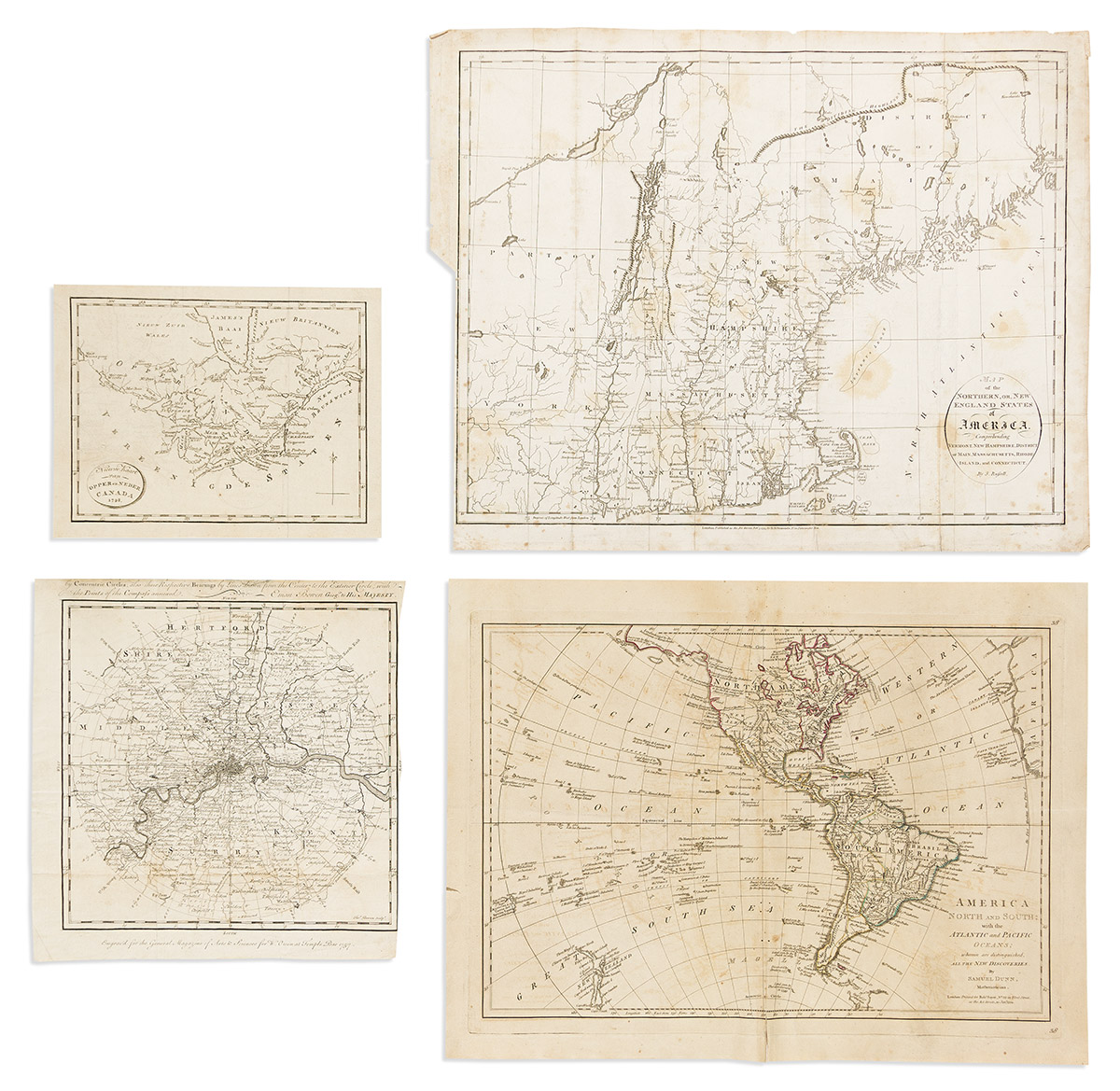
- Samuel Dunn. America North and South with the Atlantic and Pacific Oceans; Wherein are Distinguished all the New Discoveries. Double-page engraved map of North and South America. 14½x19½ inches sheet size, wide margins; general age tone, small defects. London: Robert Sayer, 1774.
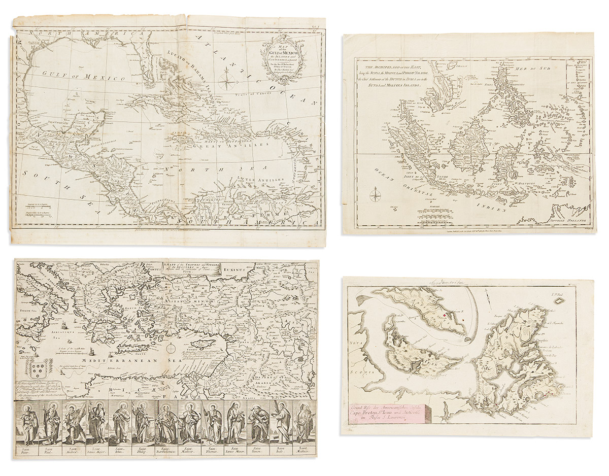
- John Lodge. The Archipelago of the East, Being the Sunda, the Molucca, and Philipp.s Islands, the Chief Settlements of the Dutch in India are in the Sunda and Molucca Islands. Engraved folding map of Southeast Asia and Indonesia. 12½x15½ inches sheet size, ample margins; accompanying text leaf tipped to left edge; generally nice. London: John Bew, 1781.
- After John Stockdale. Nieuwe Kaart van Opper en Neder Canada 1798. Engraved folding map of the Great Lakes region from the Dutch edition of Isaac Weld's Travels Through the States of North America. 7½x10 inches sheet size, wide margins; mounted on heavy stock. The Hague, 1801.
- Thomas Bowen/General Magazine. [An Accurate Map of the Country 17 Miles round London, showing the Distances of all Places from the Metropolis by Concentric Circles]. Engraved folding map of the environs of London. 11½x11 inches sheet size, upper and right margins shaved, partially excising the title. London, 1757.
- Gabriel Nicolaus Raspe. Grund Riss der Americanischen Insuln Cape Breton, St. Jean und Anticosti im Flusse S. Laurencii. Hand-colored engraved map of Cape Breton and Prince Edward Islands with an inset of Anticosti Island. 9½x15¼ inches sheet size, wide margins; minor signs of age. Nuremberg, circa 1770.
- Richard Blome. A Mapp of the Travels and Voyages of the Apostles in Their Mission and in Particular of Saint Paul. Double-page engraved map of the Mediterranean Sea and the Holy Land with portraits of the Apostles. 12x18¼ inches sheet size, narrow margins; minor signs of age. London, circa 1680.
- Thomas Kitchin. Map of the Gulf of Mexico, the Islands and Countries Adjacent. Engraved folding map of the Caribbean and Gulf of Mexico. 14x19 inches sheet size, ample margins; minor foxing and edge wear. London, 1777.
- John Russell. Map of the Northern, or, New England States of America, Comprehending Vermont, New Hampshire, District of Main, Massachusetts, Rhode Island, and Connecticut. Engraved folding map of New England. 16x20 inches sheet size, ample margins; heavy foxing and edge wear. London, 1795.