?Final Price Realized includes Buyer’s Premium added to Hammer Price
Estimate: $ 2,000 - $ 3,000
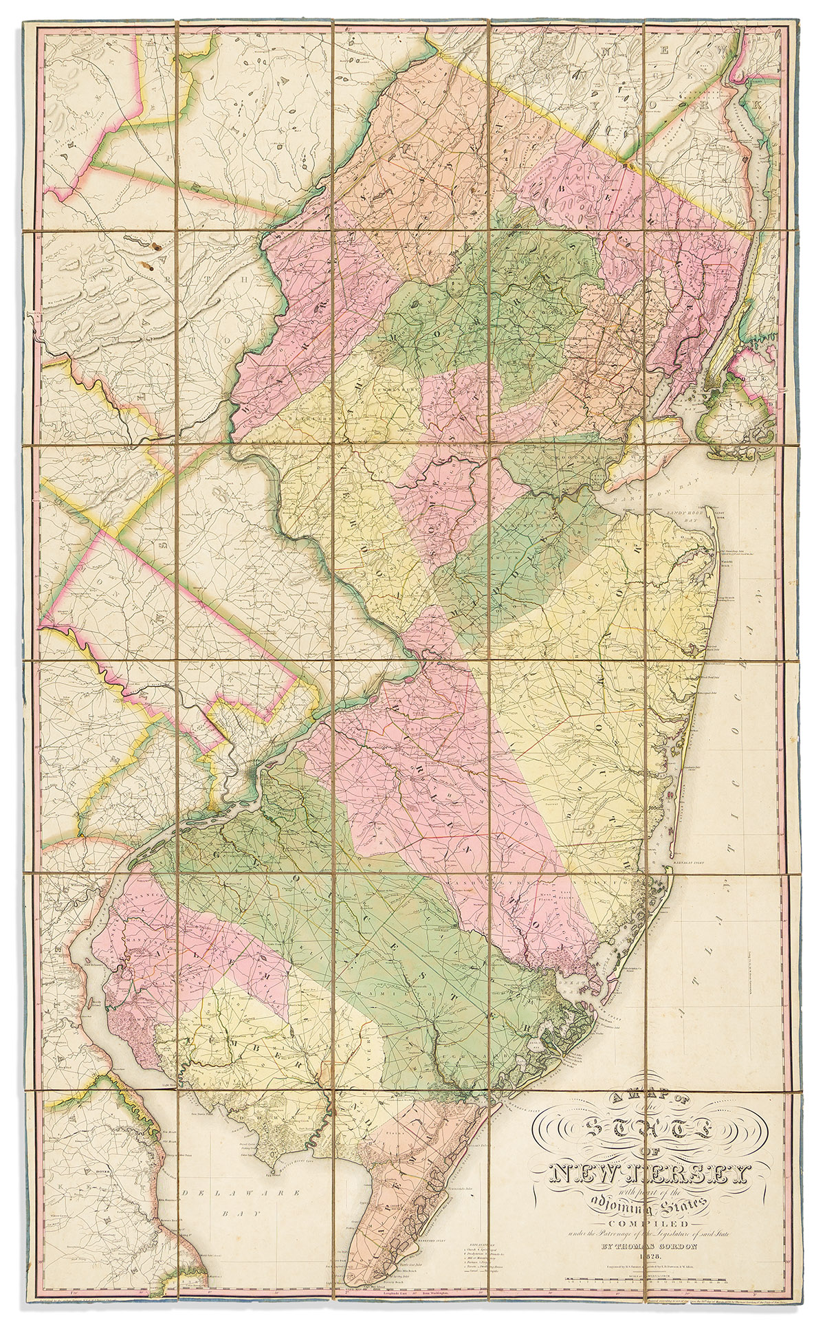
(NEW JERSEY.) Thomas Gordon. A Map of the State of New Jersey with Part of the Adjoining StatesCompiled Under the Patronage of the Legislature of Said State. Large engraved case map, the first officially commissioned surveying of New Jersey and the standard for all 19th-century cartography of the state. 56¼x34 inches overall, segmented and mounted to original linen backing with powder blue silk selvage and folding into marbled paper self-wrappers; exceptional original hand-color in full; minor signs of age but generally an outstanding example. Trenton, NJ: the author; and Philadelphia: H.S. Tanner, 1828