Sale 2687 - Lot 183
Price Realized: $ 3,400
Price Realized: $ 4,250
?Final Price Realized includes Buyer’s Premium added to Hammer Price
Estimate: $ 1,500 - $ 2,500
(NEW YORK.) Records of the Sterling iron mines and railway in Orange County. Hundreds of items (1 linear foot) including manuscripts, 46 large maps and plans, 11 photographs, and printed ephemera; condition varies but generally minor wear; some items with the inked stamp of early owner A. Brodrick. Sterlington, NY, 1859-1948
Additional Details
This company traced its roots to an iron forge in Ramapo, NY as far back as 1736. The company was sold out of family hands in 1864, and soon split into two related companies: Sterling Iron and Railway Company, and the Sterling Mountain Railway Company (both are represented in this collection). The mine wrapped up its operations in 1923, but the company retained control of property through at least 1936.
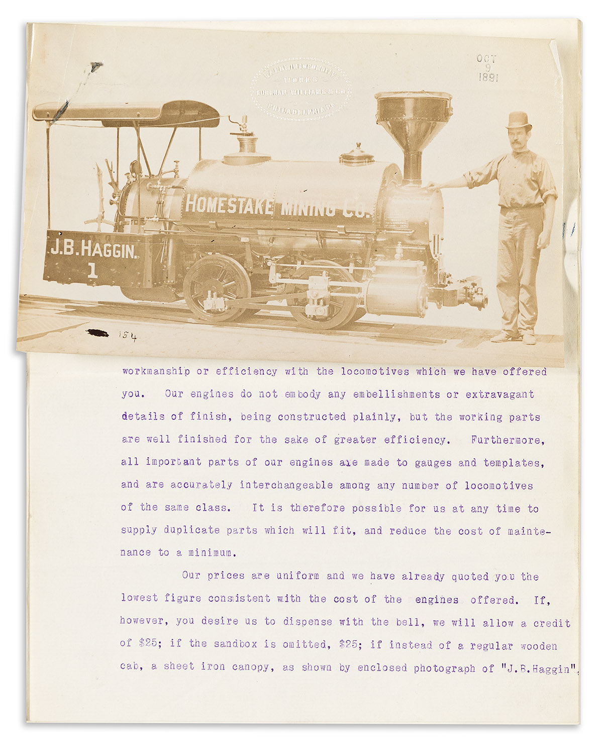
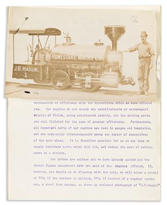
One folder of correspondence relates to the purchase of a new locomotive from the Baldwin Locomotive Works, 1891-1892; it is notable for three appended photographs of the machine, unmounted.
Another folder of miscellaneous correspondence, 1878-1936, contains one unusual personal letter dated 31 January 1878, from a Sterling Furnace worker named James Akers to his father, describing an industrial accident in which a co-worker was buried in a ditch by a collapsing oven: "All we can see of him is his head and sholder . . . It killed him instly. . . . Evry one is doing their best to get the boddy out. . . P.S. Friday we got John out this morning at 8 o'clock. He was mashe up bad. They are washing him now before sending him home." A small drawing of the accident site ends the letter.
Also of interest for labor history are two packets of monthly pay lists, one from 1889 and one from 1916, plus pay receipts from 1916. A small account book from the Sterling Store shows one worker's purchases there in 1900 and 1901.
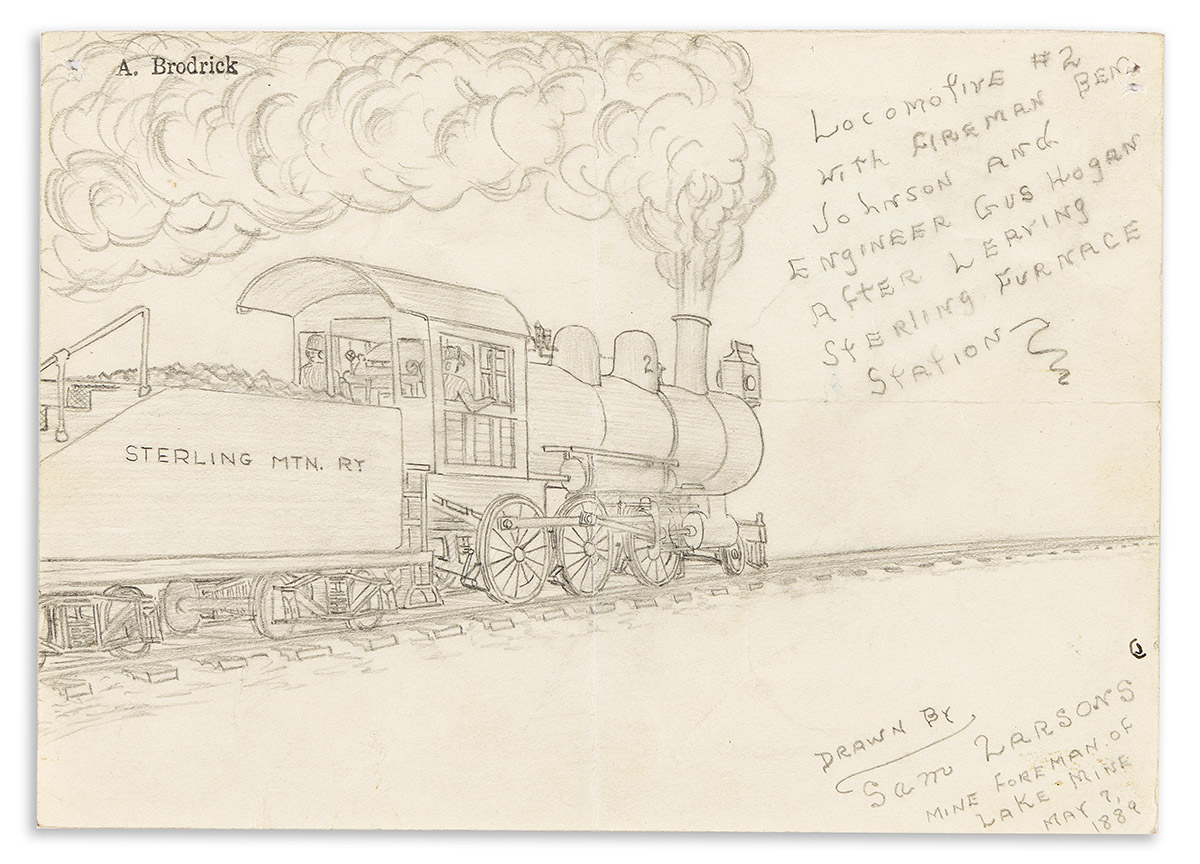
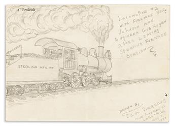
A small pencil drawing is titled "Locomotive #2 with Fireman Ben Johnson . . . after Leaving Sterling Furnace Station," drawn by mine foreman Sam Larsons in 1889.
Three packets of waybills document the railroad's cargo near the end of its operations.
Among the company reports are several 1890 industrial census schedules completed in manuscript for the company's mines.
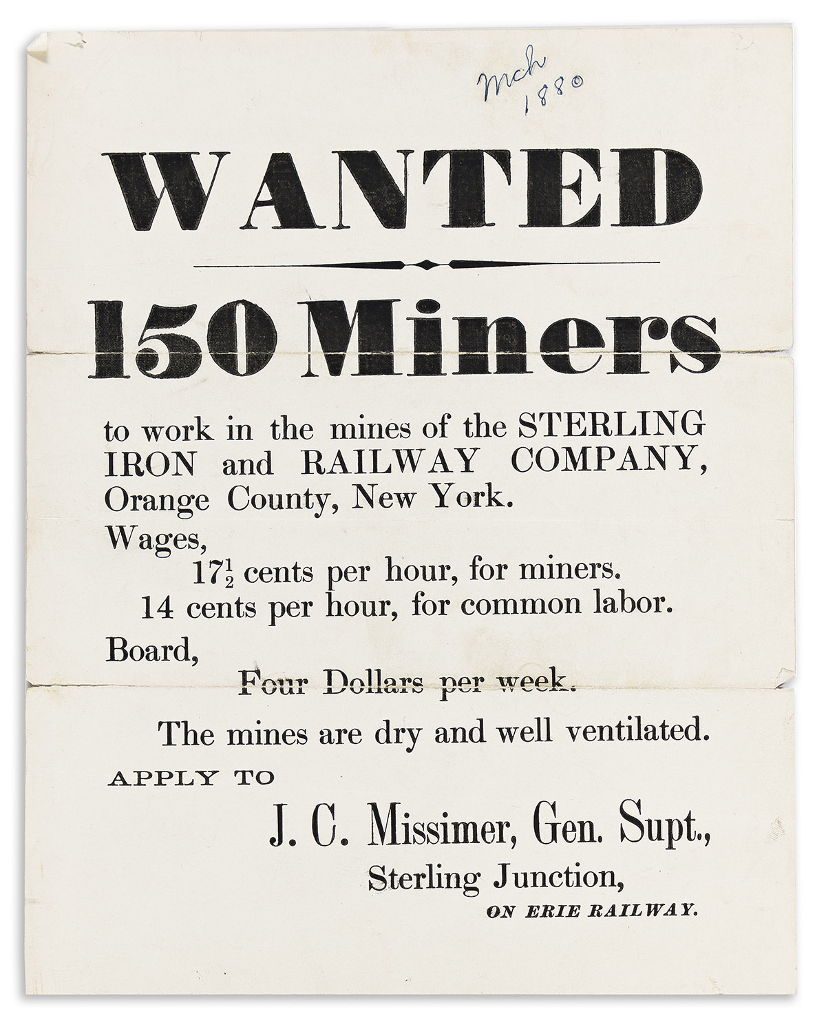
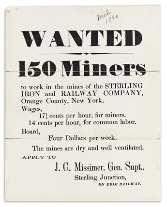
Printed ephemera includes two copies of an 1880 employment broadside headed "Wanted 150 Miners . . . The mines are dry and well ventilated"; 4 of the railway's annual "Commutation Tickets" good for 50 trips; 3 blank fishing permits for the company's lands, "to be shown to the game keeper"; 3 copies of a linen broadside "Notice, the Following Rules to be Observed by All Employees" regarding mine safety; and another linen broadside of "Rules to be Observed by Employees . . . and others Occupying the Companies' Houses." The collection also includes stocks, bonds, financial records, and a file of news clippings.
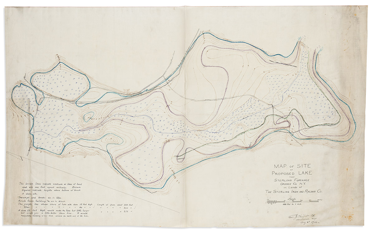
Finally, an additional group of oversized maps and plans includes 19 manuscripts on paper or architectural vellum, 1859-1916 and undated; 23 blueprints, 1899-1927 and undated (some being period reproductions of the manuscripts); and 4 printed and photostatic maps, 1924 and undated; plus tracings done on 15 sheets in 1948 by an early owner of the archive. Some of the folding maps are quite large, with one of the manuscripts being 49½ x 58 inches.
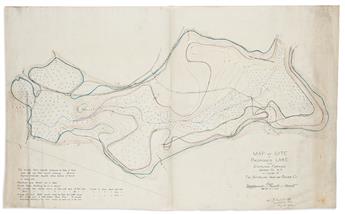
A few sample manuscript maps include "Sketch Showing the Present Condition on the Lower California Mine on the Sterling Estate," 9¼ x 14¾ inches, May 1859; "Map of the Sterling Estate Situated in Orange County, N.Y. and Owned by Messers Townsend," 42 x 40¾ inches, the only one of these maps which is quite worn, but also present in a nice clean tracing, 1859; "Map and Profile of the Sterling Mountain Railroad," 13½ x 19½ inches, 1864; "Map of the Located Line of Southfield Branch Railroad, 20½ x 22½ inches, 1867; "Sterlington, N.Y. Topographical Map Showing Proposed Improvements on Bering Tract," 28 x 38 inches, 1906; "Map of Site of Proposed Lake near Sterling Furnace," 28 x 42 inches, 1906; "Map of the Sterling and Lake Mines, Property of the Sterling Iron & Railway Co.," 54 x 41 inches; and "Map of the lands in the Towns of Monroe, Woodbury and Tuxedo . . . Conveyed by Mary W. Harriman to W. Averill Harriman," 27 x 1916.
Exhibition Hours
Exhibition Hours
Aliquam vulputate ornare congue. Vestibulum maximus, libero in placerat faucibus, risus nisl molestie massa, ut maximus metus lectus vel lorem.


