Sale 2148 - Lot 276
Unsold
Estimate: $ 4,000 - $ 6,000
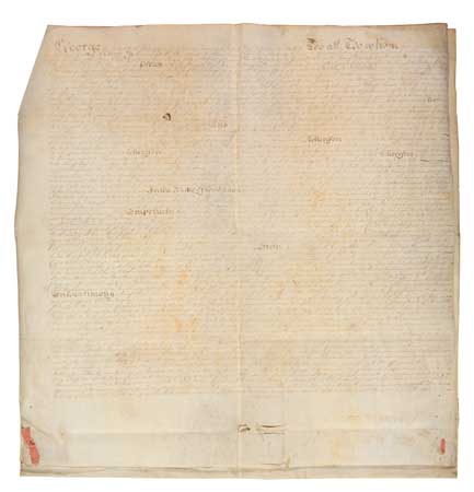
PARTITION OF THE STUYVESANT ESTATE, WHERE SWANN NOW SITS (NEW YORK CITY.) Ann Pritchard Proceedings in Partition. Manuscript Document. 2 full vellum sheets and one partial sheet stitched together with ribbon, 672 x 645 mm overall. Minor wear at folds and staining; small divot on front page, affecting text; several slits and holes in bottom blank areas. Contemporary manuscript transcript of the original partition decree, with Autograph Signature "Examined by me, Daniel Horsmanden." Title from docketing on verso. New York, 12 October [1742]
Additional Details
This document certifies the partition of 400 acres of the Stuyvesant family's Manhattan estates between his two surviving New York grandchildren. Peter Stuyvesant (1612-1672) was the last Dutch ruler of New Amsterdam, remaining in power until the arrival of the English in 1664. His son Nicholas William Stuyvesant (1648-1698) was his sole New York heir. After 1707, Nicholas's estate was owned jointly by his children Gerardus Stuyvesant and Anne Pritchard until Anne petitioned for the land to be formally divided in 1739. This document offers the background of the case, transcribes Nicholas's 1698 will (including a bequest of "one Negro boy" to his eldest son), and sets forth the land granted to Anne from the partition.
The property described here does not follow modern street lines. The first and largest lot described includes the land where Swann Galleries is presently located: "Bounded northerly by the Kings Highway leading from the City of New York to Harlem, Easterly by land belonging to Samuel Kipp, Southerly by the East River . . . and Westerly by Charles Dawson's Land and the highway aforesaid, Beginning at a Great Stone on the East Side of the said highway . . . and runs thence along a row of Peartrees . . . Containing One hundred and thirty one Acres." This lot encompassed what would soon become known as Rose Hill farm and the bulk of the "Gramercy Seat," ranging from modern 20th to 30th Streets, and containing much of the land from Broadway east to the river, including modern Gramercy Park and a corner of Madison Square Park. Those pear trees would have sliced diagonally from East 21st Street to 4th Avenue.
The second lot is a 16-acre strip of meadow land, extending southeast of what is now Tompkins Square Park, from East 5th to 9th Streets. The third lot described here covers "part of that tract called Leenderts Land," 45 acres in what is now the East Village and Lower East Side.
Listed among the jurors in the case is Jacobus Roosevelt, great-great-great-grandfather of Franklin D. Roosevelt. Daniel Horsmanden, who certified this document with his signature, was best known as the judge who ruled on New York's 1741 slave insurrection and investigated Rhode Island's 1772 Gaspee Rebellion. Overall, a handsome and significant document, worthy of further research for the light it sheds on Manhattan's early development.
References: Lamb, History of the City of New York, 654; Stokes, Iconography of Manhattan Island, VI:141-144 and plates 84B-b and c.

Exhibition Hours
Exhibition Hours
Aliquam vulputate ornare congue. Vestibulum maximus, libero in placerat faucibus, risus nisl molestie massa, ut maximus metus lectus vel lorem.


