Apr 08, 2014 - Sale 2344

Sale 2344 - Lot 197

Price Realized: $ 18,750
?Final Price Realized includes Buyer’s Premium added to Hammer Price
Estimate: $ 7,000 - $ 10,000
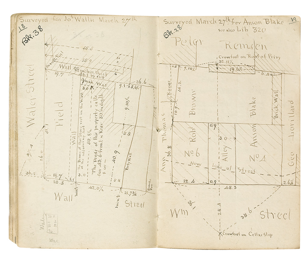
(NEW YORK CITY.) Archive of manuscript field notebooks of the Bridges family surveying firm. 116 manuscript volumes, most about 40 pages, 12mo, original wrappers; a few wrappers and leaves detached or lacking, volume 80 with vermin damage, a few with moderate dampstaining, many pages marked with later references to an index (not present), general minor wear consistent with regular use. New York, 1809-51

Additional Details

William Bridges (circa 1773-1814) was appointed as a New York city surveyor in 1806, and (as a rival to John Randel) figures prominently in Marguerite Holloway's recent book The Measure of Manhattan. Shortly before his death, he took in Thomas Poppleton as a partner. His sons Edward W. Bridges (circa 1797-1851) and Joseph F. Bridges (circa 1805-1883) followed in his footsteps.
Most of these survey notes were taken in downtown Manhattan south of 14th Street, though a few are from further uptown, Brooklyn, Westchester, or even further afield. 3 of the volumes were done during the time of William Bridges, 1809-1813, and a few were done from 1814 to 1819 (probably by Poppleton in partnership with young Edward). The bulk of the notebooks were done by Edward and Joseph in the 1820s, 1830s, and 1840s. Most of their work was done on specific parcels of land for private property-owners, though a few surveys seem to have been done for city street projects. Most volumes include sketches of property lines, along with detailed measurements as they were recorded on the spot.
Highlights include a "Field Book of Phillipsburgh Estate" done by Bridges & Poppleton in 1813, relating to Phillipsburg Manor in Tarrytown, Westchester County "Notes and Angles for Establishing Points on Manhatten Island and Adjoining Shores" by E.W. Bridges, 1820-24 "An Account of Levels taken on York Island in the Summer of 1809" by William Bridges, the earliest book in the collection A two-volume survey of the levels between Havre-de-Grace and Baltimore, MD by Edward W. Bridges, 1823 "Canal Street Sewer Assessment Book No. 2," Edward W. Bridges, 1824 Survey of James I. Roosevelt's land on Wall Street, 1836, in book 345.
The Bridges surveys have long held great interest for those interested in Manhattan's geography. Upon the death of Joseph F. Bridges in 1883, parts of the collection were scattered, but the bulk were acquired by rare map dealer Richard D. Cooke in 1885. In 1899, the city attempted to buy out the entire archive for the then-majestic sum of $30,000. A trade publication argued that "the Bridges collection . . . apart from books and manuscripts, is the most important source in existence for the history of New York City during three-quarters of a century. Besides, it has an extremely practical bearing on practical interests, for should the information it contains regarding old boundaries and surveys be lost, a cloud would be thrown upon many titles to real estate" (New York Real Estate Record and Builders' Guide, 9 December 1899, pages 877-8). However, a bargain was not reached and the collection was dispersed among private collectors. This group is the largest known surviving portion of the Bridges archive in existence, including the 12 volumes held by the New York Public Library.