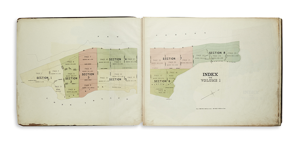
Jun 07, 2017 - Sale 2450

Sale 2450 - Lot 251

Unsold
Estimate: $ 1,500 - $ 2,500
(NEW YORK CITY.) Commissioners of the Board of Taxes and Assessments. The Land Map of the City of New York. 43 numbered full page lithographed sectional maps, double-page color-printed index map to volume 1 (Manhattan), full page color-printed index map to volume 2 (Bronx), lithographed title-page; each sheet on wove paper watermarked "Crane & Co., Dalton, Mass, 1890." 2 volumes in 1, oblong imperial folio, 22x26 1/2 inches, original cloth covered boards with gilt stamped morocco title-piece on upper cover, worn, needs binding; title and maps with some edge staining and chipping, but generally quite clean. New York: Commissioners of Taxes and Assessments, January 1, 1891

Additional Details

The present maps come across with a much cleaner, more restrained feel than the busy meticulousness seen in other more commercially produced real estate atlases of the period by publishers such as Bromley and Hyde. Maps 1-24 concern Manhattan; 25-43 the Bronx. The detailed sections reference each block, offering a much clearer overall sense of the actual city planning compiled for tax assessment purposes. Very scarce, with only three copies located and no record of its ever having appeared on the market.