?Final Price Realized includes Buyer’s Premium added to Hammer Price
Estimate: $ 400 - $ 600
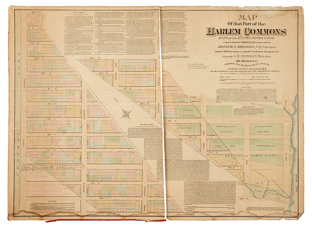
(NEW YORK CITY.) Holmes, John Bute. Map of that Part of the Harlem Commons East of the 5th Ave & Central Park.Copied from the Original map made by Joseph F. Bridges, City Surveyor, January 1826, now in possession of a Gentleman who purchased it through A.R. Morgan, Esq. from Mr. Bridges, showing also the Boundaries given by Charles Clinton, Surveyor, Dec. 1825, and the inaccuracies of both the above-named maps, with other important information. Large format hand-colored lithographed plat map, with manuscript additions in two hands. Backed on linen and edged with red silk, as issued. 24x33 inches sheet size; fully bisected by a vertical split, soft creases, paper quite friable with some chipping and loss, selvage lacking along top, right, and some of the bottom edge. sold as is. New York, May 1871