Dec 17, 2020 - Sale 2555

Sale 2555 - Lot 180

Price Realized: $ 469
?Final Price Realized includes Buyer’s Premium added to Hammer Price
Estimate: $ 150 - $ 250
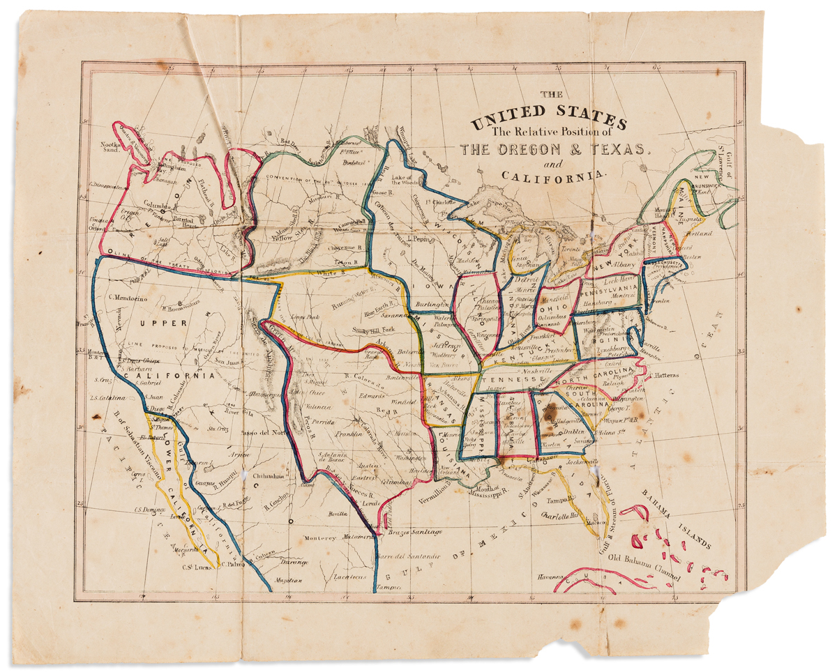
(OREGON BOUNDARY DISPUTE.) after James Wyld. The United States / The Relative Position of The Oregon & Texas and California. Small-scale lithographed folding map. 10x12 1/2 inches sheet size; hand-colored in outline; a few stains, small losses at intersecting folds and margins. Np, circa 1845

Additional Details

Anonymous map of the United States showing an independent Texas and California as part of Mexico. Compared to a similar example in the Norman B. Leventhal Map Center Collection subtle differences are seen: variances in the main typography and more notably at the upper left where that copy states "Boundary U.S. settled in 1846 British retaining the right to navigate Columbia River" is here labeled "Line Proposed Convention of the 20th October 1818".