Jun 22, 2023 - Sale 2642

Sale 2642 - Lot 104

Price Realized: $ 688
?Final Price Realized includes Buyer’s Premium added to Hammer Price
Estimate: $ 600 - $ 900
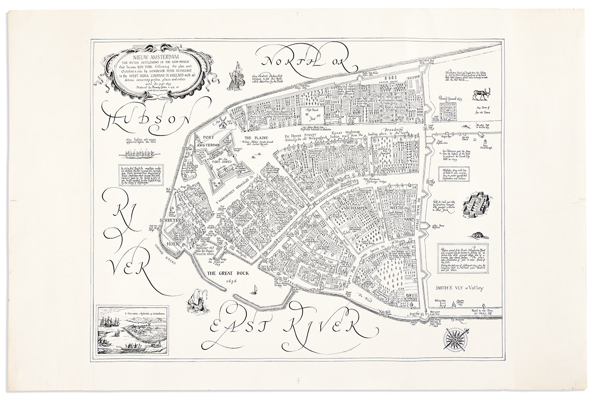
(PICTORIAL MAPS.) Manning Exton. Nieuw Amsterdam the Dutch Settlement in the New World that Became New York Following the Plan Sent October 6, 1660 by Governor Peter Stuyvesant to the West India Company in Holland with Additions Concerning Persons, Places and Events Until the Year 1699. Large lithographed pictorial plan of early Manhattan on "Hamilton Andorra" watermarked laid paper. 23x35 inches sheet size, wide margins; soft creases, minor edge wear. South Port, CT, 1965

Additional Details

A lively and illuminating mid-twentieth century map styled on the Jacques Cortelyou manuscript "Castello Plan" of 1660. In 1916 John Wolcott Adams and Isaac Newton Phelps Stokes created a "Redraft" of the Castello Plan, adding greater clarity to the seventeenth-century masterpiece of urban Manhattan.

Here, our little-known illustrator Manning Exton has further improved upon the Adams revision, adding scores of period municipal toponyms, names of property owners, merchants, businesses, markets, and anecdotes relating to the contemporary history of lower Manhattan from the beginnings of its urban settlement by Europeans through 1699. E.g.: First Meat Market 1659; Orchard of Peter Stuyvesant; First Poor House 1653; First street lighting, at every seventh house a candle 1697; Weekly Market, Parade Ground and Annual Kermess; First Tavern, Gereardy's Wooden Horse 1641; Stone St. 1665 First Cobbled Street; First British Barracks outside of the Fort 1665; etc., etc.

OCLC lists 5 institutional examples, none traced in market database records.