?Final Price Realized includes Buyer’s Premium added to Hammer Price
Estimate: $ 1,500 - $ 2,500
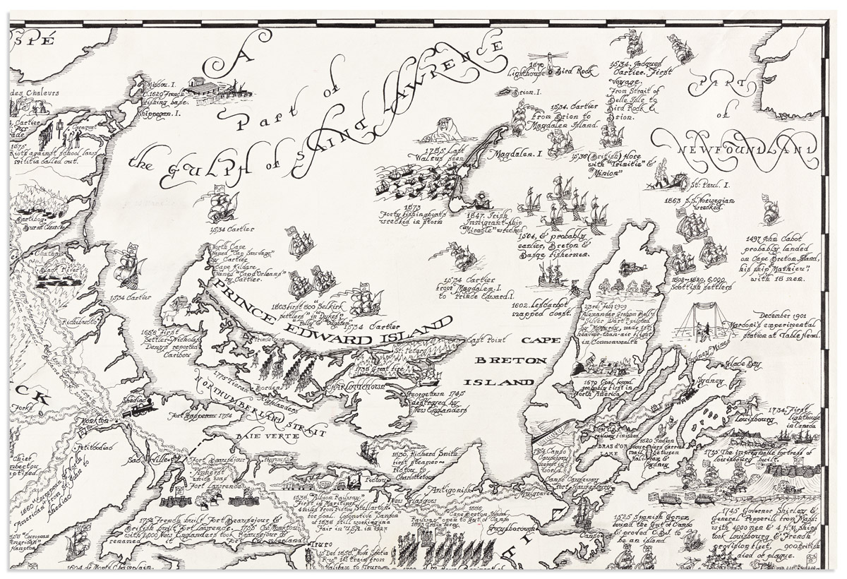
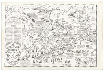
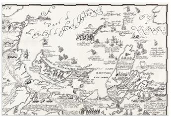
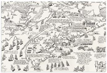
(PICTORIAL MAPS -- MANUSCRIPT.) Peter Reynolds Furse. The Maritime Provinces of Canada. Pen and ink map of New Brunswick, Nova Scotia, and Prince Edward Island drawn on an untrimmed deckle-edged sheet of "JWhatman/1959" watermarked wove paper; 27 3/4x40 1/2 inches overall; minimal margin soiling and short edge closures, adhesive residue from an removed limitation label at lower left margin. Hampton, New Brunswick, 1963
Peter Furse was a British Navy officer who began his service in World War I at age 17, during which time he received his first exposure to map drafting. After the war he continued his education at the University of Cambridge and when World War II came, he again served with the Royal Navy, ultimately elevating to the rank of Lieutenant Commander. After spending several years in Africa, Furse and his wife Barbara settled down in the village of Hampton, New Brunswick, Canada. There he spent his retirement years creating and publishing well-studied whimsical pictorial cartography in the mid-1960s.
The present manuscript was published circa 1963 with lithographed examples located at the Tides Institute Museum of Art, and (as of November 2021) one copy on offer by a Canadian mapseller. That printed map measures approximately 2/3 smaller than our original drawing.
The map is painstaking in its arrangement of regional information and illustrative charm; a small sampling of the illustrated anecdotes includes:
1580 Sable Island, first settlement. 40 convicts landed by first Governor, de la Roche. 12 survivors; C1810 222 negroes to Freetown, Sierra Leone at their own request. Freetown was started by British abolitionists in 1787, 34 years before U.S.A. started Liberia; 1524 Verrazano exploring, in "Dolphin", reported U.S.A. to be a narrow strip. Contemporary maps show "The Gulf of Verrazano" where (inland) Carolina, Virginia, Maryland & Pennsylvania should be; 1753 1,600 German colonists to Lunenburg; 1761 First ship built in Yarmouth, "James". Later built more tonnage per head than any other place in the world; 1849 "Pony Express" Halifax-Digby for first formed "Associated Press"; 1765 First Agricultural Show in the Maritimes at Windsor; 1604 de Monts, Champlain, Pontrincourt, Pontgrave explored Fundy, 1605 they explored Annapolis Basin; 1612 Chief Membertou baptized; 1534 Cartier 1st fur trade at Baie des Chaleurs; 1745 Georgetown [PEI] destroyed by New Englanders; 1656 First settlers - Nicholas Denys reported Caribou; 1785 Last Walrus seen, Magdalen I.; 1820 Indian couriers carried mail between Halifax & Sydney; 1715 The impregnable fortress of Louisbourg built; 26 July 1758 Generals Amherst & Wolfe with Admiral Boscawen took Louisbourg for the last time; C1000-1121 Eric the Red, Bishop Eric of Iceland in search of Vineland; and there is also a large embellished panel at left describing "Events, for the illustration of which, space is lacking".