Sep 28, 2023 - Sale 2646

Sale 2646 - Lot 244

Price Realized: $ 1,875
?Final Price Realized includes Buyer’s Premium added to Hammer Price
Estimate: $ 800 - $ 1,200
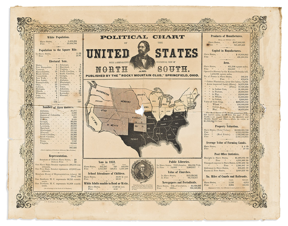
(PRESIDENTS--1856 CAMPAIGN.) Political Chart of the United States, with a Comparative Statistical View of the North and South. Hand-colored engraving, 16 x 20 1/4 inches; folds, wear including 3/4-inch loss at center of map, several short tears, moderate foxing and toning, unusual but not unpleasant scent of smoked meat, backed with period strips of linen on left and right edges (repairs or perhaps mounting for use at a rally?). Stereotyped by D. Hills & Co., and printed in Cincinnati by C.F. Bradley & Co. Springfield, OH: Rocky Mountain Club, 1856

Additional Details

The central image is a map of the United States, showing the free states in yellow, free territories in pink, and slave states in black. The territories in which the issue remained unsettled are shown in shaded pink. The print is additionally illustrated with an inset portrait of Republican candidate John C. Frémont, and a smaller portrait of George Washington. Frémont was the Republican Party's first candidate for president. Because he had risen to fame as an explorer of the Rocky Mountains in the 1840s, many of his political supporters organized themselves into Rocky Mountain Clubs, and this print was produced by the Springfield, OH club.

Flanking the map are a variety of statistical comparisons intended to demonstrate the impoverished and stunted nature of the slave states, which lagged in education, infrastructure, manufacturing, and more. The potential opening of 1,472,061 square miles to slavery by the Kansas-Nebraska bill is noted.

None in OCLC, though a copy is held by the Gilder Lehrman Institute. Only one other traced at auction.