Sep 28, 2023 - Sale 2646

Sale 2646 - Lot 258

Price Realized: $ 1,188
?Final Price Realized includes Buyer’s Premium added to Hammer Price
Estimate: $ 1,500 - $ 2,500
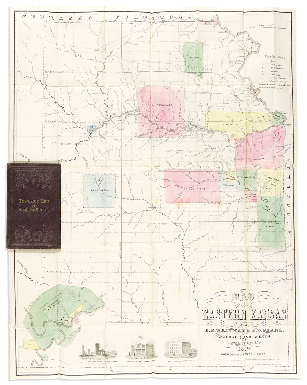
(SLAVERY & ABOLITION.) E.B. Whitman & A.D. Searl. Map of Eastern Kansas. Hand-colored lithographic map, 27 1/2 x 21 1/2 inches, folding into original cloth cover, 6 1/4 x 4 inches, titled in gilt "Township Map of Eastern Kansas"; minimal wear and foxing. Boston: J.P. Jewett & Co., 1856

Additional Details

This map was compiled by two general land agents in Lawrence, Kansas. In addition to the expected roads, towns, trading posts, rivers, and forts, the map shows 13 Indian reservations and a few parcels of government-held land, each blocked out in color. Lawrence is noted with a tiny American flag. Three of the big cross-country emigrant roads are noted, "Oregon Road," "California Road," and "Santa Fe Road." The map is illustrated with three vignettes, plus an inset map showing Fort Riley in additional detail. A one-page introduction by Whitman & Searl dated 15 June 1856 is printed on the front pastedown, explaining the services they offered to new settlers, including the location of land warrants, and an "Emigrant's Intelligence Office" offering helpful advice.

Left almost unstated: "Bleeding Kansas" had been mired in a violent civil war for the past year between supporters and opponents of slavery. Border ruffians from Missouri, vigilantes led by John Brown, the pro-slavery sacking of Lawrence, the caning of Charles Sumner on the Senate floor--all of this context would have been well understood by any potential emigrant to Kansas, or at least any American capable of reading a newspaper. None of this was good for the land agent business, but Whitman & Searl could hardly ignore it altogether on this map. The vignettes include "before-and-after" views of "Eldridge House, Lawrence, Kansas" and "Ruins of Eldridge House, Lawrence, Kansas, Destroyed May 21st, 1856." In very small type along the Kansas River near Lawrence, they note three encampments of the pro-slavery governor's militia, "Shannon's Posse," on 10 December 1855. Heaston, Kansas Pocket Maps 4; Streeter sale, VI:3903.