Sep 30, 2021 - Sale 2580

Sale 2580 - Lot 226

Price Realized: $ 3,750
?Final Price Realized includes Buyer’s Premium added to Hammer Price
Estimate: $ 500 - $ 750
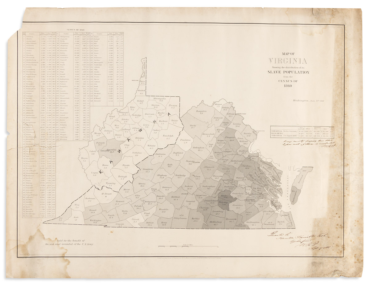
(SLAVERY & ABOLITION.) Map of Virginia, Showing the Distribution of its Slave Population from the Census of 1860. Printed map, 22 x 29 inches; wear on left edge including 5-inch closed tear and loss on upper corner, two 5-inch dampstains, soiling and foxing along right edge; gift inscription dated 7 September 1861 from Major William R. Palmer of the Topographical Engineers, signed twice as "W.R.P." Washington: Henry S. Graham, 13 June 1861

Additional Details

Shows the percentage of slave population by county throughout the newly seceded state of Virginia. The western counties were in the process of separating from Virginia and rejoining the Union as West Virginia; most of them are here noted as "Kanawha," although the eastern panhandle was yet to join them. The map clearly illustrates that the heavily slaveholding counties had driven secession, while the counties with few slaves had chosen to stay in the Union.

The map was drawn by E. Hergesheimer and lithographed by C.B. Graham. This copy is inscribed to Hamilton Fish (1808-1893), then a former United States Senator and an active Lincoln supporter; he later served as Secretary of State. The Library of Congress holds another example where Major Palmer signed in full. None traced at auction since a Swann sale, 11 December 2003, lot 153.