?Final Price Realized includes Buyer’s Premium added to Hammer Price
Estimate: $ 2,000 - $ 3,000
(SPACE.) NASA. Large archive of approximately 45 lunar mission charts and pamphlets. First editions; various sizes, one signed; all generally excellent condition. Washington, D.C., 1960s-1970s
- Mercury Orbit Chart MOC-6. 10 1/2x35 inches. February 1963.
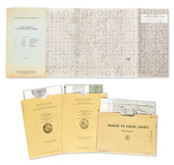
- Ranger VII Lunar Charts RLC 1 Through 5 (Mare Cognitum, Guericke Mare Cognitum, Bonpland H Mare Cognitum, Bonpland PQC Mare Cognitum, RLC 5. Original printed manila folder. 1st Edition, 1964.
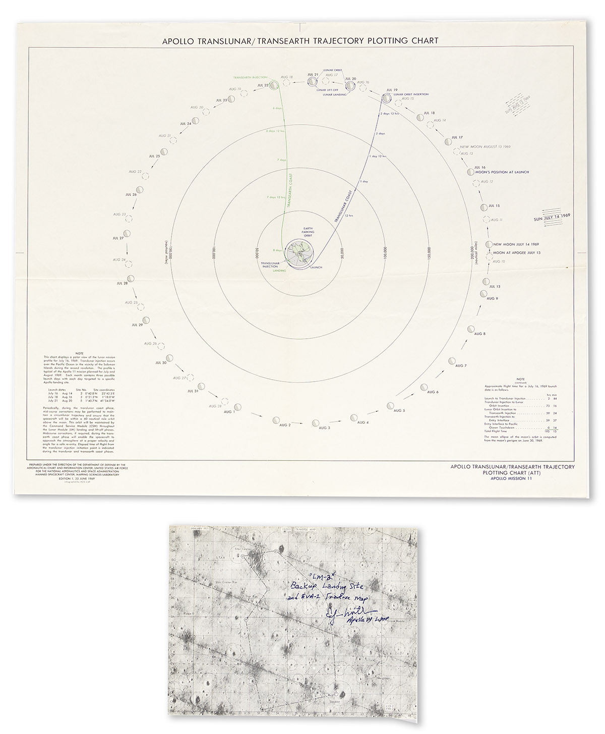
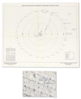
- Apollo Translunar/Transearth Trajectory Plotting Chart. 20x24 inches, flattened folds. June 1969.
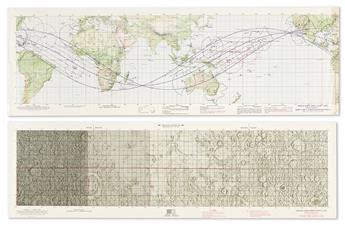
- Apollo Mission Chart (AMC) 6 Apollo Mission 6. Sheet 2 only (of 2). 13 1/2x41 1/2 inches. February 1968.
- Apollo Mission Chart (AMC) 7 Apollo Mission 7. 13 1/2x41 1/2 inches. August 1968.
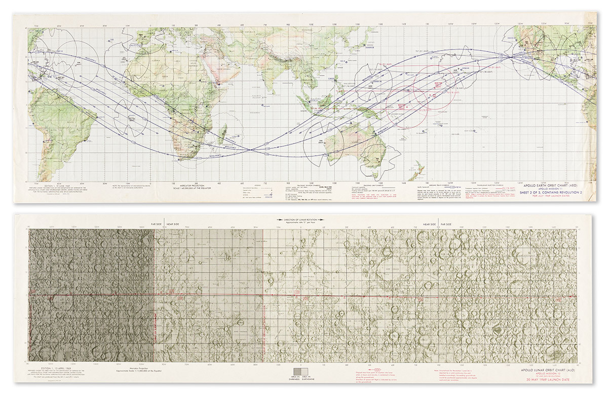
- Apollo Earth Orbit Chart (AEO) Apollo Mission 8. Sheets 1-3 (of 3). 13 1/2x41 1/2 inches each. November 1968.
- Apollo Target of Opportunity Flight Chart (ATO) Apollo Mission 8. 14x58 1/2 inches. December 1968.
- Apollo Earth Orbit Chart (AEO) Apollo Mission 10. Sheets 1-3 (of 3). 13 1/2x41 1/2 inches each. April 1969.
- Apollo Lunar Orbit Chart (ALO) Apollo Mission 10 1st and 26th Revolutions. 12x41 inches. April 1969.
- Apollo Target of Opportunity Flight Chart (ATO) Apollo Mission 10. 14x58 1/2 inches. April 1969.
- Apollo Lunar Orbit Chart (ALO) Apollo Mission 11 1st and 30th Revolutions. 12x41 inches. June 1969.
- Apollo Earth Orbit Chart (AEO) Apollo Mission 11. Sheet 2 only (of 3). 13 1/2x41 1/2 inches. June 1969.
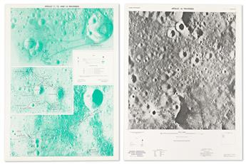
- Apollo Mission 10 Photography Indexes. 6 large folding charts, staple-bound blue printed wrappers. July 1969.
- Apollo Mission 14 Lunar Photography Indexes. 3 large folding charts, staple-bound printed wrappers. June 1971.
- Apollo 14 Traverse Map, LM-2. 8x10 1/2 inches, signed and inscribed "LM-2, Backup Landing Site and EVA-2 Traverse Map, Edgar Mitchell, Apollo 14 LMP." January 1971.
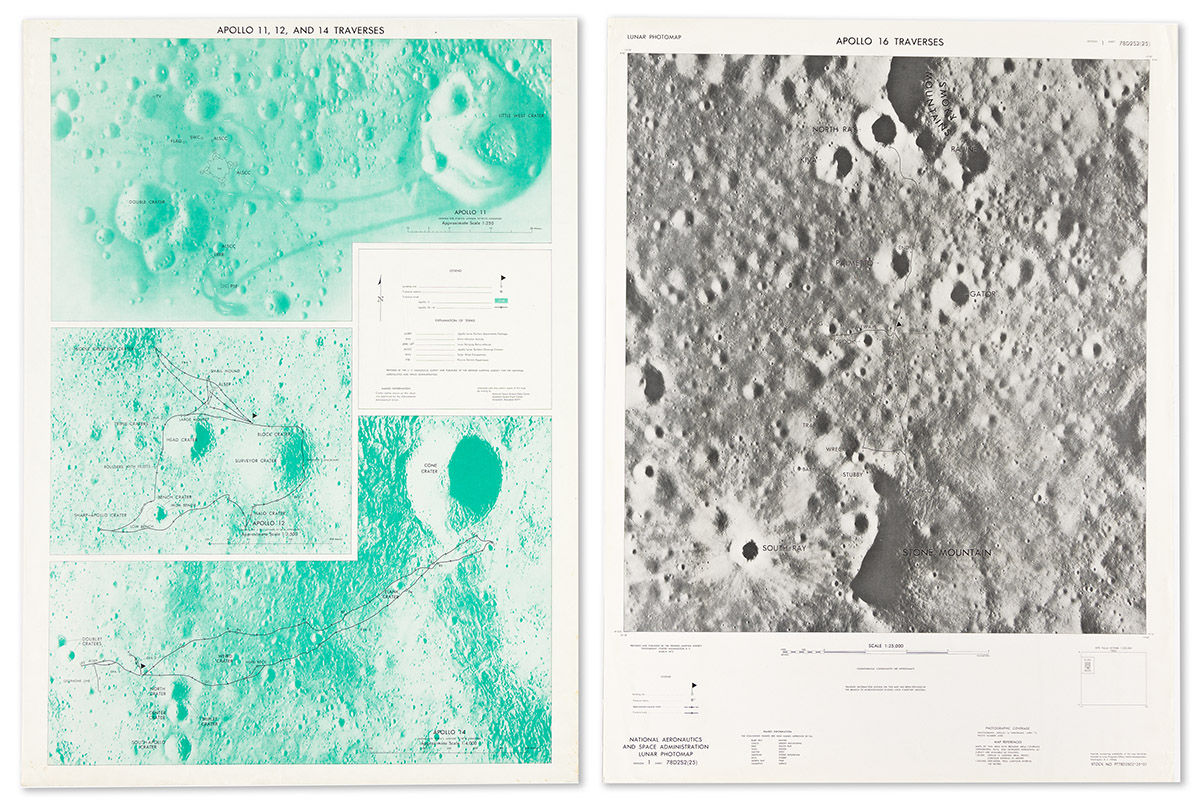
- Apollo 11, 12, and 14 Traverses. 29x21 inches. Nd, [1971]. (3 duplicate copies).
- Lunar Photomap Apollo 16 Traverses. 29x22 inches. March 1975.
- Lunar Orbital Science Flight Chart. Chart D, 1 of 3. 26 1/2x57 1/2. February 1970.
- Apollo Mission 15 Lunar Photography Index Map. Sheets 2, 5, and 6 only (of 10). March 1972.
- Apollo Mission 16 Lunar Photography Index Map. Sheet 2 only (of 6). August 1972.
- S.R. Titley and N.J. Trask. Geologic Map of Apollo Landing Site 5. 22 1/2x42 inches overall, original printed manila folder. U.S. Geological Survey, 1969.
- Mareta West and P. Jan Cannon. Geologic Map of Apollo Landing Sites 4 and 4R. 25x37 1/2 inches overall, original printed manila folder. U.S. Geological Survey, 1971.