Oct 02, 2012 - Sale 2287

Sale 2287 - Lot 457

Price Realized: $ 6,000
?Final Price Realized includes Buyer’s Premium added to Hammer Price
Estimate: $ 3,000 - $ 4,000
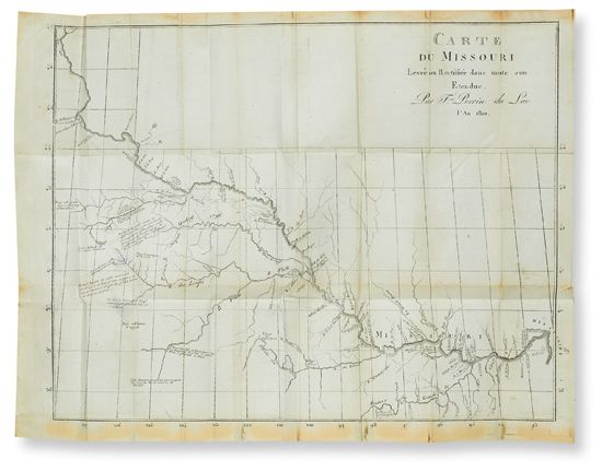
(TRAVEL.) Perrin du Lac, François Marie. Voyage dans les deux Louisianes, et chez les nations sauvages du Missouri, par les États-Unis, l'Ohio et les Provinces qui le bordent. Folding map, folding plate (closed tear). 8vo, contemporary calf, moderate wear; hinges split, map on bluish paper as called for by Howes slightly adhered to page 1, intermittent early marks and small ink smudges, minor foxing, closed tear in leaf Dd7; early owner's inscriptions on front free endpaper. With half-title. Lyon, 1805

Additional Details

first edition (probably preceding the 1805 Paris edition). An account of a tour through the northeast, down the Ohio by flatboat, up the Missouri and Platte from St. Louis, and then down to New Orleans. Extensive attention is given to the American Indians. Particularly important for its details on the Missouri River fur trade, and for the related map of the Missouri, described by Wagner as "the earliest published map of the trans-Mississippi region which can be said to display even the faintest resemblance to accuracy"--Wagner-Camp 3:1. It drew upon the same unpublished surveys by James Mackay that were important to the Lewis and Clark expedition. "His beautifully-executed map was the only published form in which the work of Mackay . . . could be found for upwards of a century"--Wheat, Transmississippi West I:256 and page 164.
"Of New Orleans we learn that the Catalans were too familiar with the Negroes, the governor was an old scoundrel . . . the men were lazy and pleasure-seeking and preferred colored concubines to wives, the slaves were vicious and poorly furnished"--Clark, Old South 2:114. The 1807 English translation omits all of the racy bits. If you read French, this is the one to get. Field 1204; Graff 3254; Howes P244 ("b"); Monaghan, French Travellers 1176; Sabin 61102; Streeter sale III:1773.