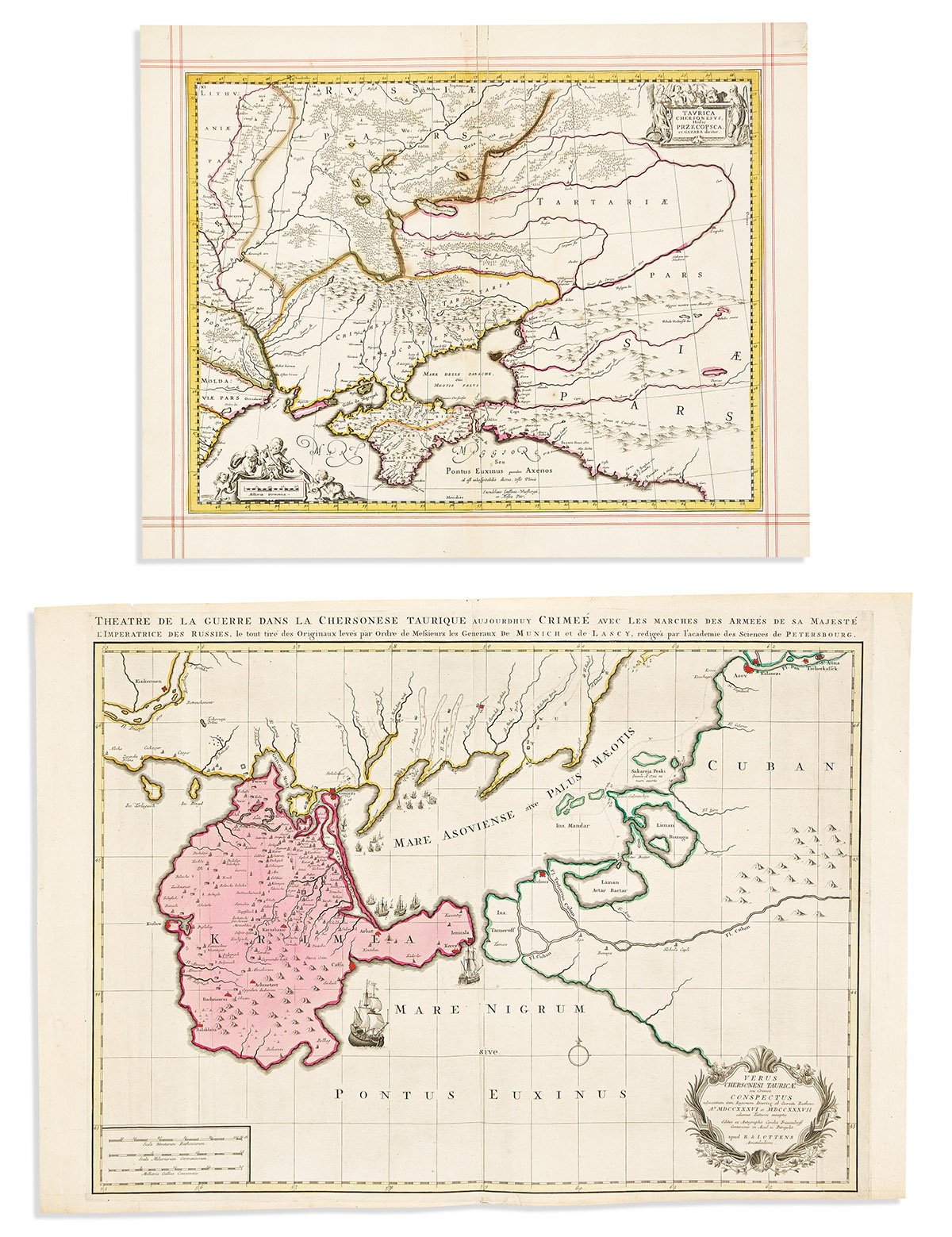
- Reiner & Josua Ottens. Verus Chersonesi Tauricae seu Crimea Conspectus. Double-page engraved map of the Crimean peninsula and Sea of Azov. Two sheets joined, 20 3/4x30 inches sheet size, wide margins; original hand-color; minor edge wear. Amsterdam, circa 1740.
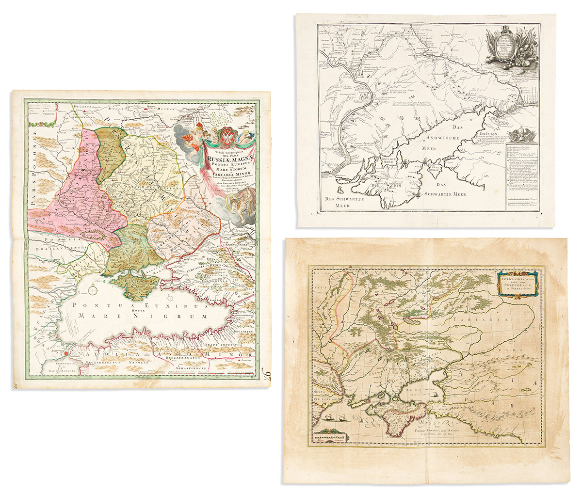
- Johann Baptist Homann. Tabula Geographica qua pars Russiae Magnae Pontus Euxinus seu Mare Nigrum et Tartaria Minor. Double-page engraved map the Black Sea and present-day Ukraine. 24 1/2x21 inches sheet size, wide margins; original hand-color; repaired tear at lower edge. Nuremberg, circa 1720.
- Willem Blaeu. Taurica Chersonesus Nostra Aetate Przecopsca, et Gazara Dicitur. Double-page engraved map of the Crimean peninsula and present-day Ukraine. 20x23 1/2 inches sheet size, wide margins, Latin text on verso; original hand-color; age toning. Amsterdam, circa 1640.
- Russian Academy of Sciences. Charte der Kriegs Operationen am Donn und Dnieper Ihro Russisch Keyserl: Maiest: Glorieusen Armeen Ano 1736. Double-page engraved map of the Crimean peninsula and Donetsk region of Ukraine. 17 1/2x21 1/4 inches sheet size, wide margins; minor wear. St. Petersburg, circa 1736.
- Moses Pitt; and Johannes Janssonius. Taurica Chersonesus, Hodie Przecopsca et Garza Dicitur. Double-page engraved map of the Crimean peninsula and present-day Ukraine. 18x22 3/4 inches sheet size, wide margins with presentation red ruling; original hand-color in outline; mounted to card, stabilizing a few tears. Oxford, circa 1680.